Ohariu, New Zealand
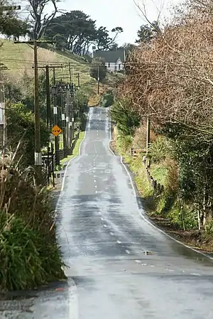
Ohariu (or Ohariu Valley) is a suburb of Wellington, New Zealand. It is a rural area, located 5 kilometres (3.1 mi) from Khandallah.
Ohariu | |
|---|---|
 Ohariu Valley Rd | |
| Country | New Zealand |
| City | Wellington |
| Local authority | Wellington City Council |
| Electoral ward |
|
| Community board | Mākara/Ōhāriu Community Board[2] |
| Area | |
| • Land | 17,749 ha (43,859 acres) |
| Population (June 2022)[4] | |
| • Total | 1,090 |
| Churton Park | ||
|
|
||
| Mākara | Johnsonville |
The name is a corruption of Owhariu, where, according to Māori mythology, Kupe dried the sails of his canoe.[5] The area is governed by the Mākara / Ōhāriu Community Board.[2]
The name of the locality has given its name to two general electorates: Ōhāriu (first formed for the 1978 election without macrons) and Ohariu-Belmont (which existed from 1996 to 2008).[6]
History
In the 19th century, Ohariu was divided into Country Sections by the New Zealand Company. Many were sold to absentee owners, and there were only three resident settlers in 1854: James Smith, James Hallett and James Holder. Later settlers from the 1860s were James Bryant and his sons of Huia Farm, Thomas Bassett of Willow Bank, Charles Austin, George Best, and George Beech. Initially farms ran sheep and beef cattle.
Access was by tracks from Awarua Street (Ngaio), Khandallah and Johnsonville; from the 1860s by the Old Coach Road, and in 1908 via Ironside Road to Johnsonville.[7]
From 1916 there was a dairying invasion which lasted fifty years, because of a better return than from sheep. It began when Frank Nossiter bought Alf Kirby's 100 acre (41 ha) sheep farm, and moved 25 cows from Fielding to his Catewell Farm. He was joined by a dozen more dairy farmers.[8]
Ohariu Valley has an article from 1896 in The Cyclopedia of New Zealand.[9]
Demographics
Mākara-Ohariu statistical area covers 177.49 km2 (68.53 sq mi),[3] and includes Mākara and Mākara Beach. It had an estimated population of 1,090 as of June 2022,[4] with a population density of 6 people per km2.
| Year | Pop. | ±% p.a. |
|---|---|---|
| 2006 | 768 | — |
| 2013 | 852 | +1.49% |
| 2018 | 951 | +2.22% |
| Source: [10] | ||
Mākara-Ohariu had a population of 951 at the 2018 New Zealand census, an increase of 99 people (11.6%) since the 2013 census, and an increase of 183 people (23.8%) since the 2006 census. There were 321 households, comprising 477 males and 474 females, giving a sex ratio of 1.01 males per female. The median age was 42.7 years (compared with 37.4 years nationally), with 159 people (16.7%) aged under 15 years, 177 (18.6%) aged 15 to 29, 504 (53.0%) aged 30 to 64, and 108 (11.4%) aged 65 or older.
Ethnicities were 92.1% European/Pākehā, 10.1% Māori, 1.9% Pasifika, 3.2% Asian, and 2.2% other ethnicities. People may identify with more than one ethnicity.
The percentage of people born overseas was 20.8, compared with 27.1% nationally.
Although some people chose not to answer the census's question about religious affiliation, 56.5% had no religion, 31.5% were Christian, 0.3% were Hindu, 0.6% were Buddhist and 2.5% had other religions.
Of those at least 15 years old, 255 (32.2%) people had a bachelor's or higher degree, and 84 (10.6%) people had no formal qualifications. The median income was $47,700, compared with $31,800 nationally. 276 people (34.8%) earned over $70,000 compared to 17.2% nationally. The employment status of those at least 15 was that 474 (59.8%) people were employed full-time, 141 (17.8%) were part-time, and 21 (2.7%) were unemployed.[10]
Further reading
References
- "Ward maps and boundaries". Wellington City Council. Retrieved 24 January 2022.
- "Mākara/Ōhāriu Community Board". Wellington City Council. Retrieved 24 January 2022.
- "ArcGIS Web Application". statsnz.maps.arcgis.com. Retrieved 15 June 2021.
- "Population estimate tables - NZ.Stat". Statistics New Zealand. Retrieved 25 October 2022.
- Reed, A. W. (2010). Peter Dowling (ed.). Place Names of New Zealand. Rosedale, North Shore: Raupo. p. 280. ISBN 9780143204107.
- "Ōhāriu: Electoral Profile" (PDF). Parliamentary Library. September 2014. Retrieved 3 October 2014.
- Bremner, Julie (1983). Wellington’s Northern Suburbs 1840-1918. Wellington: Millwood Press. pp. 87–92. ISBN 0-908582-59-5.
-
- Bremner, Julie (1987). Wellington’s Northern Suburbs 1919-1945. Wellington: Millwood Press. p. 99. ISBN 0-908582-80-3.
- "Ohariu Valley, 1896". Cyclopedia of New Zealand. 1896.
- "Statistical area 1 dataset for 2018 Census". Statistics New Zealand. March 2020. Mākara-Ohariu (247500). 2018 Census place summary: Mākara-Ohariu