Oisterwijk
Oisterwijk (Dutch pronunciation: [ˈoːstərˌʋɛik] ⓘ) is a municipality and a city in the south of the Netherlands.
Oisterwijk | |
|---|---|
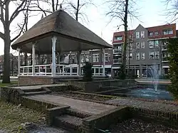 Gazebo in Oisterwijk | |
 Flag  Coat of arms | |
.svg.png.webp) Location in North Brabant | |
| Coordinates: 51°35′N 5°12′E | |
| Country | Netherlands |
| Province | North Brabant |
| Government | |
| • Body | Municipal council |
| • Mayor | Hans Janssen (CDA) |
| Area | |
| • Total | 65.13 km2 (25.15 sq mi) |
| • Land | 63.84 km2 (24.65 sq mi) |
| • Water | 1.29 km2 (0.50 sq mi) |
| Elevation | 10 m (30 ft) |
| Population (January 2021)[4] | |
| • Total | 32,373 |
| • Density | 507/km2 (1,310/sq mi) |
| Demonym | Oisterwijker |
| Time zone | UTC+1 (CET) |
| • Summer (DST) | UTC+2 (CEST) |
| Postcode | 5059–5066 |
| Area code | 013 |
| Website | oisterwijk |
Population centres
- Haaren
- Heukelom
- Moergestel
- Oisterwijk
Topography
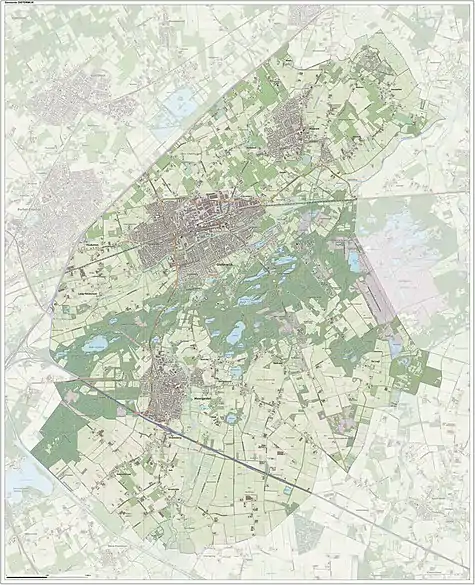
Dutch topographic map of the municipality of Oisterwijk, 2021
Transportation
- Railway station: Oisterwijk
City
Oisterwijk received city rights in 1230. Part of the municipality of Oisterwijk includes the 'Oisterwijkse bossen en vennen' (Oisterwijk forests and fens) and the 'Kampina', two nature reserves. The reserves are owned and kept by the 'Vereniging Natuurmonumenten' (Nature Monuments Society).
Notable people
.jpg.webp)
Cora van Nieuwenhuizen, 2018
- Maria van Oisterwijk (died 1547), Dutch Catholic mystic and writer
- Nicolaus van Esch (1507 in Oisterwijk – 1578) a Dutch Roman Catholic theologian and mystical writer.[5]
- Adriaan Poirters (1605 in Oisterwijk – 1674) a Dutch Jesuit poet and prose writer, active in the Counter Reformation
- Johan Antony Barrau (1873 in Oisterwijk – 1953) a Dutch mathematician and geometer
- Arnold Meijer (1905 – 1965 in Oisterwijk) a Dutch fascist politician
- Annita van Iersel (born 1948 in Oisterwijk) former wife of Paul Keating, former Prime Minister of Australia
- Jan Schuurkes (born 1950 in Oisterwijk) a Dutch biologist and gastrointestinal researcher
- Cora van Nieuwenhuizen (born 1963 in Ridderkerk) a Dutch politician, municipal councillor 1994 to 2006
Gallery
 Oisterwijk, church: Sint-Petrus'-Bandenkerk
 Oisterwijk, Netherlands - panoramio
.jpg.webp) Essche stroom
Essche stroom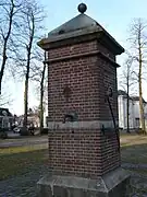 Pomp Oisterwijk
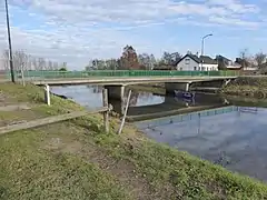 Gasthuisbrug over de Esschestroom in Esch
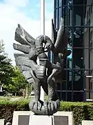 Gevleugelde vrijheid - Oisterwijk
References
- "Samenstelling college" [Members of the board] (in Dutch). Gemeente Oisterwijk. Retrieved 2 June 2014.
- "Kerncijfers wijken en buurten 2020" [Key figures for neighbourhoods 2020]. StatLine (in Dutch). CBS. 24 July 2020. Retrieved 19 September 2020.
- "Postcodetool for 5061HX". Actueel Hoogtebestand Nederland (in Dutch). Het Waterschapshuis. Retrieved 2 June 2014.
- "Bevolkingsontwikkeling; regio per maand" [Population growth; regions per month]. CBS Statline (in Dutch). CBS. 1 January 2021. Retrieved 2 January 2022.
- Maas, Anthony John (1909). . Catholic Encyclopedia. Vol. 5.
External links
 Media related to Oisterwijk at Wikimedia Commons
- Official website
Places adjacent to Oisterwijk | ||||||||||||||||
|---|---|---|---|---|---|---|---|---|---|---|---|---|---|---|---|---|
| ||||||||||||||||

This article is issued from Wikipedia. The text is licensed under Creative Commons - Attribution - Sharealike. Additional terms may apply for the media files.