Olokemeji Forest Reserve
Olokemeji Forest Reserve is Nigeria's first Forest Reserve, established around 1900. Olokemeji Forest Reserve features two primary vegetation types, namely Deciduous Forest and Derived Savanna woodland, within a distinctly seasonal climate characterized by wet and dry seasons.[1] Olokemeji is situated on the northern fringe of the forest belt, with its predominant forest type being deciduous.[2] While the reserve does contain freshwater swamp forest areas, particularly in the south, its primary composition is characterized by moist evergreen forest, often referred to as 'mixed rainforest'[2]
| OLOKEMEJI FOREST RESERVE | |
|---|---|
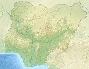 | |
| Location | Between Abeokuta and Ibadan, Nigeria |
| Nearest city | Lagos |
| Coordinates | 7°15′N 3°20′E |
| Area | 71 km2 (27 sq mi) |
| Established | 1900 |
| Governing body | Ogun State Government |
The Olokemeji Forest Reserve, one of the largest in southwest Africa, covers about 5,900 hectares and is located between the Nigerian cities of Abeokuta and Ibadan.[3] Olokemeji Forest Reserve is positioned at coordinates 7° 25' N latitude and 3° 33' E longitude, forming an almost rectangular shape with boundaries oriented roughly north–south and east–west, covering an area of 71 km2 (27.5 sq. miles).[1] Additionally, it is traversed by both the Lagos to Ibadan railway and the road connecting Abeokuta to Eruwa and Lanlate.[1]
History
Olokemeji, located in western Yorubaland, was initially settled by the Yoruba people at an early stage, but by the year 1700, the kingdom experienced a decline marked by conflicts between Yoruba clans, and it was certainly used by troops during these wars.[1] For an extended period, they encamped along the Ogun river at Olokemeji, with the Egba community subsequently choosing to stay there as a protective measure and it was during this time that the Ijaye group encountered the army at Olokemeji.[4] These activities took place in 1835 and 1861, respectively.[5]
Numerous villages within the reserve were deserted during these conflicts and remained uninhabited until peace was reestablished in the late nineteenth century.[1] Following the establishment of the reserve, all villages except Olokemeji itself were gradually deserted, with the process unfolding gradually: one village, Agbola, continued to be inhabited until approximately 1940.[6]
Plantations were started in 1908, and farming was extended north of these plantations as a firebreak, leading to the formation of a savanna strip.[1] Present-day plantations mainly feature Tectona grandis and Cassia siamea.[1] Olokemeji served as the administrative center for both the Nigerian Departments of Forestry and Agriculture for a period, and it hosted a tropical battle training school during the Second World War.[1]
Climate
In Nigeria, the dominant wind patterns originate from two contrasting directions: a moist south-western wind originating from the Atlantic Ocean, characterized by the equatorial maritime air mass, and a dry north-eastern wind, known as the harmattan, which originates from the Sahara Desert and represents the tropical continental air mass.[1]
The convergence point of these two wind systems forms a zone of climatic volatility referred to as the intertropical front.[7] The location of this front fluctuates seasonally, with it residing to the north of Olokemeji for most of the year, except for approximately 19 days, resulting in a predominantly humid climate.[1]
The annual average rainfall measured in Olokemeji amounts to 1232 mm, which is equivalent to 48.5 inches.[7] In Olokemeji, the wet season typically spans from March to October, with a brief dry spell typically occurring in August.[1]
Soil Composition
The soil in Olokemeji Forest Reserve originates from a Precambrian basement complex consisting of banded biolite gneisses with granite intrusions, with an additional layer of alluvial deposits found along river courses and floodplains.[8] The reserve is located on undulating terrain, with elevations ranging from 90 meters above sea level (asl) to 140 meters asl, except for the ridge where the altitude increases to 240 meters asl. The Ogun River has carved its path through the ridge, effectively dividing it into two peaks, which is why it is called Olokemeji. The climate in the area is tropical, characterized by a rainy season from March to November and a dry season from November to March.
Alluvial soils host a distinct vegetation type characterized by an abundance of Manilkara multinervis, Diospyros mespiliformis, and Nesogordonia papaverifera.[9] To the north and west of the reserve, in the derived savanna, you can find species like Danellia oliveri, Vitellaria paradoxa, Parkia biglobosa, Lophira lanceolata, and Pterocarpus erinaceous.[9]
Plant species
A well-established and widely recognized feature of tropical forests is their remarkable species diversity, which refers to the substantial number of plant species found within a given area.[10] Every plant species within the Olokemeji Forest Reserve falls into one of three categories: tree, shrub, or climber, and each of them belongs to distinct families.[9]
In Olokemeji forest, the classification of plant species by life form reveals that trees were the most predominant in the fringing forest, accounting for 56 (43.1%) of the total, closely followed by herbs at 40 (30.8%), climbers at 28 (2.15%), and shrubs at 6 (4.6%).[11] Similarly, in the savannah region, trees dominated with 69 (46.9%), surpassing herbs at 59 (40.1%), shrubs at 14 (9.5%), and climbers at 5 (3.4%).[11]
In the Fringing forest of Olokemeji, a total of 130 individual plant species were observed, with Paulina pinatum, Chromolaena odorata, and Sida acuta being the most abundant, each representing 11.5%, while Cissus nodosa had the lowest abundance at 0.8%.[11] The Savannah region exhibited a total of 147 plant species, with Phyllanthus samaras and Tridax procumbens equally sharing the highest prevalence at 6.8%, while Parkia biglobosa was the least abundant species at 0.7%.[11]
The Olokemeji forest displays a notable abundance of tree species, signifying a natural rejuvenation process; nevertheless, both forest types continue to exhibit a high prevalence of herbaceous plants.[11] The notable prevalence of herbaceous plant species such as P. pinatum, C. odorata, S. acuta, P. amarus, and T. procumbens in the forest signifies the presence of substantial human activities within the area. The Olokemeji Forest Reserve continues to house essential plant species crucial for human survival, yet it requires adjustments to reduce the prevalence of non-tree life forms and fully unlock its botanical potential for human advantage.[11]
Anthropogenic interference in Olokemeji forest reserve
The structure and composition of the woody flora at Olokemeji forest reserve reflect the significant anthropogenic interference that has taken place in the area.[12] A portion of the Olokemeji forest reserve, which has historically boasted a rich diversity of native trees and shrubs, is now undergoing a transformation into a Tectona Grandis plantation, while nearby villagers have allowed certain areas to revert to secondary forest as a result of prior agricultural activities.[11] The reserve has witnessed a sequence of activities including plantation establishment, bush burning, shifting cultivation, and various development practices, leading to a decline in biodiversity, particularly affecting local communities and having broader economic consequences at the national level.[13]
Furthermore, the process of natural regeneration for secondary forests on degraded tropical lands is frequently characterized by a sluggish and unpredictable pace, hindered by a multitude of factors such as human and livestock activities, recurring fires, the prevalence of dominant grasses and non-woody species, unfavorable microclimatic conditions, soil infertility, depletion of soil seed reserves and root stocks, as well as limited seed contributions from neighboring forests.[14] A significant number of villagers rely on the forest reserve for their livelihood by gathering plant parts for use in herbal practices, including roots, leaves, twigs, and barks. However, this collection can harm the source plants, potentially resulting in their demise.[9]
Engaging in additional destructive activities within the forest may lead to the extinction of many vital plant species found in the area.[11] The economic consequences of biodiversity loss, both for local communities and the overall national economy, emphasize the need for a collaborative effort involving all stakeholders.[9] Deforestation has alarming and distressing consequences, with one of the most significant being the extinction of animal and plant species resulting from habitat destruction.[15] The forest reserve is currently in a precarious condition and requires prompt and substantial intervention.[14] A holistic plan is necessary to alleviate farming pressures on the forest reserve, incorporating poverty alleviation measures and promoting sustainable farming practices to reduce dependence on extensive cultivation.[14]
References
- Hopkins, Brian; Jenkin, R. N. (1962). "Vegetation of the Olokemeji Forest Reserve, Nigeria: I. General Features of the Reserve and the Research Sites". Journal of Ecology. 50 (3): 559–598. doi:10.2307/2257471. ISSN 0022-0477.
- Hopkins, Brian (1966). "Vegetation of the Olokemeji Forest Reserve, Nigeria: IV. The Litter and Soil with Special Reference to Their Seasonal Changes". Journal of Ecology. 54 (3): 687–703. doi:10.2307/2257811. ISSN 0022-0477.
- "Olokemeji Project Profile". Forest Center. Retrieved 2023-09-16.
- Johnson, S. (1921). The History of the Yorubas. London.
- Jones G.I (2012) The Egba and their Neighbours 1842–1872. By Saburi O. Biobaku. Oxford: Clarendon Press, 1957. Pp. 128, maps. 21s. https://www.cambridge.org/core/journals/africa/article/abs/egba-and-their-neighbours-18421872-by-saburi-o-biobaku-oxford-clarendon-press-1957-pp-128-maps-21s/0DC3DF56C898FAE65276E25F3BBA7E7F
- Allison, P. A. & Gray, R. T. (1956). A working plan for the Olokemeji plantation dem circle, Vol. 1. Unpublished MS., Forestry Division, Wester
- Clackson, J. R. (1957-1960). Seasonal movement of boundary of northern air. With three addenda. Brit. West Afr. Meteor. Serv. Tech. Note, No. 5
- Hopkins S.B. (1972) The Olokemeji Forest Reserve II. The local history of the reserve, The Nigerian Field 34: 171.
- Ogunleye, A.J; Adeola, A.O; Ojo, L.O; Aduradola, A.M (2004). "Impact Of Farming Activities On Vegetation In Olokemeji Forest Reserve, Nigeria" (PDF). Global Nest: the International Journal. 6 (2): 131–140.
- Keay R.W.J. (1952), An outline of Nigerian vegetation, Colonial forest service. No. 333.
- Onefeli Alfred Ossai (2018) Taxonomic Rambling of Flora Diversity in Olokemeji Forest Reserve, Nigeria. Proceedings of 6th NSCB Biodiversity Conference; Uniuyo 2018 (245 - 249pp). https://www.academia.edu/45083168/Taxonomic_Rambling_of_Flora_Diversity_in_Olokemeji_Forest_Reserve_Nigeria
- Olubode, S.O; Taiwo, D.M; Woghiren, A.I (2021). "Floristic Structure of Some Selected Plots in Olokemeji Forest Reserve, Ogun State, Nigeria". FUTY Journal of the Environment. 15 (1): 65–72.
- Agbo-Adediran, Olajire-Ajayi, Olokeogun and Bolanle-Ojo (2019) Floristic Composition of the Restricted Zone in Olokemeji Forest Reserve. Proceedings of NTBA/NSCB Joint Biodiversity Conference; Unilorin 2016 (276-282). https://www.researchgate.net/publication/333117603_Floristic_Composition_of_the_Restricted_Zone_in_Olokemeji_Forest_Reserve
- Agbo-adediran, O.A., Olajiire-Ajayi, B., Olokeogun O.S., and Bolanle-Ojo, O.T (2016) Floristic Composition of the Restricted Zone in Olokemeji Forest Reserve. Proceedings of NTBA/NSCB Joint Biodiversity Conference; Unilorin 2016 (276-282). https://www.researchgate.net/publication/333117603_Floristic_Composition_of_the_Restricted_Zone_in_Olokemeji_Forest_Reserve
- "Effects of Deforestation". pachamama.org. Retrieved 2023-09-15.