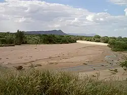
Omaruru River
The Omaruru River is a major river crossing the Erongo Region of western central Namibia from East to West. It originates in the Etjo Mountains, crosses the town of Omaruru and the village of Okombahe, and reaches the sea a few kilometers north of Henties Bay.[1] Inflows of the Omaruru are Otjimakuru, Goab, Spitzkop, Leeu and Okandjou.[2]
| Omaruru River | |
|---|---|
 Almost dried up bed of Omaruru River | |
| Native name | Khoekhoe: ǃKhuidiǁgams |
| Physical characteristics | |
| Source | Mount Etjo |
| • location | Otjozondjupa Region |
| Mouth | Atlantic Ocean |
• location | north of Hentiesbay, Erongo Region |
• coordinates | 22°05′S 14°14′E |
• elevation | 0 m (0 ft) |
| Length | c.330 km (210 mi) |
| Basin size | 13,100 km2 (5,100 sq mi) |
| Basin features | |
| Tributaries | |
| • left | Otjimakuru, Goab, Spitzkop |
| • right | Leeu, Okandjou |
| Waterbodies | Omdel Dam |
.jpg.webp)
Aerial view of Omaruru River (2018)
The Omaruru is an ephemeral river with a mean run-off of roughly 40 million cubic metres per annum. Its palaeochannels form an underground delta of the Namib Desert.[1] Its catchment area (including its tributaries) is estimated to be between 11,579[3] and 13,100 square kilometres (5,100 sq mi).[2]
References
- "ELECTIONS 2010: Erongo regional profile". New Era. 16 November 2010.
- Jacobson, Peter J.; Jacobson, Kathryn M.; Seely, Mary K. (1995). Ephemeral rivers and their catchments: Sustaining people and development in western Namibia (PDF 8.7MB). Windhoek: Desert Research Foundation of Namibia. pp. 136–137. ISBN 9991670947.
- Strohbach, B.J. (2008). "Mapping the Major Catchments of Namibia" (PDF 1.0MB). Agricola. 2008: 63–73. ISSN 1015-2334. OCLC 940637734.
This article is issued from Wikipedia. The text is licensed under Creative Commons - Attribution - Sharealike. Additional terms may apply for the media files.