Orkdalen
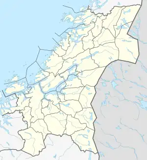
Orkdalen or Orkladalen (English: Orkla Valley[1][2]) is a valley and a traditional Norwegian district in Trøndelag county, Norway. In the early Viking Age, before King Harald Fairhair, the Orkla Valley was also a petty kingdom.
| Orkdalen | |
|---|---|
| Orkladalen | |
 View of the Orkdalen valley | |
 Orkdalen Location of the valley  Orkdalen Orkdalen (Norway) | |
| Length | 100 kilometres (62 mi) N-S |
| Geology | |
| Type | River valley |
| Geography | |
| Location | Trøndelag, Norway |
| Population centers | Orkanger, Meldal, Berkåk |
| Coordinates | 63.0555°N 09.6191°E |
| Rivers | Orkla |
The valley begins in the high Dovrefjell mountains and creates a deep, narrow valley. As the river progresses, the valley widens and flattens out. From Rennebu northwards, the valley is fairly heavily populated with good farmland. At the mouth of the river (the north end of the valley) is the town of Orkanger, the largest population centre in the valley.[3]
The district encompasses all the municipalities that surround the Orkla River in the valley. The district includes the municipalities of Rennebu and Orkland. The municipalities of Oppdal and Skaun are often traditionally counted as a parts of the district also even though they lie outside the actual valley of the river Orkla. The river itself actually begins in Oppdal and then winds its way north to the Trondheimsfjord.[3]
References
- Lemmer, Gerhard; Frey, Elke; Rahe, Helga (2001). Norway. Basingstoke, UK: GeoCenter. p. 113.
- Barman, T. G. (1939). Guide to Norway, Sweden, Denmark, Finland, Iceland. London: Cook. pp. 162–163.
- Haugen, Morten, ed. (2017-07-13). "Orkladalen". Store norske leksikon (in Norwegian). Kunnskapsforlaget. Retrieved 2018-01-24.