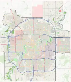
Ozerna, Edmonton
Ozerna is a neighbourhood in northeast Edmonton, Alberta, Canada. Subdivision and development of the neighbourhood is guided by the Ozerna Neighbourhood Structure Plan (NSP).[8]
Ozerna | |
|---|---|
Neighbourhood | |
 Ozerna Location of Ozerna in Edmonton | |
| Coordinates: 53.622°N 113.450°W | |
| Country | |
| Province | |
| City | Edmonton |
| Quadrant[1] | NW |
| Ward[1] | tastawiyiniwak |
| Sector[2] | North |
| Area[3][4] | Lake District |
| Government | |
| • Administrative body | Edmonton City Council |
| • Councillor | Karen Principe |
| Area | |
| • Total | 1.12 km2 (0.43 sq mi) |
| Elevation | 686 m (2,251 ft) |
| Population (2012)[7] | |
| • Total | 4,495 |
| • Density | 4,013.4/km2 (10,395/sq mi) |
| • Change (2009–12) | |
| • Dwellings | 1,394 |
It is located within Edmonton's Lake District and was originally considered Neighbourhood 6 within the Edmonton North Area Structure Plan (ASP).[9]
Ozerna is bounded by the Mayliewan neighbourhood to the west, the Schonsee neighbourhood across 167 Avenue to the north, the Matt Berry neighbourhood across 66 Street to the east, and the Kilkenny neighbourhood across 153 Avenue to the south.[10]
As with all neighbourhoods located within the Lake District, which are named after a body of water or a term for water in a language other than English, Ozerna is a Ukrainian word that means “lake area.”
Demographics
In the City of Edmonton's 2012 municipal census, Ozerna had a population of 4,495 living in 1,394 dwellings,[7] a -1.3% change from its 2009 population of 4,552.[11] With a land area of 1.12 km2 (0.43 sq mi),[6] it had a population density of 4,013.4 people/km2 in 2012.[7][6]
Housing
In 2005, Ozerna's housing breakdown consisted of 78% single-family dwellings, 12% duplexes, 10% low-rise apartments (fewer than five storeys), and 1% row houses.[12] I
Surrounding neighbourhoods
References
- "City of Edmonton Wards & Standard Neighbourhoods" (PDF). City of Edmonton. Archived from the original (PDF) on May 3, 2014. Retrieved February 13, 2013.
- "Edmonton Developing and Planned Neighbourhoods, 2011" (PDF). City of Edmonton. Archived from the original (PDF) on September 4, 2013. Retrieved February 13, 2013.
- "The Way We Grow: Municipal Development Plan Bylaw 15100" (PDF). City of Edmonton. 2010-05-26. Archived from the original (PDF) on May 2, 2015. Retrieved February 13, 2013.
- "City of Edmonton Plans in Effect" (PDF). City of Edmonton. November 2011. Archived from the original (PDF) on October 17, 2013. Retrieved February 13, 2013.
- "City Councillors". City of Edmonton. Retrieved February 13, 2013.
- "Neighbourhoods (data plus kml file)". City of Edmonton. Retrieved February 22, 2013.
- "Municipal Census Results – Edmonton 2012 Census". City of Edmonton. Retrieved February 22, 2013.
- "Ozerna Neighbourhood Structure Plan, Neighbourhood 6 of the Edmonton North Area Structure Plan (Office Consolidation)" (PDF). City of Edmonton. June 2003. Archived from the original (PDF) on 2012-05-12. Retrieved 2012-04-29.
- "Edmonton North Area Structure Plan (Office Consolidation)" (PDF). City of Edmonton. September 2010. Archived from the original (PDF) on 2011-06-16. Retrieved 2012-04-29.
- "Welcome to Edmonton Maps". City of Edmonton. Retrieved 2012-04-29.
- "2009 Municipal Census Results". City of Edmonton. Retrieved February 22, 2013.
- http://censusdocs.edmonton.ca/C05002/MUNICIPAL%202005/Neighbourhood/OZERNA.pdf