Pabal
Pabal, is a panchayat village[1] in Shirur Taluka in Pune district of state of Maharashtra, India.[2] It is located in the northwest corner of the taluka, bordering on Ambegaon Taluka to the north and Khed Taluka to the west. It lies on the left (north) bank of the Vel River.[3] Pabal is 39.34 km far from the district's main city of Pune.
Pabal | |
|---|---|
village | |
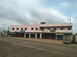 Panchayat building, Pabal | |
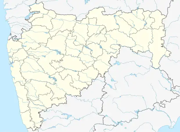 Pabal Location in Maharashtra, India  Pabal Pabal (India) | |
| Coordinates: 18°49′51″N 074°03′10″E | |
| Country | |
| State | Maharashtra |
| District | Pune |
| Taluka | Shirur |
| Languages | |
| • Official | Marathi |
| Time zone | UTC+5:30 (IST) |
| PIN | 412403 |
| Telephone code | 022488 |
| Vehicle registration | MH-12, MH-14 |
| Lok Sabha constituency | Shirur |
| Vidhan Sabha constituency | Ambegaon |
Nearby villages of Pabal with distance are Pur (3.792 km), Pur (3.792 km), Kanhersar (4.552 km), Kendur (5.564 km), Dhamari (6.302 km), Wadgaon Pir (6.617 km), Gosasi (7.471 km),Kanhur Mesai, Morachi Chincholi Shirur, Saradwadi, Shindodi, Shirasgaon Kata, Sonesangavi, Takali Bhima, Takali Haji, Talegaon Dhamdhere, Tardobachiwadi, Uralgaon, Vitthalwadi, Shikrapur (20 km). This is also the burial place of Mastani.
Education
- श्री भैरवनाथ विद्या मंदिर पाबळ Shri Bhairavnath Vidya Mandir, Pabal
- Vigyan Ashram
- Padmamani Jain Mahavidyalaya, Pabal.
Gallery
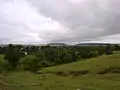 Pabal view
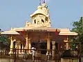 Bhairavnath Temple front view
 QR code for Pabal
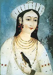 Mastani 28tt13
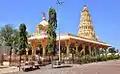 Bhairavanath mandir
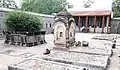 Mastani-759
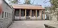 मस्तानी कबरीचे बांधकाम
Religion
The majority of the population in the village is Hindu.
The village also has an ancient Jain temple. Devotees from Pune and Mumbai flock here for pujan and darshan quite frequently.
Economy
The majority of the population has farming as their primary occupation.
Weather
The general climate here is hot and dry. According to the climate change, there are mainly three seasons in each year.Summer from March to May, monsoon from June to October and winter from November to February. The climate is cold in winter. The average annual rainfall in the village is up to 470 mm.
Notes and references
- 2011 Village Panchayat Code for Pabal = 188605, "Reports of National Panchayat Directory: Village Panchayat Names of Shirur, Pune, Maharashtra". Ministry of Panchayati Raj, Government of India. Archived from the original on 11 May 2013.
- "Pabal in Pabal India".
- Poona India, Sheet NE 43-06 (topographic map, scale 1:250,000), Series U-502, United States Army Map Service, May 1960