Pallahara
Pal Lahara is a small town in Angul district of the state of Odisha and located on NH6, where it intersects with NH23, 91 kilometres (57 mi) by road north of Angul.[1] Not far from the banks of the Rengali Reservoir which is to the west, the Malayagiri Forest Range is to the southeast.[1] Pallahara is one of the sub divisional headquarters in the Angul district.
Pallahara | |
|---|---|
Town | |
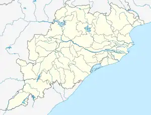
 Pallahara Location in Odisha  Pallahara Pallahara (India) | |
| Coordinates: 21°27′N 85°11′E | |
| Country | |
| State | Odisha |
| District | Angul |
| Languages | |
| • Official | Odia |
| Time zone | UTC5:30 (IST) |
| Vehicle registration | OD-35 (Talcher) Nearest RTO OD-28 (Deogarh) |
History
Pallahara was the capital of Pal Lahara State, which was a small princely state of British India.[2]
The forests in the area were traditionally rich in bamboo and the local Juang people are adept at basketry.[3]
Connectivity
Pallahara is present nealy in the middle of Odisha. It has good connectivity to Bhubaneswar Keonjhar, Rourkela, and Sambalpur by night buses. There is no train line to Pallahara. The nearest railway station to Pallahara is Talcher road. The Bhubaneswar airport and Jharsuguda airport are nearly equal distances from Pallahara. The Pallahara is underdeveloped although it is the center of Odisha.
Education
The school and colleges include the followings: 1-Saraswati Sishu Vidya Mandir, 2-Town Model Primary School Pallahara, 3-Town Girls High School, 4-Mahatab High School 5-Malyagiri Mahavidyalay Pallahara Many students are working in national and International level from Pallahara as a scientist, engineer, professor, doctors, and also in the administrative work.
Population
Pallahara Tehsil population in 2023 is 87,628. According to 2011 census of India, Total Pallahara population is 66,385 people are living in this Tehsil, of which 33,728 are male and 32,657 are female. Literate people are 37,556 out of 21,865 are male and 15,691 are female. Total workers are 31,416 depends on multi skills out of which 18,663 are men and 12,753 are women. Total 2,748 Cultivators are depended on agriculture farming out of 2,429 are cultivated by men and 319 are women. 3,501 people works in agricultural land as a labour in Pallahara, men are 2,457 and 1,044 are women.[4]
Hospital
The Sub-Divisional Hospital Pallahara is the biggest hospital situated between the new stand and old bus stand of the Pallahara. Many people come for their health check-up. There is no private medical or Nursing home. All people depend only on the Govt hospital but lack of specialist doctors and adequate manpower plagues it.
Temples
Pallahara is a culturally rich sub-division of the Angul District. People worship many Gods and Goddesses. Adhistatri Devi (main Goddess) of Pallahara is Maa Kundheibira and believed to have power (shakti) over pallahara to save in the critical situations. In addition, temple of Lord Shiva, Jagganath, Hanuman and Kali also present in pallahara. Each year, the Laxmi Puja celebrated for two weeks at pallahara by preparing nealy 15 medhas (statues) at different parts of the pallahara. Many cultural programs are scheduled in this two weeks. People from nearby villages come to see the Laxmi puja and cultural programs.
References
- Maps (Map). Google Maps.
- India. Foreign and Political Dept (1930). A collection of treaties, engagements and sanads relating to India and neighboring countries. Government of India Central Publication Branch. p. 340. Retrieved 26 October 2012.
- Patnaik, Nihar Ranjan (1997). Economic History of Odisha. Indus Publishing. p. 373. ISBN 978-81-7387-075-0. Retrieved 26 October 2012.
- https://www.indiagrowing.com/Odisha/Angul/Palalahada
External links