Palot
Palot (पालोट) is a village in Didwana Tehsil in Nagaur district of Rajasthan, India. It belongs to Ajmer Division Division. It is located 85 km towards East from district headquarters Nagaur district. 15 km from Didwana. 171 km from the state capital Jaipur.

Temple Photo

Tejaji Mandir

Sunset view

Peacocks

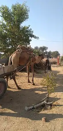
Camels

Camel Cart
Palot | |
|---|---|
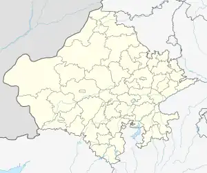
 Palot Location of Palot in Rajasthan, India  Palot Palot (India) | |
| Coordinates: 27.24°N 74.26°E | |
| Country | |
| State | Rajasthan |
| District | Nagaur |
| Named for | Palot |
| Area | |
| • Total | 18.1609 km2 (7.0120 sq mi) |
| Elevation | 1,072 m (3,517 ft) |
| Population (2019) | |
| • Total | 2,232 |
| • Density | 120/km2 (320/sq mi) |
| Languages | |
| • Official | Hindi |
| • Local | Marwari |
| Time zone | UTC+5:30 (IST) |
| PIN | 341305 |
| Vehicle registration | RJ-37 |
| Nearest village | Koliya, Ratau, Sinwa, Chomu, Dudoli, Baldu, Kerap, Nimbi |
| Nearest city | Didwana, Ladnun, Degana, Kuchaman City, Nagaur, Sikar, Jhunjhunu, Jaipur |
| Website | www |
Palot Pin code is 341305 and postal head office is Koliya.[1]
Koliya (7 km), Baldu ( 10 km), Mamroda (11 km), Singhana (11 km), Ratau are the nearby villages to Palot. Palot is surrounded by Ladnun Tehsil towards North, Jayal Tehsil towards west, Sujangarh Tehsil towards North, Makrana Tehsil towards South.
Ladnu, Sujangarh, Losal, Makrana are the nearby cities to Palot.
Gotras
This article is issued from Wikipedia. The text is licensed under Creative Commons - Attribution - Sharealike. Additional terms may apply for the media files.