Panüelerkopf
The Panüeler Kopf (also called Panüler Kopf, Panüeler Kopf, short Panüeler or Panüler) is a mountain in the Austrian state Vorarlberg. The Panüeler Kopf is part of the Schesaplana group and with an elevation of 2,859 m (AA) the second highest mountain in the Rätikon mountain range. The 950 m high west face is the highest rock face in the Rätikon.[1]
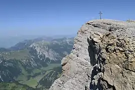
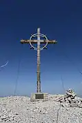
 Summit of Panüeler Kopf
| Panüelerkopf | |
|---|---|
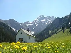
 Panüeler Kopf as seen from Nenzinger Himmel (chapel St. Rochus in front) | |
| Highest point | |
| Elevation | 2,859 m (9,380 ft)[1][2] |
| Prominence | 143 m (469 ft)[2] |
| Isolation | 2.4 km (1.5 mi) |
| Coordinates | 47°04′01″N 09°40′47″E |
| Geography | |
 Panüelerkopf Location of Panüeler Kopf in the Alps | |
| Location | Vorarlberg, Austria |
| Parent range | Rätikon |
Ascents
Ascents from alpine club huts:
- From Mannheimer Hütte in maximum one hour.[1]
- From Oberzalimhütte via the hiking path Straußsteig in three to four hours. The Straußsteig follows the north ridge of the Panüeler Kopf.[1]
Climbing:
- Difficulty is UIAA grade III. First ascensionists of this route were R. Jenny and F. Schatzmann in 1923.[1]
References
- Flaig, Günther (1982). Alpenvereinsführer Rätikon. Munich: Bergverlag Rudolf Rother. pp. 229–230. ISBN 3-7633-1236-6.
- Clements, C.; de Ferranti, J.; Jurgalski, E.; Trengove, M. (October 2011). "The 2500 m SUMMITS of AUSTRIA – 443 peaks of between 2500 m and 2999 m with at least 150 m of prominence". Retrieved 22 February 2015.
![]() Media related to Panüeler Kopf at Wikimedia Commons
Media related to Panüeler Kopf at Wikimedia Commons
This article is issued from Wikipedia. The text is licensed under Creative Commons - Attribution - Sharealike. Additional terms may apply for the media files.