Pandarikulam
Pandarikulam (Vavuniya-03 or official designation 214E[2]), (Tamil: பண்டாரிகுளம், romanized: Paṇṭārikuḷam; Sinhala: පණ්ඩාරිකුලම්, romanized: Paṇḍārikulam) is a suburb of Vavuniya in northern Sri Lanka.[3]
Pandarikulam
பண்டாரிகுளம் පණ්ඩාරිකුලම් | |
|---|---|
Suburb | |
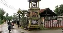
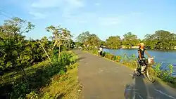 Road connecting Vavuniya and Pandarikulam | |
 Pandarikulam 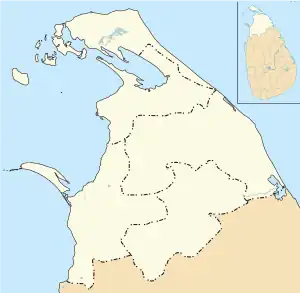 Pandarikulam 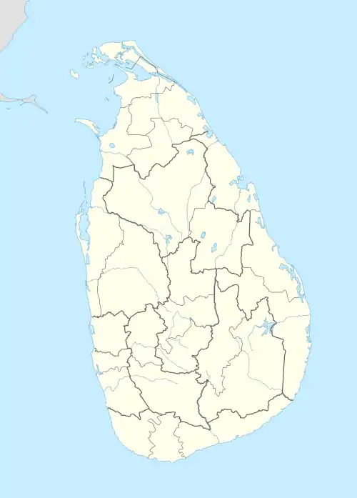 Pandarikulam | |
| Coordinates: 8°45′25″N 80°28′30″E | |
| Country | Sri Lanka |
| Province | Northern Province, Sri Lanka |
| District | Vavuniya |
| Urban Council | Vavuniya Urban Council |
| Weather | |
| Named for | Pandara Wanniyan |
| Government | |
| • Type | Urban Council |
| • Body | Grama Niladhari |
| • GS | S. Rahulprasadh |
| • Local Authority Member | K. Sumanthiran |
| Area | |
| • Total | 15.3 km2 (5.9 sq mi) |
| Elevation | 104 m (341 ft) |
| Population | |
| • Total | 7,065[1] |
| Time zone | UTC+5:30 |
| Postal Code | 43000 |
| Area code | 024 |
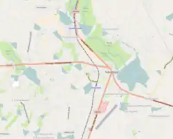
Pandarikulam is one of a number of villages that surrounded Vavuniya which have been annexed by the town as it expanded.[4] Pandarikulam is located 1 km (0.62 mi) away from the centre of Vavuniya.[5]
Etymology
The village was previously known as Karunkaliyadithoddam (Tamil: கருங்காலியடித்தோட்டம், romanized: Karuṅkāliyaṭittōṭṭam, lit. 'Ebony Garden') because of the Ebony trees in the area, the village is known to have been given to the citizens of "Pandaram" during the reign of the Vanni kings who used to build garlands and worship at Shaivaite temples. The historical texts of Vavuniya state that Pandarakulam was later renamed as "Pandarikulam" after the hero King Pandaravanniyan[6].[7][8]
Location
Pandarikulam is located 1 km (0.62 mi) away from Vanuniya. It is bordered to the north by Kurumankadu, to the east by Vairavarpuliyankula, to the west by Ukkulankulam, and to the south by Pandarikulam South.
History
After the death of King Pandara Vanniyan in 1803, the place fell under the Kingdom of Kandy, until its eventual absorption by the British Empire as a protectorate following the Kandyan Convention of 1815.[9][10]
Historical Place
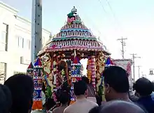
Pandarikulam Muthumari Amman Kovil is a Hindu Temple in Pandarikulam. This temple was built in 1522AD. This is the Largest & Biggest Hindu Temple in Vavuniya District.[11]
Education
- Vipulanantha College[12]
- Maths Centre
- Education Development Institute (EDI)
- Lincoln English Academy
- Colombus Best Institute (CBI)
Transport
- Vavuniya Railway Station
- Vavuniya Airport
- Vavuniya Bus Stand
References
- Kularatne, Ranil K. A. (2015). "Case study on municipal solid waste management in Vavuniya township: Practices, issues and viable management options". Journal of Material Cycles and Waste Management. 17: 51–62. doi:10.1007/s10163-013-0225-7. S2CID 110062399.
- "214E". www.vavuniya.dist.gov.lk. Retrieved 17 June 2019.
- The traditional homeland of the Tamils. Kanal Publications. 1996. p. 376. ISBN 9789559424000.
- Geographia Polonica, Issues 35-39. Polish Scientific Publishers. 1977. p. 160.
- "Satellite map of Sri Lanka : Google™ — share any place, address search; cities, countries, regions". Satellites.pro. Retrieved 8 April 2019.
- Jeganathan, Gnapirakasam (2019). Perum Oorum (in Tamil). Vavuniya: Author. pp. 45 to 55. ISBN 978-624-95247-0-5.
- "Maps, Weather, and Airports for Pandarikulam, Sri Lanka". Fallingrain.com. Retrieved 8 April 2019.
- "Pandarikulam, Sri Lanka - Geographical Names, map, geographic coordinates". Geographic.org. Retrieved 8 April 2019.
- "Pandarikulam Road, Vavuniya District". Mapio.net. Retrieved 22 June 2019.
- "Vipulananda college, Pandarikulam, Vavuniya". Mapio.net. Retrieved 22 June 2019.
- "Amman Kovil Road Pandarikulam". Mapio.net. Retrieved 26 June 2019.
- "Vipulananda college, Pandarikulam, Vavuniya". Mapio.net. Retrieved 26 June 2019.