Panjakent
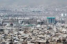
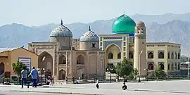
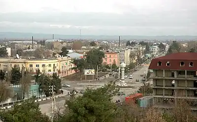
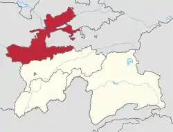
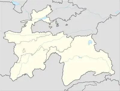
Panjakent (Tajik: Панҷакент), or Penjikent (Russian: Пенджикент[lower-alpha 1]) is a city in the Sughd province of Tajikistan on the river Zeravshan, with a population of 52,500 (2020 estimate). It was once an ancient town in Sogdiana. The ruins of the old town are on the outskirts of the modern city. The Sarazm Important Bird Area lies downstream of the city on the tugay-vegetated floodplain of the river.
Panjakent
Панҷакент Пенджикент | |
|---|---|
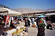
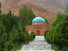
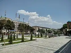 Central Panjakent | |
 Panjakent Location of Panjakent  Panjakent Panjakent (Central Asia) | |
| Coordinates: 39.486769°N 67.619734°E | |
| Country | |
| Region | Sughd Region |
| Elevation | 996 m (3,268 ft) |
| Population (2020)[2] | |
| • City | 303,000 |
| • Urban | 52,500 |
| Time zone | UTC+5 |
| Official languages | |
History
Ancient Panjakent was a small but flourishing town of the Sogdians in pre-Islamic Central Asia. It was known as Panchekanth.[4] It means five towns (villages) in Persian. The ethnic and territorial name "Soghd/Soghdian" or Sughd/Sughdian was mentioned in history as early as the Iranian Achaemenid dynasty (6th century BC). The Achaemenids founded several city-states, as well as cities along the ancient Silk road and in the Zarafshan valley.
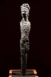
The town grew in the 5th century AD and many professionals such as established businessmen and landowners made their livelihoods in Panjakent. In AD 722, Arab Muslims forces besieged and took the town. The last ruler of the town Divashtich fled into upper Zarafshan but he was captured and sentenced to death. For around 50 years, ancient Panjakent was ruled by new administrators but towards the end of the 8th century the town on the upper terraces was depopulated and relocated. Many ancient ruins of the old city, particularly the city architecture and works of art remain today.
Numerous records of a Penjikent rulership, written in Sogdian, were located not far of Penjikent on Mount Mug. Through their reading of these texts, the public of Central Asia in the 8th century will judge on social, economic and political life.[5]
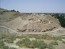
According to Arab geographers, Panjakent in the 10th century had a formal Friday mosque that distinguished the place as a town from a village. It was the easternmost city of Soghd, and became well known for its walnuts.[6]
Russian archaeologist Boris Marshak spent more than fifty years excavating the ruins at Panjakent.[7] He remained there even after Tajik independence as director of the excavation of the Panjakent ruins, during the years of Civil War in Tajikistan from 1992 to 1997. Through close cooperation with the government of Tajikistan, Marshak ensured the protection and continued excavation of the Panjakent ruins.
Ancient murals and artifacts
Numerous murals were recovered from the site of Panjikent, and many of them are now on display in the Hermitage Museum and in the National Museum of Antiquities of Tajikistan in Dushanbe. A great variety influences are visible in the paintings, which show details of dress and daily life: Greek decorative styles encounter the Iranian narratives of the Shahnameh and the epic cycle of Rostam, scenes of festivities alternate with depictions of combats, local cults mix with Iranian and Indian deities. Shaivism was popular in Sogdiana and Eastern Turkestan as found from the wall painting from Penjikent on the river Zervashan. In this depiction, Shiva is portrayed with a sacred halo and a sacred thread ("Yajnopavita"). He is clad in a tigerskin while his attendants are wearing Sogdian dress. There is a depiction of him four-legged seated cross-legged on a cushioned seat supported by two bulls.
The production of paintings started in the 5th century AD and stopped in 722 AD with the invasion of the Abbasid Caliphate, and many works of art were damaged or destroyed at that time.[8][9]
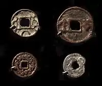 Chinese-style coinage of the rulers of Penjikent, Tajikistan, 7-8th century CE
.jpg.webp) She-wolf suckling two infants ("Romulus and Remus"), Penjikent, 5th century CE, National Museum of Antiquities of Tajikistan (KP 208–243).[10]
She-wolf suckling two infants ("Romulus and Remus"), Penjikent, 5th century CE, National Museum of Antiquities of Tajikistan (KP 208–243).[10].jpg.webp) Uma-Maheshvara: ithyphallic Shiva with spouse Uma riding the bull Nandi, Penjikent Temple II, 690-722 CE, National Museum of Antiquities of Tajikistan (60).[11]
Uma-Maheshvara: ithyphallic Shiva with spouse Uma riding the bull Nandi, Penjikent Temple II, 690-722 CE, National Museum of Antiquities of Tajikistan (60).[11]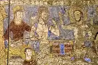 Penjikent, figures with halos, Hermitage Museum
 Men banquet, pigment on plaster. Pendjikent, Tajikistan
.jpg.webp) Panjikent mural (6th-7th century AD). Hermitage Museum
Panjikent mural (6th-7th century AD). Hermitage Museum_mural_%252C_6th-8th_Centuries_(2).jpg.webp) Panjakent (Panjīkant) mural, 6th-8th centuries AD. Hermitage Museum
Panjakent (Panjīkant) mural, 6th-8th centuries AD. Hermitage Museum_mural_%252C_6th-8th_Centuries.jpg.webp) Panjakent (Panjīkant) mural, 6th-8th centuries AD. National Museum of Antiquities of Tajikistan
Panjakent (Panjīkant) mural, 6th-8th centuries AD. National Museum of Antiquities of Tajikistan_mural%252C_6th-8th_Centuries_(3).jpg.webp) Panjakent (Panjīkant) mural, 6th-8th centuries AD
Panjakent (Panjīkant) mural, 6th-8th centuries AD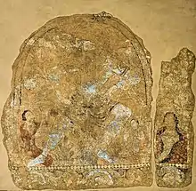
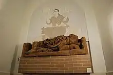 Lion and Goddess Anahita, Penjikent, 6th-8th c AD
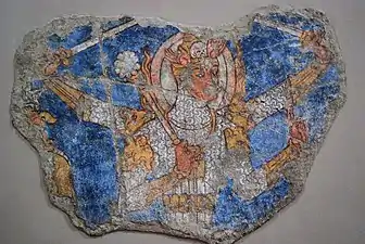 Multi-armed deity in armour
Geography
Climate
Panjakent has a hot summer humid continental climate (Köppen climate classification Dsa). The average annual temperature is 10.7 °C (51.3 °F). The warmest month is July with an average temperature of 22.8 °C (73 °F) and the coolest month is January with an average temperature of −1.6 °C (29.1 °F). The average annual precipitation is 468.5 mm (18.4") and has an average of 87.9 days with precipitation. The wettest month is April with an average of 94 mm (3.7") of precipitation and the driest month is August with an average of 2.6 mm (0.1") of precipitation.[1]
| Climate data for Panjakent (Pendzikent-38705) | |||||||||||||
|---|---|---|---|---|---|---|---|---|---|---|---|---|---|
| Month | Jan | Feb | Mar | Apr | May | Jun | Jul | Aug | Sep | Oct | Nov | Dec | Year |
| Daily mean °C (°F) | −1.6 (29.1) |
−0.4 (31.3) |
4.9 (40.8) |
11.2 (52.2) |
15.6 (60.1) |
20.5 (68.9) |
22.8 (73.0) |
21.1 (70.0) |
16.4 (61.5) |
10.4 (50.7) |
5.5 (41.9) |
1.4 (34.5) |
10.7 (51.3) |
| Average precipitation mm (inches) | 53.0 (2.09) |
53.2 (2.09) |
85.0 (3.35) |
94.0 (3.70) |
62.6 (2.46) |
11.1 (0.44) |
6.0 (0.24) |
2.6 (0.10) |
4.6 (0.18) |
31.8 (1.25) |
33.9 (1.33) |
48.7 (1.92) |
468.5 (18.44) |
| Average precipitation days (≥ 0.1 mm) | 10.7 | 11.3 | 13.5 | 12.1 | 9.3 | 3.1 | 2.3 | 1.2 | 1.7 | 5.6 | 7.5 | 9.6 | 87.9 |
| Average relative humidity (%) | 66.1 | 66.9 | 64.4 | 60.9 | 53.8 | 42.3 | 41.3 | 42.1 | 45.3 | 55.1 | 59.1 | 64.4 | 55.1 |
| Source: "The Climate of Panjakent". Weatherbase. Retrieved 7 August 2014. | |||||||||||||
Subdivisions
Before ca. 2018, Panjakent was the seat of Panjakent District, which covered the rural part of the present city of Panjakent.[12] The city of Panjakent covers Panjakent proper and fourteen jamoats.[2] These are as follows:[13]
| Jamoat | Population (Jan. 2015)[13] |
|---|---|
| Amondara | 13,380 |
| Chinor | 6,879 |
| Farob | 8,650 |
| Khalifa Hassan | 14,728 |
| Khurmi | 10,451 |
| Kosatarosh | 18,986 |
| Loiq Sherali | 18,675 |
| Moghiyon | 19,553 |
| Rudaki | 18,465 |
| Sarazm | 27,877 |
| Shing | 10,873 |
| Sujina | 12,285 |
| Voru | 12,347 |
| Yori | 19,045 |
Notable people
- Nigina Amonkulova, folk singer[14]
- Khayrinisso Yusufi, vice-premier of Tajikistan, member of the Assembly of Representatives.[15]
- Otakhon Latifi (Tajik: Отахон Латифи) (1936–1998), was a noted journalist and politician[16]
- Yaqub Beg, leader of Uighur state of Yettishar during the Dungan Revolt against the Qing dynasty in years 1865–1877[17]
- Rustem Umierov (b. 1982), Ukrainian Crimean Tatar politician
See also
Notes
- Also spelled or romanized as Pendzhikent, Penjikent, Panjekent, Panjikent, etc.
References
- "Climate of Panjakent". Weatherbase.com. Archived from the original on 8 August 2014. Retrieved 7 August 2014.
- "Population of the Republic of Tajikistan as of 1 January 2020" (PDF) (in Russian). Statistics office of Tajikistan. Retrieved 3 October 2020.
- "КОНСТИТУЦИЯ РЕСПУБЛИКИ ТАДЖИКИСТАН". prokuratura.tj. Parliament of Tajikistan. Retrieved 9 January 2020.
- Gorgâni, Tirdâd. "Welcome to Penjakent". GEOCITIES. Archived from the original on 2009-07-28. Retrieved July 23, 2008.
- "Panjikent". Retrieved March 30, 2021.
- Marshak, B.I. "Panjikant". Encyclopædia Iranica. Archived from the original on 2015-11-16. Retrieved 2011-08-08.
- Shkoda, V. (October 2003). "Marshak's Bibliography and CV". Transoxiana Webfestschrift Series I. Transoxiana: Journal Libre de Estudios Orientales. Archived from the original on 2007-01-01. Retrieved 2006-10-14.
- "PANJIKANT – Encyclopaedia Iranica". iranicaonline.org.
- Compareti, Matteo (2012). "Classical elements in Sogdian art: Aesop's fables represented in the mural paintings at Penjikent". Iranica Antiqua. XLVII: 303–316.
- [978-9461616272 Tadjikistan : au pays des fleuves d'or]. Paris, Gand: Musée Guimet, Snoek. 2021. p. 133. ISBN 978-94-6161-627-2.
{{cite book}}: Check|url=value (help) - [978-9461616272 Tadjikistan : au pays des fleuves d'or]. Paris, Gand: Musée Guimet, Snoek. 2021. p. 164. ISBN 978-94-6161-627-2.
{{cite book}}: Check|url=value (help) - "Population of the Republic of Tajikistan as of 1 January 2015" (PDF) (in Russian). Statistics office of Tajikistan. Archived from the original (PDF) on 2 July 2015. Retrieved 3 October 2020.
- Jamoat-level basic indicators, United Nations Development Programme in Tajikistan, accessed 3 October 2020
- "Nigina Amonkulova (Amonqulova)". life.ansor.info. Retrieved 2020-12-17.
- Kamoludin Abdullaev; Shahram Akbarzaheh (27 April 2010). Historical Dictionary of Tajikistan. Scarecrow Press. ISBN 978-0-8108-7379-7. Archived from the original on 31 May 2014. Retrieved 15 September 2017.
- "Opposition-Chief-Dies". Associated Press. Archived from the original on 2018-01-03. Retrieved 2018-01-02.
- "Yaqub Beg".
External links
 Panjakent travel guide from Wikivoyage
