Pasadena orogeny
Pasadena orogeny is a mountain building event in the Western United States. Conventionally it refers to the formation of mountains in mainly Southern California during the Pleistocene and lasting until the present day; originally it referred to the uplift of the San Gabriel Mountains.

The Pasadena orogeny is a major Late Quaternary[1]-modern event[2] of mountain formation,[1] which took place in the middle or perhaps late Pleistocene[3] or to the present-day.[4] It is also known as the "Coast Ranges orogeny"[3] or considered to be part of the Cascadian orogeny[5] or Alpide Orogeny.[6] Finally, the term "Pasadena orogeny" is sometimes applied to all very recent orogenies around the Pacific Ocean.[7] The type location is close to Pasadena, California in the Transverse Ranges,[8] and originally referred to the fast rise of the San Gabriel Mountains recorded there.[9]
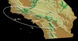
During this orogeny mountain ranges such as the San Bernardino Mountains, San Gabriel Mountains, San Jacinto Mountains, Santa Monica Mountains, Santa Ynez Mountains[10] and the Transverse Ranges grew,[11] as did the northern Channel Islands[10] such as Catalina Island and San Clemente Island,[12] the Kettleman Hills anticline in the San Joaquin Valley[13] and the Palos Verdes Hills.[14][12] Sometimes the concept is limited to the uplift of the Transverse Ranges.[15]
The general uplift of mountains over a length of over 400 kilometres (250 mi) is caused by the collision of the North American Plate with other geologic structures that are attached to the Pacific Plate.[10] This orogeny has resulted in the uplift of mostly north-south trending mountain chains, although some east-west trending uplifts are also found such as the Channel Islands and the Transverse Ranges;[13] much of the uplift took place at the edge of basins.[16] The Pasadena orogeny is accompanied by earthquake activity, which includes tsunami hazards.[17]
Folding accompanying the uplift of the Coast Ranges in Southern California,[3] folding farther north at Morro Bay[18] and the structure of the Santa Barbara Basin[1] and Ventura Basin are consequences of the Pasadena orogeny.[4] The city of Long Beach, California lies within the affected region.[2]
References
- Marsaglia, K.M.; Rimkus, K.C.; Behl, R.J. (October 1995), "Provenance of Sand Deposited in the Santa Barbara Basin at Site 893 during the Last 155,000 Years" (PDF), Proceedings of the Ocean Drilling Program, 146 Part 2 Scientific Results, vol. 146–2, Ocean Drilling Program, doi:10.2973/odp.proc.sr.146-2.274.1995, retrieved 2018-11-20
- Bohannon & Gardner 2004, p. 261.
- Davis, W. M. (1932). "Glacial Epochs of the Santa Monica Mountains, California". Proceedings of the National Academy of Sciences of the United States of America. 18 (11): 659–665. Bibcode:1932PNAS...18..659D. doi:10.1073/pnas.18.11.659. JSTOR 85970. PMC 1076305. PMID 16577491.
- Scott, Edward W. (1983). "Petroleum potential of wilderness lands in California; petroleum potential of wilderness lands in the Western United States". Circular. p. D4. doi:10.3133/cir902D. ISSN 2330-5703.
{{cite book}}:|journal=ignored (help) - Bandy, Orville L. (1970). Radiometric Dating and Paleontologic Zonation. Geological Society of America. p. 191. ISBN 9780813721248.
- Stille 1936, p. 875.
- Stille 1936, p. 849.
- Blakey & Ranney 2017, p. 186.
- Blakey & Ranney 2017, p. 183.
- Blakey & Ranney 2017, p. 31.
- Wright, Tom (1987). Geologic Evolution of the Petroleum Basins of Southern California (Report). Petroleum Geology of Coastal Southern California. p. 7.
- Platt, John P.; Grove, Marty; Kimbrough, David L.; Jacobson, Carl E. (2020), "Structure, metamorphism, and geodynamic significance of the Catalina Schist terrane", From the Islands to the Mountains: A 2020 View of Geologic Excursions in Southern California, Geological Society of America, p. 178, doi:10.1130/2020.0059(05), ISBN 978-0-8137-0059-5, S2CID 219407435, retrieved 2020-09-04
- Stille 1936, p. 869.
- HANER, BARBARA E. (1971). "Morphology and Sediments of Redondo Submarine Fan, Southern California". Geological Society of America Bulletin. 82 (9): 2413. Bibcode:1971GSAB...82.2413H. doi:10.1130/0016-7606(1971)82[2413:MASORS]2.0.CO;2.
- Blakey & Ranney 2017, p. 197.
- Blakey & Ranney 2017, p. 181.
- Bohannon & Gardner 2004, p. 262.
- Blakey & Ranney 2017, p. 184.
Sources
- Blakey, Ronald C.; Ranney, Wayne (2017). Ancient landscapes of western North America : a geologic history with paleogeographic maps. Cham, Switzerland. ISBN 9783319596365. OCLC 1005353728.
{{cite book}}: CS1 maint: location missing publisher (link) - Bohannon, Robert G; Gardner, James V (January 2004). "Submarine landslides of San Pedro Escarpment, southwest of Long Beach, California". Marine Geology. 203 (3–4): 261–268. Bibcode:2004MGeol.203..261B. doi:10.1016/S0025-3227(03)00309-8. ISSN 0025-3227.
- Stille, Hans (1936). "The Present Tectonic State of the Earth". AAPG Bulletin. 20 (7). ISSN 0149-1423.