Peacocke, New Zealand
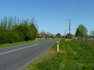
Peacocke is a semi-rural suburb in southern Hamilton in New Zealand. Peacocke was brought into the city boundaries in 1989. It is one of the future urban zones of Hamilton, along with Rotokauri.[3]
Peacocke | |
|---|---|
 Peacocke, Hamilton | |
| Coordinates: 37°48′44.13″S 175°18′43.56″E | |
| Country | New Zealand |
| City | Hamilton, New Zealand |
| Local authority | Hamilton City Council |
| Electoral ward | West Ward |
| Area | |
| • Land | 693 ha (1,712 acres) |
| Population (June 2022)[2] | |
| • Total | 410 |
| Hillcrest | Riverlea | |
| Fitzroy |
|
|
| Rukuhia | Tamahere |
The Peacocke Structure Plan of 2007 provided for development on 620 ha (1,500 acres) over about 25 years.[4]
Two consent applications were made in 2018 proposing an 'Amberfield' development of 862 sections on 105 ha (260 acres) between Peacockes Rd and the Waikato River.[5] By 2020 the granting of the consent had been appealed to the Environment Court, a major issue being protection of habitats for endangered long tailed bats.[5]
History
Nukuhau Pā is one of the best preserved pā sites on the Waikato. It is at the south end of Peacocke, beside the river. Ngāti Mahuta may have been occupied it around 1700, after which Ngati Raukawa conquered it, or it may have belonged to Ngāti Ruru and been taken back by Ngāti Māhanga. It was reported as abandoned about 1830, at the time of the musket wars.[6] After the 1863 invasion of the Waikato it was confiscated.[7]
The land was acquired in 1868 by Colonel de Quincy, who named it “Weston Lea” after his grandmother’s English home,[8] near Bath.[9] In 1887,[10] Fitzroy Peacocke, a son of Captain Peacocke, bought the land from the Colonel, who was step-father of his wife, Florence Henrietta.[8] However, they didn't move there until 1889[11] and the farm was for sale 3 years later.[12] Their son, Egerton Peacocke, took on the farm in 1905 and cleared much of the bush to form a dairy farm. His brother Noel, an architect, designed a new homestead, built in 1912.[8]
Demographics
The statistical area, which is called Peacockes, covers 6.93 km2 (2.68 sq mi)[1] and had an estimated population of 410 as of June 2022,[2] with a population density of 59 people per km2.
| Year | Pop. | ±% p.a. |
|---|---|---|
| 2006 | 291 | — |
| 2013 | 327 | +1.68% |
| 2018 | 348 | +1.25% |
| Source: [13] | ||
Peacockes had a population of 348 at the 2018 New Zealand census, an increase of 21 people (6.4%) since the 2013 census, and an increase of 57 people (19.6%) since the 2006 census. There were 138 households, comprising 168 males and 183 females, giving a sex ratio of 0.92 males per female. The median age was 44.8 years (compared with 37.4 years nationally), with 63 people (18.1%) aged under 15 years, 57 (16.4%) aged 15 to 29, 150 (43.1%) aged 30 to 64, and 78 (22.4%) aged 65 or older.
Ethnicities were 90.5% European/Pākehā, 12.9% Māori, 1.7% Pacific peoples, 7.8% Asian, and 2.6% other ethnicities. People may identify with more than one ethnicity.
The percentage of people born overseas was 18.1, compared with 27.1% nationally.
Although some people chose not to answer the census's question about religious affiliation, 49.1% had no religion, 41.4% were Christian, 0.9% were Buddhist and 1.7% had other religions.
Of those at least 15 years old, 84 (29.5%) people had a bachelor's or higher degree, and 51 (17.9%) people had no formal qualifications. The median income was $38,200, compared with $31,800 nationally. 63 people (22.1%) earned over $70,000 compared to 17.2% nationally. The employment status of those at least 15 was that 135 (47.4%) people were employed full-time, 48 (16.8%) were part-time, and 9 (3.2%) were unemployed.[13]
See also
References
- "ArcGIS Web Application". statsnz.maps.arcgis.com. Retrieved 22 October 2022.
- "Population estimate tables - NZ.Stat". Statistics New Zealand. Retrieved 25 October 2022.
- "Peacocke". Hamilton City Council. Archived from the original on 26 September 2010. Retrieved 18 September 2010.
- "Peacocke Structure Plan" (PDF). Hamilton City Council. 2007.
- "Rail and transport progress outlined". Our Hamilton. 5 September 2018. Retrieved 16 April 2020.
- "Amberfield: Assessment of Archaeological Values" (PDF). Hamilton City Council. 10 April 2018.
- "NOTICE OF RAHUI PLACED ON AMBERFIELD DEVELOPMENTS" (PDF). Te Hapū o Te Wakaminenga Wahi o Maniapoto. 7 November 2019.
- "EVIDENCE-IN-CHIEF OF MARK EDWIN PEACOCKE FOR WESTON LEA LIMITED" (PDF). 12 April 2019.
- Stephen, Leslie, "De Quincey Thomas", Dictionary of National Biography, 1885-1900, vol. 14, retrieved 18 April 2020
- "Page 3 Advertisements Column 5 WAIKATO TIMES". paperspast.natlib.govt.nz. 23 June 1887. Retrieved 18 April 2020.
- "WAIKATO TIMES". paperspast.natlib.govt.nz. 31 December 1889. Retrieved 18 April 2020.
- "WAIKATO TIMES". paperspast.natlib.govt.nz. 14 May 1892. Retrieved 18 April 2020.
- "Statistical area 1 dataset for 2018 Census". Statistics New Zealand. March 2020. Peacockes (181300). 2018 Census place summary: Peacockes