Peck Lake
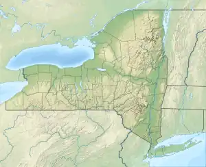
Peck Lake is man-made lake in the Town of Bleecker, New York in Fulton County, in the southern Adirondack region. It was created with a dam and combined the old Peck's Pond, East Lake, and Gould Lake.[1] The lake is named after John Peck.[2]
| Peck Lake | |
|---|---|
 Peck Lake  Peck Lake | |
| Coordinates | 43.112°N 74.410°W |
| Primary outflows | Peck Creek |
| Basin countries | United States |
| Max. length | 5 miles (8.0 km) |
| Max. width | 2 miles (3.2 km) |
| Surface area | 1,370 acres (5.5 km2) |
| Average depth | 14 feet (4.3 m) |
| Max. depth | 40 feet (12 m) |
| Shore length1 | 13.9 feet (4.2 m)[1] |
| Settlements | Caroga Lake, New York |
| 1 Shore length is not a well-defined measure. | |
History
The Mohawk Hydro-Electric Company, wanted to build a hydroelectric station in Ephratah, and needed an upstream reservoir that produced enough water for the operation of this plant. Peck's Pond was chosen due to its close location. The power company built a dam at the outlet of the present day mill pond. The dam raised the water level 20 or so feet.[2]
Climate
| Climate data for Peck Lake, New York, 1991–2020 normals, 2008-2022 snowfall: 1455ft (443m) | |||||||||||||
|---|---|---|---|---|---|---|---|---|---|---|---|---|---|
| Month | Jan | Feb | Mar | Apr | May | Jun | Jul | Aug | Sep | Oct | Nov | Dec | Year |
| Average high °F (°C) | 24.5 (−4.2) |
27.1 (−2.7) |
35.3 (1.8) |
48.1 (8.9) |
62.9 (17.2) |
71.5 (21.9) |
76.7 (24.8) |
73.1 (22.8) |
66.9 (19.4) |
53.0 (11.7) |
40.5 (4.7) |
30.4 (−0.9) |
50.8 (10.5) |
| Daily mean °F (°C) | 15.8 (−9.0) |
17.4 (−8.1) |
25.8 (−3.4) |
38.8 (3.8) |
52.5 (11.4) |
61.7 (16.5) |
66.2 (19.0) |
63.5 (17.5) |
56.6 (13.7) |
44.3 (6.8) |
32.8 (0.4) |
23.1 (−4.9) |
41.5 (5.3) |
| Average low °F (°C) | 7.1 (−13.8) |
7.8 (−13.4) |
16.4 (−8.7) |
29.4 (−1.4) |
42.1 (5.6) |
51.9 (11.1) |
55.8 (13.2) |
53.9 (12.2) |
46.3 (7.9) |
35.6 (2.0) |
25.1 (−3.8) |
15.7 (−9.1) |
32.3 (0.1) |
| Average precipitation inches (mm) | 3.87 (98) |
3.48 (88) |
3.72 (94) |
4.35 (110) |
4.47 (114) |
4.91 (125) |
4.83 (123) |
4.10 (104) |
4.34 (110) |
4.87 (124) |
3.65 (93) |
4.14 (105) |
50.73 (1,288) |
| Average snowfall inches (cm) | 27.4 (70) |
33.7 (86) |
18.2 (46) |
3.7 (9.4) |
0.2 (0.51) |
0.0 (0.0) |
0.0 (0.0) |
0.0 (0.0) |
0.0 (0.0) |
1.1 (2.8) |
8.1 (21) |
25.0 (64) |
117.4 (299.71) |
| Source 1: NOAA[3] | |||||||||||||
| Source 2: XMACIS (snowfall)[4] | |||||||||||||
References
- "peck lake" (PDF). oneonta.edu. bio field station. 1995. Retrieved 21 April 2017.
data
- "Peck lake". Peckslake.com. peckslake.com. 1995. Retrieved 21 April 2017.
data
- "Gloversville 7NW (Peck Lake), New York 1991-2020 Monthly Normals". Retrieved October 20, 2023.
- "xmACIS". National Oceanic and Atmospheric Administration. Retrieved October 20, 2023.
This article is issued from Wikipedia. The text is licensed under Creative Commons - Attribution - Sharealike. Additional terms may apply for the media files.