Pennsylvania Route 284
Pennsylvania Route 284 (PA 284) is a 9.043-mile-long (14.553 km) state highway located in Lycoming County in Pennsylvania. The western terminus is at PA 287 in English Center and the eastern terminus is at an interchange with U.S. Route 15 (US 15) in the Buttonwood section of McNett Township. PA 284 was designated as a spur of PA 84 in the 1928 renumbering of state highways in Pennsylvania. The route was paved in 1932 and has remained relatively untouched since, although PA 84 was re-designated as PA 287 in 1961 to avoid duplication with Interstate 84 (I-84).
Pennsylvania Route 284 | ||||
|---|---|---|---|---|
| Route information | ||||
| Maintained by PennDOT | ||||
| Length | 9.043 mi[1] (14.553 km) | |||
| Existed | 1928–present | |||
| Major junctions | ||||
| West end | ||||
| East end | ||||
| Location | ||||
| Country | United States | |||
| State | Pennsylvania | |||
| Counties | Lycoming | |||
| Highway system | ||||
| ||||
Route description

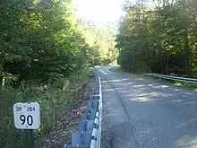
PA 284 begins at an intersection with PA 287 just north of the village of English Center. The road winds northeast through rural Lycoming County alongside nearby Little Pine Creek. PA 284 runs through Pine Township, soon reaching the newly named Blockhouse Creek (from Little Pine). The two-lane continues through the dense woods in the area, paralleling Blockhouse Creek into the village of Buttonwood. In Buttonwood, PA 284 enters an interchange with US 15, first intersecting with the ramp to US 15 south. After crossing the freeway, PA 284 curves north and ends at the junction with an on-ramp to US 15 northbound.[2]

History
A road in the location of PA 284 first shows on maps as early as 1873.[3] PA 284 was first designated along its current alignment during the 1928 renumbering of state highways in Pennsylvania. The designation was done as a spur to the alignment of PA 84, which was designated from Piatt Township to the New York state line.[4] The entire alignment of PA 284 was paved by the Pennsylvania Department of Highways in 1932, including the bridge over Flooks Run and Blacks Creek.[5] However, the alignment has remained relatively unchanged since. In 1961, with the designation of I-84, the alignment of PA 84 was re-designated as PA 287 to avoid duplication.[6] In 1974, PA 284 was adjusted for the construction of the new US 15 alignment. This was adjusted in 1998 with the construction of US 15 for preparations to convert the route to I-99.[7]
Major intersections
The entire route is in Lycoming County.
| Location | mi[1] | km | Destinations | Notes | |
|---|---|---|---|---|---|
| Pine Township | 0.000 | 0.000 | Western terminus; Village of English Center | ||
| McNett Township | 8.330 | 13.406 | US 15 exit 158 | ||
| 9.043 | 14.553 | Eastern terminus; US 15 exit 158; Village of Buttonwood | |||
| 1.000 mi = 1.609 km; 1.000 km = 0.621 mi | |||||
See also
References
- Bureau of Maintenance and Operations (January 2015). Roadway Management System Straight Line Diagrams (Report) (2015 ed.). Pennsylvania Department of Transportation. Retrieved June 30, 2015.
- Lycoming County (PDF)
- Microsoft; Nokia (September 14, 2015). "overview map of PA 284" (Map). Bing Maps. Microsoft. Retrieved September 14, 2015.
- 1873 Atlas of Lycoming County Pennsylvania from Actual Surveys by and under the direction of Beach Nichols published by A. Pomeroy & Co.
- Official Road Map of Pennsylvania State Highways (Map). Cartography by Pennsylvania Department of Highways. Pennsylvania Department of Highways. 1928.
- Official Road Map of Pennsylvania State Highways (Map). Cartography by Pennsylvania Department of Highways. Pennsylvania Department of Highways. 1932.
- Road Map of Pennsylvania (Map). Cartography by Pennsylvania Department of Highways. Pennsylvania Department of Highways. 1961.
- Inventory, National Bridge (2011). "Structure Number: 410015177103250". Washington D.C.: United States Department of Transportation. Archived from the original on 4 March 2016. Retrieved 26 June 2012.
