Perley, Minnesota
Perley is a city in Norman County, Minnesota, United States. Its population was 113 at the 2020 census.[2]
Perley | |
|---|---|
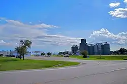 Perley, Minnesota at the intersection of US Highway 75 and Norman County Highway 39 | |
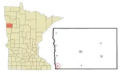 Location of Perley, Minnesota | |
| Coordinates: 47°10′37″N 96°48′11″W | |
| Country | United States |
| State | Minnesota |
| County | Norman |
| Area | |
| • Total | 0.25 sq mi (0.64 km2) |
| • Land | 0.25 sq mi (0.64 km2) |
| • Water | 0.00 sq mi (0.00 km2) |
| Elevation | 876 ft (267 m) |
| Population | |
| • Total | 113 |
| • Estimate (2021)[3] | 110 |
| • Density | 457.49/sq mi (176.29/km2) |
| Time zone | UTC-6 (CST) |
| • Summer (DST) | UTC-5 (CDT) |
| ZIP code | 56574 |
| Area code | 218 |
| FIPS code | 27-50506 |
| GNIS feature ID | 0649302[4] |
History
A post office called Perley has been in operation since 1885.[5] The city was named for George Edmund Perley, a local attorney.[6]
Geography
According to the United States Census Bureau, the city has a total area of 0.24 square miles (0.62 km2), all land.[7]
Demographics
| Census | Pop. | Note | %± |
|---|---|---|---|
| 1910 | 188 | — | |
| 1920 | 222 | 18.1% | |
| 1930 | 231 | 4.1% | |
| 1940 | 246 | 6.5% | |
| 1950 | 204 | −17.1% | |
| 1960 | 165 | −19.1% | |
| 1970 | 149 | −9.7% | |
| 1980 | 134 | −10.1% | |
| 1990 | 132 | −1.5% | |
| 2000 | 121 | −8.3% | |
| 2010 | 92 | −24.0% | |
| 2020 | 113 | 22.8% | |
| 2021 (est.) | 110 | [3] | −2.7% |
| U.S. Decennial Census[8] 2020 Census[2] | |||
As of 2000, the median income for a household in the city was $31,250, and the median income for a family was $35,625. Males had a median income of $21,528 versus $19,063 for females. The per capita income for the city was $13,998. There were 10.5% of families and 12.2% of the population living below the poverty line, including 23.7% of under eighteens and none of those over 64.
2010 census
As of the census of 2010, there were 92 people, 48 households, and 28 families residing in the city. The population density was 383.3 inhabitants per square mile (148.0/km2). There were 53 housing units at an average density of 220.8 per square mile (85.3/km2). The racial makeup of the city was 93.5% White, 1.1% Native American, 3.3% from other races, and 2.2% from two or more races. Hispanic or Latino of any race were 7.6% of the population.
There were 48 households, of which 16.7% had children under the age of 18 living with them, 50.0% were married couples living together, 6.3% had a female householder with no husband present, 2.1% had a male householder with no wife present, and 41.7% were non-families. 39.6% of all households were made up of individuals, and 6.3% had someone living alone who was 65 years of age or older. The average household size was 1.92 and the average family size was 2.50.
The median age in the city was 48 years. 15.2% of residents were under the age of 18; 4.3% were between the ages of 18 and 24; 22.8% were from 25 to 44; 39.2% were from 45 to 64; and 18.5% were 65 years of age or older. The gender makeup of the city was 52.2% male and 47.8% female.
References
- "2020 U.S. Gazetteer Files". United States Census Bureau. Retrieved July 24, 2022.
- "Explore Census Data". United States Census Bureau. Retrieved April 20, 2022.
- "City and Town Population Totals: 2020-2021". United States Census Bureau. June 19, 2022. Retrieved June 19, 2022.
- "US Board on Geographic Names". United States Geological Survey. October 25, 2007. Retrieved January 31, 2008.
- "Norman County". Jim Forte Postal History. Retrieved July 26, 2015.
- Upham, Warren (1920). Minnesota Geographic Names: Their Origin and Historic Significance. Minnesota Historical Society. p. 383.
- "US Gazetteer files 2010". United States Census Bureau. Archived from the original on July 2, 2012. Retrieved November 13, 2012.
- United States Census Bureau. "Census of Population and Housing". Retrieved February 12, 2014.
Municipalities and communities of Norman County, Minnesota, United States | ||
|---|---|---|
| Cities | 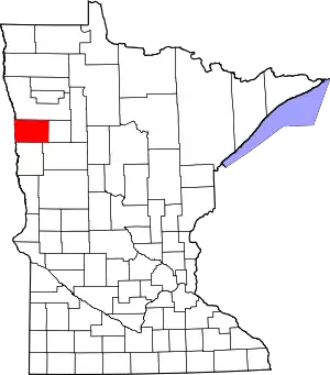 Map of Minnesota highlighting Norman County | |
| Townships | ||
| Unincorporated communities | ||
| Ghost town | ||