Phalombe
Phalombe is a town in Malawi. It is the district capital of Phalombe District.[1]
Phalombe | |
|---|---|
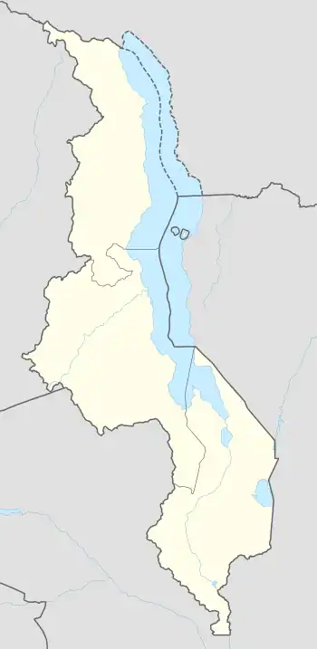
 Phalombe Location in Malawi | |
| Coordinates: 15°48′12″S 35°39′12″E | |
| Country | |
| Region | Southern Region |
| District | Phalombe District |
| Elevation | 2,513 ft (766 m) |
| Population (2018 (Census)) | |
| • Total | 6,242 |
| Time zone | +2 |
| Climate | Cwa |
Location
Phalombe is located about 44 kilometres (27 mi), by road, north-east of Mulanje, along the T408 Road.[2] This is approximately 97 kilometres (60 mi), by road, east of Blantyre, the financial capital of Malawi and the largest city in the country's Southern Region.[3] Phalombe lies at an average location of 766 metres (2,513 ft) above sea level.[4] The geographical location of Phalombe are 15°48'12.0"S, 35°39'12.0"E (Latitude:-15.803333; Longitude:35.653333).[5]
Overview
It is situated below the Fort Lister Gap between the two larger parts of the Mulanje Massif. Due to this location it is vulnerable for flash floods, which can easily occur during the rainy season. The most devastating one in recent history occurred in March 1991, which left Phalombe with a 2-3 meter (7 to 10 feet) high mud layer and killed hundreds of people. On this spot a monument was erected to remember the named and unnamed victims.[6]
Points of interest
5 kilometres (3 mi), south of the town center, along the Phalombe-Mulanje Road, is a Catholic mission consisting of a Catholic church and the Holy Family Hospital. The hospital is run by locals in association with the Dutch charity Memisa and is staffed by Malawian clinical officers as well as Dutch tropical doctors. Holy Family Nursing College is attached to the hospital.[7]
The road from Mulanje to Phalombe is tarmacked, as of May 2019.[8]
Demographics
| Year | Population |
|---|---|
| 1998 | 2 592 |
| 2008 | 3 058 |
| 2013 | 6 126 |
| 2018 | 6 242[9] |
Weather
Generally, the weather in Phalombe is warm, muggy and cloudy, from November to April and is comfortable, clear and cool from May through October. During the course of the year, the temperature typically varies from 59 °F to 86 °F (15 °C to 30 °C) and is rarely below 56 °F (13 °C) or above 92 °F (33 °C).[10]
References
- Hudson Institute of Mineralogy (2019). "Phalombe is a settlement in the Southern Region of Malawi". Mindat.org. Retrieved 10 May 2019.
- Globefeed.com. "Distance between Mulanje, Southern Region, Malawi and Phalombe, Southern Region, Malawi". Globefeed.com. Retrieved 10 May 2019.
- Globefeed.com (10 May 2019), Distance between Blantyre, Southern Region, Malawi and Phalombe, Southern Region, Malawi, Globefeed.com, retrieved 10 May 2019
- Date & Time (2019). "Elevation of Philombe Above Sea Level: 766 m = 2513 feet". Dateandtime.info. Retrieved 10 May 2019.
- Google (10 May 2019). "Location of Phalombe, Southern Region, Malawi" (Map). Google Maps. Google. Retrieved 10 May 2019.
- Malawi News Agency (11 March 2016). "Remembering Phalombe Disaster". Malawi Nation. Blantyre. Retrieved 10 May 2019.
- Phalombe Holy Family Hospital (10 March 2010). "Holy Family Hospital, Phalombe, Malawi". Phalombe, Malawi: Phalombe Holy Family Hospital. Retrieved 10 May 2019.
- Google (10 May 2019). "Satellite Map Showing Tarmacked Phalombe-Mulanje Road" (Map). Google Maps. Google. Retrieved 10 May 2019.
- United Nations Population Fund (December 2018). "Population of Phalombe in 2018" (PDF). United Nations Population Fund. p. 50. Retrieved 10 May 2019.
- Cedar Lake Ventures, Inc. (2019). "Average Weather In Phalombe, Malawi Year Round". Excelsior, Minnesota, United States: Weatherspark.com. Retrieved 10 May 2019.