Phu Ruea
Phu Ruea (Thai: ภูเรือ), is a 1365 m high mountain in Loei province, Thailand. It is in Phu Ruea district. This mountain is part of the Phetchabun Mountains, a massif forming a natural boundary between northern Thailand and Isan. The peak rises seven kilometers north of Highway 203, between Loei town and Phetchabun.[1] The name of the mountain comes from the fact that it looks like an upside down boat (Thai: เรือ) from certain angles.
| Phu Ruea | |
|---|---|
| ภูเรือ | |
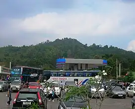 South side of the summit seen from Route 203 | |
| Highest point | |
| Elevation | 1,365 m (4,478 ft) |
| Listing | List of mountains in Thailand |
| Coordinates | 17°30′00″N 101°20′00″E |
| Geography | |
 Phu Ruea Thailand | |
| Location | Loei, Thailand |
| Parent range | Phetchabun Mountains |
| Geology | |
| Mountain type | sandstone |
The Phu Ruea High Altitude Agricultural Research Station is on the mountain [2] and Phu Ruea National Park encompasses the peak. The park borders Sainyabuli province in Laos at its northern end.[3] Most of the mountain is covered in mixed evergreen forest.[4] The area around the mountain is part of the Luang Prabang montane rain forests ecoregion.[5]
References
- National parks in north-eastern Thailand - Phu Rua National Park
- "Phu Ruea High Altitude Agricultural Research Station". Bangkok Post.
- "National Parks & Marine Reserves - Phu Rua National Park". Archived from the original on 2011-11-23. Retrieved 2011-12-22.
- Phu Ruea Thai Website
- Luang Prabang montane rain forests
External links
- Thai geography: Isan northern and eastern riparian belt
- "Luang Prabang montane rain forests". Terrestrial Ecoregions. World Wildlife Fund.
- Phu Rua National Park Official Website
- Phu Ruea High Altitude Agricultural Research Station,Phu Ruea,Loei