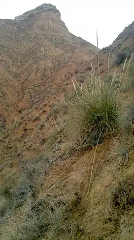
Pico del Águila (La Alcarria)
Pico del Águila (en: Beak of the Eagle) is a tabular mountain at the limits of the Alcarria altiplano, or high plain. It lies in the Spanish province of Guadalajara with a prominent drop of about 200 m at its northern side.
| Pico del Águila | |
|---|---|
 Looking up from the foot of the drop at the northern end | |
| Highest point | |
| Elevation | 970 m (3,180 ft) |
| Coordinates | 40°39′19″N 3°06′23″W |
| Geography | |
| Location | Guadalajara |
Access is provided by dirt tracks from the east, north and west side.[1]
References
- "Subida al Pico del Águila (Guadalajara) - Ruta de Senderismo". 11 December 2013.
This article is issued from Wikipedia. The text is licensed under Creative Commons - Attribution - Sharealike. Additional terms may apply for the media files.