Pinet Butte
Pinet Butte.png Pinet Butte (73°10′S 161°41′E) is a small butte comprising the westernmost portion of the Caudal Hills, in Victoria Land. Mapped by United States Geological Survey (USGS) from surveys and U.S. Navy air photos, 1960–64. Named by Advisory Committee on Antarctic Names (US-ACAN) for Paul R. Pinet, geologist at McMurdo Station, 1966–67.
| Pinet Butte | |
|---|---|
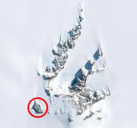 Pinet Butte and the Caudal Hills, Pinet Butte circled in red. |
![]() This article incorporates public domain material from "Pinet Butte". Geographic Names Information System. United States Geological Survey.
This article incorporates public domain material from "Pinet Butte". Geographic Names Information System. United States Geological Survey.
This article is issued from Wikipedia. The text is licensed under Creative Commons - Attribution - Sharealike. Additional terms may apply for the media files.