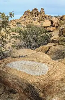
Pioneertown Mountains Preserve
Pioneertown Mountains Preserve is a Wildlands Conservancy nature preserve consisting of 25,500 acres (103 km2) of land in San Bernardino County, California. It features geologically interesting mountain ranges and riparian zones. It is located in the Mojave Desert in the eastern San Bernardino Mountains.
| Pioneertown Mountains Preserve | |
|---|---|
IUCN category V (protected landscape/seascape) | |
 Location of Pioneertown Mountains Preserve | |
| Location | San Bernardino County, California |
| Nearest city | Pioneertown, California |
| Coordinates | 34°10′20″N 116°32′46″W |
| Area | 25,500 acres (103 km2) |
| Max. elevation | 6,450 feet (1,970 m) |
| Min. elevation | 3,600 feet (1,100 m) |
| Created | 1995 |
| Operator | The Wildlands Conservancy |
| Website | Pioneertown Mountains Preserve |
Recreation
The preserve has hiking trails, picnic area, and restroom. Indian Loop Trail passes through a wetlands from a perennial stream and climbs to a ridge with views of rocky peaks. It passes by the Olsen Cabin ruins. A spur trail ascends Chaparrosa Peak which provides views in all directions. The peak is on the Hundred Peaks Section list.[1] Sawtooth Loop encircles the Sawtooth Mountains which have massive jumbles of boulders. [2]

Geography
It is notable for its rock formations, desert-riparian corridor, and diverse ecology. Pipes Canyon and Little Morongo Canyon are year-round riparian corridors.
The Conservancy has three desert preserves in this region: Whitewater Preserve, Mission Creek Preserve, and Pioneertown Mountains Preserve.
Flora and fauna
Scrub oak is growing in place of the vegetation burned in 2006.
History
In the 1930s a stone cabin was built in Pipes Canyon by a miner. Ruins of this cabin remain.
In 1995, property was acquired and opened to the public. This was the first Wildlands Conservancy preserve.
In 2006, the Sawtooth Complex Fire severely burned most vegetation in the preserve. The area has begun recovering. [3]
In 2017, a severe flash flood caused extensive damage in Pipes Canyon. The upper part of Pipes Canyon Trail beyond the Olsen Ruins was destroyed and has not been reopened. Debris flows covered the road into the preserve 3-5 feet deep. [4] [5]
References
- Biller, Steven (March 31, 2022). "Out of the Park: These High Desert hikes lead to sand dunes, a palm oasis, and even a volcanic crater". Palm Springs Life. Retrieved May 11, 2022.
- Newell, Shane (March 21, 2020). "Need to exercise amid the coronavirus pandemic? Here are 5 great hikes in Palm Springs area". Palm Springs Desert Sun. Retrieved December 18, 2021 – via northjersey.com.
- Summons, Trevor (January 5, 2016). "Pioneertown area rebounding from fire". Daily Bulletin.
- The Wildlands Conservancy (August 8, 2017). "Pioneertown Road, Pipes Canyon Road, and the Indian Loop Trail experienced severe flooding". Facebook.
- The Wildlands Conservancy (August 12, 2017). "Classic flash flood in the desert". Facebook.