Place LaRue, Edmonton
Place LaRue is a commercial neighbourhood located in west Edmonton, Alberta, Canada. According to the 2001 federal census, there were only 75 private dwellings located in the neighbourhood.[4] By 2005, this had declined to 51.[5] As of the 2019 municipal census, the population is 0.[6]
Place LaRue | |
|---|---|
Neighbourhood | |
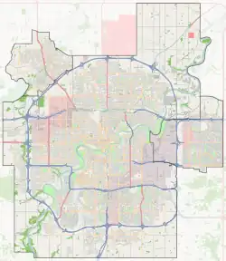
 Place LaRue Location of Place LaRue in Edmonton | |
| Coordinates: 53.539°N 113.644°W | |
| Country | |
| Province | |
| City | Edmonton |
| Quadrant[1] | NW |
| Ward[1] | Nakota Isga |
| Sector[2] | West |
| Government | |
| • Administrative body | Edmonton City Council |
| • Councillor | Andrew Knack |
| Elevation | 683 m (2,241 ft) |
The neighbourhood is bounded by 170 Street on the east, Anthony Henday Drive to the west, Stony Plain Road to the north, and 100 Avenue (west of 176 Street) and 99A Avenue (east of 176 Street) to the south.

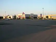
Commercial area in Place LaRue
Surrounding neighbourhoods
References
- "City of Edmonton Wards & Standard Neighbourhoods" (PDF). City of Edmonton. Archived from the original (PDF) on May 3, 2014. Retrieved February 13, 2013.
- "Edmonton Developing and Planned Neighbourhoods, 2011" (PDF). City of Edmonton. Archived from the original (PDF) on September 4, 2013. Retrieved February 13, 2013.
- "City Councillors". City of Edmonton. Retrieved February 13, 2013.
- http://censusdocs.edmonton.ca/DD23/FEDERAL%202001/Neighbourhood/PLACE%20LARUE.pdf
- http://censusdocs.edmonton.ca/C05002/MUNICIPAL%202005/Neighbourhood/PLACE%20LARUE.pdf
- https://public.tableau.com/profile/city.of.edmonton#!/vizhome/2019EdmontonMunicipalCensus/2019EdmontonMunicipalCensusNeighbourhood
This article is issued from Wikipedia. The text is licensed under Creative Commons - Attribution - Sharealike. Additional terms may apply for the media files.