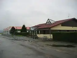
Pontarlier Airfield
Pontarlier Airfield | |||||||||||||||
|---|---|---|---|---|---|---|---|---|---|---|---|---|---|---|---|
 | |||||||||||||||
| Summary | |||||||||||||||
| Airport type | Civil | ||||||||||||||
| Owner/Operator | Town of Pontarlier | ||||||||||||||
| Serves | Pontarlier | ||||||||||||||
| Location | |||||||||||||||
| Opened | March 12, 1930 | ||||||||||||||
| Elevation AMSL | 818 m / 2,683 ft | ||||||||||||||
| Coordinates | 46°54′30″N 006°19′45″E | ||||||||||||||
| Website | aeroclub-pontarlier | ||||||||||||||
| Map | |||||||||||||||
 Pontarlier Airfield | |||||||||||||||
| Runways | |||||||||||||||
| |||||||||||||||
Pontarlier Airfield (ICAO: LFSP) is a French municipal aerodrome located near Pontarlier in the department of Doubs, region of Franche-Comté, 400 km southeast of Paris. It is managed by the town of Pontarlier, and is open to the public.[1]
The land around Pontarlier Airport is hilly in the east and flat in the west. The highest part is located 6.4 km east of Pontarlier Airport, and has an elevation of 1,275 meters above sea level. The area around the airport has a population density of 56 people per square kilometer.
External links
Notes and references
- "Pontarlier Airport". Skyvector.com. Retrieved 2017-06-09.
- Official Website Pontarlier Aéroclub
- Franche Comté Air Loisirs
- SE Aviation
This article is issued from Wikipedia. The text is licensed under Creative Commons - Attribution - Sharealike. Additional terms may apply for the media files.