Poor Fork (Cumberland River tributary)
The Poor Fork is a 45-mile (72 km)[3] tributary of the Cumberland River in Letcher and Harlan Counties, southeast Kentucky, in the United States.[1] The river flows from its source at Flat Gap in Letcher County, on the Kentucky–Virginia border, generally southwest to where it meets Martin's Fork in Baxter to form the Cumberland river.
| Poor Fork | |
|---|---|
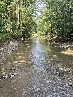 The Poor Fork near the community of Eolia in Letcher County | |
| Physical characteristics | |
| Mouth | |
• elevation | 1,148 ft (350 m)[1] |
| Length | 45 mi (72 km) |
| Discharge | |
| • location | Cumberland, Kentucky |
| • average | 147 cu/ft. per sec.[2] |
| Basin features | |
| Progression | Cumberland–Ohio–Mississippi |
| Tributaries | |
| • right | Looney Creek |
References
- U.S. Geological Survey Geographic Names Information System: Poor Fork (Cumberland River tributary)
- "USGS Surface Water data for Kentucky: USGS Surface-Water Annual Statistics".
- "USGS National Atlas Streamer". United States Geological Survey. Archived from the original on 2014-05-28. Retrieved 2013-11-09.
This article is issued from Wikipedia. The text is licensed under Creative Commons - Attribution - Sharealike. Additional terms may apply for the media files.