Popkum, British Columbia
Popkum, also known as Popkum Village, is a rural farming and tourism based community in the Fraser Valley Regional District, just east of Chilliwack, British Columbia, Canada.[1] The community is named after the Indian reserve of the Popkum First Nation, which is located on the Fraser River nearby. The name is derived from the Halq'eméylem word Pópkw'em meaning "puffballs."
Popkum | |
|---|---|
Unincorporated community | |
 | |
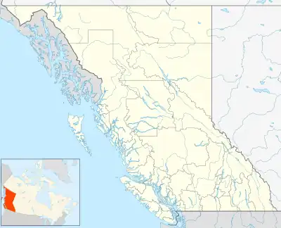 Popkum Location of Popkum in British Columbia | |
| Coordinates: 49°12′00″N 121°44′00″W | |
| Country | Canada |
| Province | British Columbia |
| Regional District | Fraser Valley |
| Time zone | UTC-8 (PST) |
| • Summer (DST) | UTC-7 (PDT) |
| Area codes | +1-250, +1-778 |
Demographics
(according to Statistics Canada 2001 census)
- Population: 1,032
- Growth Rate (1996-2001): 14.5%
- Total Private Dwellings: 401
- Area: 221.58 km2.
- Density: 4.7 people per km2.
Industry
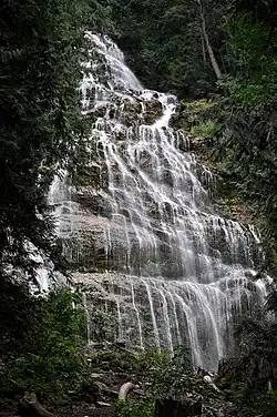
The area includes a variety of tourist attractions including Bridal Veil Falls, Cheam Lake Wetlands, Tam's Enchanted farm (Closed), Bridal Falls WaterPark and Popkum Motor Park (British Columbia's only off-road recreational vehicle (ORV) park).
This article is issued from Wikipedia. The text is licensed under Creative Commons - Attribution - Sharealike. Additional terms may apply for the media files.