Podaturpet
Podaturpet (also Podhaturpet, Podhattoorpet or Pothatturpettai) is a Town under Pallipattu(Pallipet) Taluk in Thiruvallur district in the Indian state of Tamil Nadu.
Podaturpet or Pothatturpettai
பொதட்டூர்பேட்டை | |
|---|---|
Town panchayat | |
| Podaturpet | |
| Nickname: PDT | |
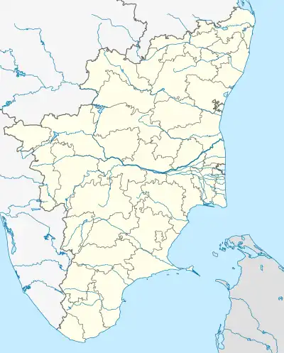 Podaturpet or Pothatturpettai Location in Tamil Nadu, India | |
| Coordinates: 13.283°N 79.484°E | |
| Country | |
| State | Tamil Nadu |
| District | Tiruvallur |
| Government | |
| • Type | Town |
| • Body | Town Panchayat |
| Area | |
| • Total | 8.86 km2 (3.42 sq mi) |
| Population (2016) | |
| • Total | 35,000 |
| • Density | 4,000/km2 (10,000/sq mi) |
| Languages | |
| • Official | Tamil |
| Time zone | UTC+5:30 (IST) |
| PIN | 631208 |
| Telephone code | 91-44 |
| Vehicle registration | TN-20 |
Podaturpet is located between Tiruttani – Pallipattu(Pallipet) and Sholinghur – Nagari (Andhra pradesh) also one of the border towns of Tamilnadu - Andhra Pradesh. This Town panchayat has 18 wards. In local body elections 2022, ADMK won majority by winning 13 wards.
Demographics
As of 2011 India census,[2] Podaturpet had a population of 28,040. Males constitute 51% of the population and females 49%. Podhaturpettai has an average literacy rate of 58%, lower than the national average of 59.5%: male literacy is 70%, and female literacy is 45%. In Podhaturpettai, 16% of the population is under 6 years of age.
Politics
The Andhra Pradesh and Madras Alteration of Boundaries Act, enacted in 1959 by the Parliament of India under the provisions of article 3 of the constitution, went into effect from 1 April 1960. Under the act, Tiruttani taluk and Pallipattu sub-taluk of the Chittoor district of Andhra Pradesh were transferred to Madras State in exchange for territories from the Chingelput (Chengalpattu)
Tiruttani's assembly constituency is in Arakkonam (Lok Sabha constituency). It was part of Sriperumbudur (Lok Sabha constituency) earlier.
The Main Industry
Weaving is the most important industry and is done by the majority of the people. They are engaged in handloom and powerloom, both types of weaving. The high quality knitwear woven here is distributed to all parts of the country. Next to the textile industry, agriculture is the primary occupation carried out by the majority of the population. Paddy and sugarcane are the major crops.
Temple, Church & Masjid
Temple :
- Sivan Temple
- Ponniyamman Temple
- Dhrowpathi Amman Temple
- Murugar Temple (foot of the Hill)
- Subramani Temple
- Ucchi Pillaiyar Temple
- Nagamannam Temple
- Dhandamman Temple
- Ganagai Amma Temple
- Sithi Vinayagar Temple - Near Bus stand
- Bavani Amman
- Sengazani Ellamman Temple
- Sri Bhoo Varaharaswami(Vishnu) Temple - (West Pothatturpettai)
Church :
- CSI St. Paul's Church - Nadu Street
- St. Joseph's Church - Tiruttani road
Masjid :
- Masjid-e-Fathima
Transport
Pothatturpettai has transport links to the nearest cities, towns and villages. Pothatturpettai has bus depot and its contains govt buses. The state of Tamil Nadu operates buses to locations including Tiruttani, Pallipattu, Sorakkaiyapettai, Tiruvallur, Poonamallee, Athimanjeripettai, R.K. Pet, Sholingur, Nagari, Walajah, Vellore, Chittoor, and Private buses Operates to Pallipattu, Tiruttani, Arakkonam, Nagari, Puttur, Narayanavanam, Arani, Arcot and Sholinghur
Near by Railway stations
- Tiruttani Railway station (Distance – 23 km)
- Nagari Railway station (Distance – 13.5 km)
- Ekambarakuppam Railway station (Distance – 14.5 km)
- Arakkonam Junction Railway station (Distance – 35 km)
- Sholinghur Railway station (Distance – 39 km)
Educational Institutions
Schools
- Govt Boys higher Secondary school – Nadu street
- Govt Boys higher school – Nadu street
- Govt Elementary school – Nadu street
- Govt Girls higher Secondary – Thoppu street
- Govt Girls higher school – Thoppu street
- Govt higher school – Ponniyamman Kovil street
- P.U Middle School
- PUM School – Kudiyanavar street
- Government Middle School – Krishnanantha Street
- Panchayat Union Primary School Government
- St. Marys Matriculation School
- Vaariar Matriculation school – Podaturpet(Bommarajupet)
- TVM Nursery and Primary School
- Panchayat Union Primary School – Vanivilasapuram
- Ess(ANM) Middle school – Ponniyamman Kovil street
- Government Middle School – Ranganathan Street
Colleges
- ESSM College of Arts and Science
- ESSM College of Education
- TVM College of Education
- TVM College (AV)
- TVM Academy of Health Science
Financial institutions
- Indian Bank
- Karur Vysya Bank
- State Bank of India
- HDFC Bank (Coming soon)
- Canara Bank Coming soon)
- Indicash ATM (ATM only)
- India1 ATM (ATM only)
Hospitals
- Government Hospital
- Government Siddha Hospital
- Sri Balaji Hospital
- Rajenthiran Hospital
- E.S.S.R Hospital
- E.S.S.R. Diabetic Centre
- E.S.S.R.Eye Care Hospital
- Sri Vinayaga Dental Clinic
- Sri Hari Clinic
- Laksharaa Skin & Hair clinic
- Bharath Eye Clinic &Opticals
- Govt. Primary Health Centre, Sorakayapet
Nearby Towns and Routes
- Podaturpet to Chennai – Via Tiruttani_Tamil Nadu (23 km) – Tiruvallur_Tamil Nadu (By Bus – 60 km) – Chennai_Tamil Nadu (By Bus – 107 km)
- Podaturpet to Poonamallee – Via Tiruttani_Tamil Nadu (23 km) – Tiruvallur_Tamil Nadu (By Bus – 60 km) – Poonamallee_Tamil Nadu (By Bus – 87 km)
- Podaturpet to Tiruvallur (Dist) – Via Tiruttani_Tamil Nadu (23 km) – Kanakamma Sathram_Tamil Nadu (39 km) – Tiruvallur_Tamil Nadu (By Bus – 60 km)
- Podaturpet to Kanchipuram – Via Tiruttani_Tamil Nadu (23 km) – Arakkonam_Tamil Nadu (36 km) – Kancheepuram_Tamil Nadu (67 km)
- Podaturpet to Tirupati – Via Nagari_Andhra Pradesh (15 km) Puttur_Andhra Pradesh (30 km) – Renigunta_Andhra Pradesh (57 km) – Tirupathi_Andhra Pradesh (60 km)
- Podaturpet to Tirupati – Via Pallipattu_Tamil Nadu (11 km) – Karvetinagar_Andhra Pradesh (23 km) – Tirupathi_Andhra Pradesh (54 km)
- Podaturpet to Chittoor & Bengaluru(Bangalore) – Via Pallipattu_Tamil Nadu (11 km) – Chittoor_Andhra Pradesh (54 km) – Bengaluru_Karnataka (233 km)
- Podaturpet to Vellore, Ranipet & Arani Via Athimanjeripet_Tamil Nadu (9 KM) – RK Pet_Tamil Nadu (9 KM) – Sholinghur_Tamil Nadu (26 KM) – Walajapet_Tamil Nadu (48 km) – Arcot_Tamil Nadu (53 km) – Ranipet_Tamil Nadu (54 km) – Vellore_Tamil Nadu (75 km) {Sholinghur to Arni – Tamil Nadu (From Podhaturpet – 81 km})
- Nearby Major Cities
Districts :-
- Thiruvallur – TN
- Tirupati - AP
- Kanchipuram – TN
- Vellore – TN
- Ranipet – TN
- Chengalpattu – TN
- Chennai – TN(Capital of TN)
- Chittoor – AP
Towns :-
- Tiruttani
- Arakkonam
- Sholinghur
- Arcot
- Arani
- Poonamallee
- Avadi
- Walajahpet
- Kaveripakkam
- Puttur – AP
- Renigunta – AP
- Karvetinagar – AP
Town Panchayat & Villages :-
- Pallipattu
- Athimanjeripet
- R.K. Pet
- Sorakayapet
- B.R palli
- Ekambarakuppam – AP
- Nagari – AP
- Banavaram
- ponnai
- Pichatur - AP
- Narayanavanam - AP
References
- "Podaturpet (Thiruvallur, Tamil Nadu, India) – Population Statistics, Charts, Map, Location, Weather and Web Information". www.citypopulation.de. Retrieved 10 July 2019.
- "Census of India 2001: Data from the 2001 Census, including cities, villages and towns (Provisional)". Census Commission of India. Archived from the original on 16 June 2004. Retrieved 1 November 2008.