Prigen
Prigen (Javanese: Prigèn or called "Tretes") is a district in the Pasuruan Regency of East Java, Indonesia. Prigen is located on the slope of the Arjuno volcano. Taman Safari II is located in Prigen.

Syncretic Hindu-Buddhist Candi Jawi temple (candi) in Prigen district. The base is made of black stones, while the upper parts are made from white stones
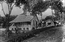
Hotel in Prigen at the base of the Arjuno volcano
The 13th century Candi Jawi (originally known as Jajawa) temple is located on the eastern slope of Mount Welirang outside Candi Wates village in the Prigen district. It is a syncretic Hindu-Buddhist temple (candi)[1]
Climate
| Climate data for Prigen, Pasuruan (elevation 832 m (2,730 ft), 1991–2020 normals) | |||||||||||||
|---|---|---|---|---|---|---|---|---|---|---|---|---|---|
| Month | Jan | Feb | Mar | Apr | May | Jun | Jul | Aug | Sep | Oct | Nov | Dec | Year |
| Record high °C (°F) | 30.8 (87.4) |
30.3 (86.5) |
29.7 (85.5) |
30.2 (86.4) |
29.0 (84.2) |
29.2 (84.6) |
30.3 (86.5) |
29.2 (84.6) |
29.9 (85.8) |
30.7 (87.3) |
31.3 (88.3) |
30.3 (86.5) |
31.3 (88.3) |
| Average high °C (°F) | 26.2 (79.2) |
26.3 (79.3) |
26.6 (79.9) |
26.8 (80.2) |
26.7 (80.1) |
26.4 (79.5) |
26.1 (79.0) |
26.2 (79.2) |
27.3 (81.1) |
28.0 (82.4) |
27.7 (81.9) |
26.5 (79.7) |
26.7 (80.1) |
| Daily mean °C (°F) | 21.9 (71.4) |
21.9 (71.4) |
22.1 (71.8) |
22.4 (72.3) |
22.5 (72.5) |
22.0 (71.6) |
21.4 (70.5) |
21.6 (70.9) |
22.5 (72.5) |
23.3 (73.9) |
23.2 (73.8) |
22.3 (72.1) |
22.3 (72.1) |
| Average low °C (°F) | 15.8 (60.4) |
15.8 (60.4) |
15.7 (60.3) |
16.0 (60.8) |
15.8 (60.4) |
15.1 (59.2) |
14.5 (58.1) |
14.3 (57.7) |
15.0 (59.0) |
15.9 (60.6) |
16.2 (61.2) |
15.9 (60.6) |
15.5 (59.9) |
| Record low °C (°F) | 12.9 (55.2) |
11.9 (53.4) |
13.0 (55.4) |
12.5 (54.5) |
11.5 (52.7) |
11.1 (52.0) |
10.3 (50.5) |
10.7 (51.3) |
11.1 (52.0) |
11.7 (53.1) |
13.1 (55.6) |
12.5 (54.5) |
10.3 (50.5) |
| Average precipitation mm (inches) | 556.6 (21.91) |
520.0 (20.47) |
472.7 (18.61) |
370.3 (14.58) |
222.3 (8.75) |
129.1 (5.08) |
62.5 (2.46) |
39.0 (1.54) |
27.8 (1.09) |
79.9 (3.15) |
256.1 (10.08) |
468.2 (18.43) |
3,204.5 (126.16) |
| Average precipitation days (≥ 1.0 mm) | 25.6 | 23.8 | 23.1 | 19.2 | 14.3 | 10.1 | 7.7 | 5.0 | 3.9 | 7.3 | 13.9 | 21.6 | 175.5 |
| Source: World Meteorological Organization[2] | |||||||||||||
References
- "Candi Jawi". Perpustakaan Nasional Republik Indonesia. Archived from the original on 3 November 2013. Retrieved 21 February 2013.
- "World Meteorological Organization Climate Normals for 1991–2020". World Meteorological Organization. Retrieved 19 October 2023.
This article is issued from Wikipedia. The text is licensed under Creative Commons - Attribution - Sharealike. Additional terms may apply for the media files.