Princeville, Quebec
Princeville is a city in the Canadian province of Quebec, located in L'Érable Regional County Municipality in the Centre-du-Québec region.
Princeville | |
|---|---|
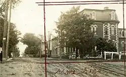 View of Princeville circa 1930. | |
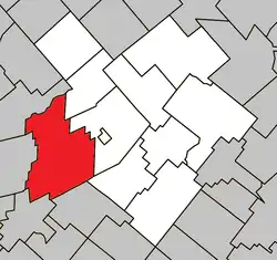 Location within L'Érable RCM. | |
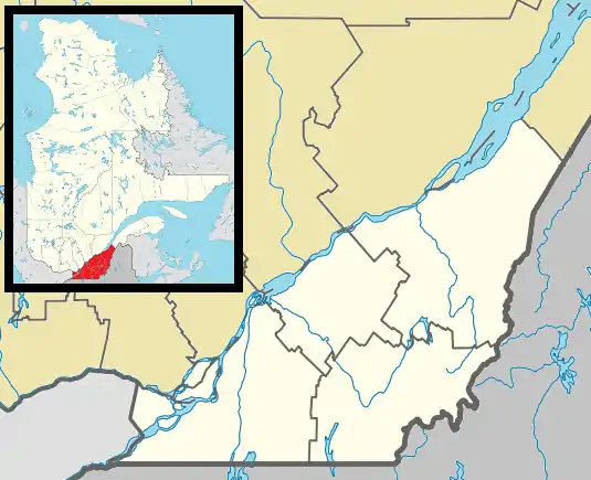 Princeville Location in southern Quebec. | |
| Coordinates: 46°10′N 71°53′W[1] | |
| Country | |
| Province | |
| Region | Centre-du-Québec |
| RCM | L'Érable |
| Constituted | February 23, 2000 |
| Government | |
| • Mayor | Gilles Fortier |
| • Federal riding | Mégantic—L'Érable |
| • Prov. riding | Arthabaska |
| Area | |
| • Total | 196.70 km2 (75.95 sq mi) |
| • Land | 195.26 km2 (75.39 sq mi) |
| Population (2016)[3] | |
| • Total | 6,001 |
| • Density | 30.7/km2 (80/sq mi) |
| • Pop 2011-2016 | |
| • Dwellings | 2,702 |
| Time zone | UTC−5 (EST) |
| • Summer (DST) | UTC−4 (EDT) |
| Postal code(s) | |
| Area code | 819 |
| Highways | |
| Website | www |
The population was 6,001 as of the Canada 2016 Census.
History
The county of Stanfold (Princeville) was created by Édouard Leclerc on July 9, 1807 when he established himself on lot 6, rang 12 in Princeville. A monument was erected in his honour on the east section of the 12th rang. Stanfold then had a new division that would become the village of Princeville in 1856. Thus two municipalities would now co-existed.
On February 23, 2000, the municipalities of the city of Princeville and the parish of Princeville become one to form the new city of Princeville.
Demographics
In the 2021 Census of Population conducted by Statistics Canada, Princeville had a population of 6,218 living in 2,781 of its 2,903 total private dwellings, a change of 3.6% from its 2016 population of 6,001. With a land area of 195.01 km2 (75.29 sq mi), it had a population density of 31.9/km2 (82.6/sq mi) in 2021.[4]
| 2016 | 2011 | |
|---|---|---|
| Population | 6,001 (+5.4% from 2011) | 5,693 (+2.2% from 2006) |
| Land area | 195.26 km2 (75.39 sq mi) | 194.02 km2 (74.91 sq mi) |
| Population density | 30.7/km2 (80/sq mi) | 29.3/km2 (76/sq mi) |
| Median age | 40.9 (M: 39.6, F: 42.3) | 41.2 (M: 40.6, F: 41.8) |
| Private dwellings | 2,702 (total) | 2,497 (total) |
| Median household income | $50,944 | $44,611 |
References
- "Reference number 51235 in Banque de noms de lieux du Québec". toponymie.gouv.qc.ca (in French). Commission de toponymie du Québec.
- "Geographic code 32033 in the official Répertoire des municipalités". www.mamh.gouv.qc.ca (in French). Ministère des Affaires municipales et de l'Habitation.
- "Census Profile, 2016 Census - Princeville, Ville [Census subdivision], Quebec and Saint-Raymond [Population centre], Quebec". 8 February 2017.
- "Population and dwelling counts: Canada, provinces and territories, and census subdivisions (municipalities), Quebec". Statistics Canada. February 9, 2022. Retrieved August 29, 2022.
- "2016 Community Profiles". 2016 Canadian Census. Statistics Canada. August 12, 2021. Retrieved 2022-07-28.
- "2011 Community Profiles". 2011 Canadian Census. Statistics Canada. March 21, 2019. Retrieved 2022-07-28.
- "2006 Community Profiles". 2006 Canadian Census. Statistics Canada. August 20, 2019.
- "2001 Community Profiles". 2001 Canadian Census. Statistics Canada. July 18, 2021.
External links
Places adjacent to Princeville, Quebec | |
|---|---|
| Cities | |
|---|---|
| Municipalities | |
| Parishes | |
| |