Puerto Rico Highway 142
Puerto Rico Highway 142 (PR-142) is a north–south road that connects the northern region of Puerto Rico with the municipality of Corozal.[2] With a length of about 8.2 kilometers (5.1 mi),[1] PR-142 crosses the municipalities of Dorado, Toa Alta and Corozal, extending from PR-2 in Dorado to PR-159 near downtown Corozal.[3]
Highway 142 | ||||
|---|---|---|---|---|
| Ruta 142 | ||||
| Carretera José Antonio "Sonny" Rodríguez Ortiz[1] | ||||
PR-142 highlighted in red | ||||
| Route information | ||||
| Maintained by Puerto Rico DTPW | ||||
| Length | 8.2 km[1] (5.1 mi) | |||
| Major junctions | ||||
| South end | ||||
| North end | ||||
| Location | ||||
| Country | United States | |||
| Territory | Puerto Rico | |||
| Municipalities | Corozal, Toa Alta, Dorado | |||
| Highway system | ||||
| ||||
Route description
Puerto Rico Highway 142 begins in Dorado as a divided highway with two lanes in both directions. Then it becomes a smaller road known as 2+1 road, with areas where there are two lanes in one direction and one lane in the other direction until its end in Corozal. At all of its junctions with other roads is a divided highway and has a speed limit of 45 miles per hour (72 km/h) in the entire length.[1] Between Toa Alta and Corozal, the road can be dangerous during the night and rainy days because the area is very dark and the fog formation is frequent, causing poor visibility to drivers.[4] In 2009, this highway was officially designated as Carretera José Antonio "Sonny" Rodríguez Ortiz, although it is also commonly known as Expreso de Corozal (Corozal Expressway).[1]
- Puerto Rico Highway 142 by municipality
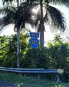
 Southbound sign in Espinosa, Dorado
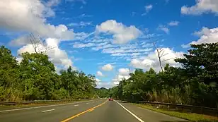
 Heading north in Río Lajas, Toa Alta
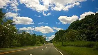
 Heading south in Abras, Corozal
Dorado
In Dorado, it is mostly a divided highway with two lanes per direction. At this municipality, PR-142 has a trumpet interchange with PR-2 at its beginning between Maguayo and Espinosa barrios.[5] Then, it has two intersections with PR-677 that serves to a few communities in Espinosa barrio.[2] Before entering Toa Alta, PR-142 becomes an undivided highway with one lane per direction. The entire length of this highway in Dorado is located in Espinosa barrio.[6]
Toa Alta
In Toa Alta, PR-142 is mostly a 2+1 road after crossing the Lajas River Bridge that is located on the municipal limit with Dorado. In this municipality, the highway has two intersections with PR-823 that serves to several communities located in Río Lajas barrio.[2] PR-823 is concurrent with PR-142 for about one kilometer (0.62 mi) and in most of this concurrency there are two lanes per direction. Shortly after the overlap ends, Corozal begins. The entire length of PR-142 in Toa Alta is located in Río Lajas barrio.[7]
Corozal
In Corozal, this highway is also mostly a 2+1 road from the Toa Alta municipal limit until its approach to PR-159, where it has two lanes in both directions. Only on the Mavilla River Bridge has a single lane per direction.[8] Around the area where the river is located, the road is often covered by fog that forms at night and on rainy days, causing poor visibility and increasing the risk of traffic accidents.[1][4] The route passes through Abras and Pueblo barrios until its end at PR-159 near downtown Corozal.[9][10]
Major intersections
.jpg.webp) PR-2 west at the exit to PR-142 south in Maguayo,[lower-alpha 1] Dorado
PR-2 west at the exit to PR-142 south in Maguayo,[lower-alpha 1] Dorado.jpg.webp) PR-2 east near the northern terminus of PR-142 in Espinosa,[lower-alpha 1] Dorado
PR-2 east near the northern terminus of PR-142 in Espinosa,[lower-alpha 1] Dorado PR-142 north approaching PR-2 interchange in Espinosa,[lower-alpha 1] Dorado
 PR-142 south near the northern terminus of PR-823 concurrency in Río Lajas, Toa Alta
| Municipality | Location | km[11] | mi | Destinations | Notes |
|---|---|---|---|---|---|
| Corozal | Pueblo | 8.2 | 5.1 | Southern terminus of PR-142; access to Área de Pesca Embalse La Plata and Centro Histórico-Turístico del Cibuco | |
| Abras | 7.6– 7.3 | 4.7– 4.5 | Calle Marginal (unsigned) | One-way street; southbound exit and entrance; Calle Marginal means frontage road | |
| Toa Alta | Río Lajas | 5.0– 4.9 | 3.1– 3.0 | Southern terminus of PR-823 concurrency; access to Quebrada Arenas | |
| 4.0 | 2.5 | Northern terminus of PR-823 concurrency; access to PR-820 | |||
| Dorado | Espinosa | 2.5 | 1.6 | ||
| 1.3 | 0.81 | ||||
| Espinosa–Maguayo line | 0.0 | 0.0 | Northern terminus of PR-142; trumpet interchange | ||
1.000 mi = 1.609 km; 1.000 km = 0.621 mi
| |||||
See also
Notes
- PR-2 is located on the Maguayo–Espinosa line. Eastbound lanes are located in Espinosa and westbound lanes are in Maguayo.[lower-alpha 2][lower-alpha 3]
References
- House of Representatives of Puerto Rico. "Resolución para ordenar a la Comisión de Transportación, Infraestructura, y de Recreación y Deportes de la Cámara de Representantes de Puerto Rico, a realizar una investigación sobre las condiciones de la Carretera 142, la cual discurre por los municipios de Dorado, Toa Alta y Corozal, debido a los constantes accidentes automovilísticos en la zona que ponen en peligro la seguridad de los usuarios de dicha vía de rodaje" (PDF) (in Spanish). Retrieved 1 April 2019.
- "Tránsito Promedio Diario (AADT)". Datos de Transito 2000-2009 (in Spanish). Puerto Rico Department of Transportation and Public Works. p. 78. Archived from the original on 1 April 2019. Retrieved 1 April 2019.
- National Geographic Maps (2011). Puerto Rico (Map). 1:125,000. Adventure Map (Book 3107). Evergreen, Colorado: National Geographic Maps. ISBN 978-1566955188. OCLC 756511572.
- "Aparatoso accidente fatal en Corozal" (in Spanish). WAPA-TV. Retrieved 1 April 2019.
- "Maguayo Barrio second-order administrative division, Dorado, Puerto Rico". pr.geoview.info. Retrieved 25 March 2023.
- "Espinosa Barrio second-order administrative division, Dorado, Puerto Rico". pr.geoview.info. Retrieved 17 March 2023.
- "Río Lajas Barrio second-order administrative division, Toa Alta, Puerto Rico". pr.geoview.info. Retrieved 17 March 2023.
- Press, Detroit Free. "PR 142 over MAVILLA RIVER Corozal Municipio, Puerto Rico Bridge Inspection Report". Detroit Free Press. Retrieved 9 August 2023.
- "Abras Barrio second-order administrative division, Corozal, Puerto Rico". pr.geoview.info. Retrieved 17 March 2023.
- "Pueblo Barrio second-order administrative division, Corozal, Puerto Rico". pr.geoview.info. Retrieved 17 March 2023.
- Google (27 February 2020). "PR-142" (Map). Google Maps. Google. Retrieved 27 February 2020.
External links
 Media related to Puerto Rico Highway 142 at Wikimedia Commons
