Qubadli District
Qubadli District | |
|---|---|
 Map of Azerbaijan showing Qubadli District | |
| Country | |
| Region | East Zangezur |
| Established | 14 March 1933 |
| Capital | Qubadli |
| Settlements[1] | 94 |
| Government | |
| • Governor | Malik Isagov |
| Area | |
| • Total | 800 km2 (300 sq mi) |
| Population | |
| • Total | 41,600 |
| • Density | 52/km2 (130/sq mi) |
| Time zone | UTC+4 (AZT) |
| Postal code | 3900 |
| Website | qubadli-ih |
Qubadli District (Azerbaijani: Qubadlı rayonu) is one of the 66 districts of Azerbaijan. It is located in the south-west of the country and belongs to the East Zangezur Economic Region.[3] The district borders the districts of Lachin, Khojavend, Jabrayil, Zangilan, and the Syunik Province of Armenia.
Its capital and largest city is Qubadli. As of 2020, the district had a nominal population of 41,600.[2]
History
The region was part of the Kurdistansky Uyezd and later the Kurdistan Okrug in the Azerbaijani SSR from 7 July 1923 to 23 July 1930. To its Kurdish population, it was known as Qûbadlî.[4]
The district was established on 14 March 1933.[1]
The district came was seized by the breakaway Republic of Artsakh in August 1993 during the First Nagorno-Karabakh War. Azerbaijani forces regained control of all of the district during the 2020 Nagorno-Karabakh war.
Demographics
According to the last Soviet census of 1989, population was 28,110.[5] According to undated Azerbaijani data, the population was 34,100.[6]
As of 1979 a total of 26,673 people:[7]
- Azerbaijanis 99,5% (26,537)
- Russians 0,2% (45)
- Armenians 0,1% (26)
As of 1989 a total of 28,110 people.[5]
References
- "İnzibati-ərazi vahidləri" (PDF). preslib.az. Retrieved 28 February 2021.
- "Population of Azerbaijan". stat.gov.az. State Statistics Committee. Retrieved 22 February 2021.
- "Azərbaycan Respublikasında iqtisadi rayonların yeni bölgüsü haqqında Azərbaycan Respublikası Prezidentinin Fərmanı » Azərbaycan Prezidentinin Rəsmi internet səhifəsi". president.az.
- Esger, Şamîlê Selîm. "Kurdên Azerbaycanên, dîroka Laçîn û yên mayîn". Kovara Çira. 3: 57.
- "Демоскоп Weekly - Приложение. Справочник статистических показателей". www.demoscope.ru (in Russian). Retrieved 11 October 2020.
- "Ministry of Culture and Tourism of Azerbaijan Republic. Gubadli". Retrieved April 28, 2010.
- "население азербайджана". www.ethno-kavkaz.narod.ru. Retrieved 11 October 2020.
Gallery
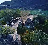 Laləzar körpüsü
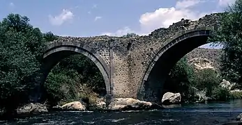 Laləzar körpüsü
%252C_Building%252C_2014.05.09_-_panoramio.jpg.webp) Qubadli, building
Qubadli, building%252C_Memorial_spring%252C_2014.05.09_-_panoramio.jpg.webp) Qubadli, Memorial spring
Qubadli, Memorial spring
External links