Quitman, Georgia
Quitman is a city in and the county seat of Brooks County, Georgia, United States.[4] The population was 3,850 at the 2010 census.[5] The Quitman Historic District is listed on the National Register of Historic Places.
Quitman, Georgia | |
|---|---|
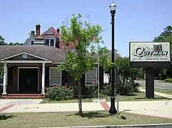 Quitman City Hall | |
| Nickname: Georgia's Camellia City | |
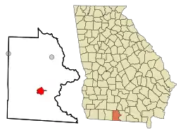 Location in Brooks County and the state of Georgia | |
| Coordinates: 30°47′5″N 83°33′39″W | |
| Country | United States |
| State | Georgia |
| County | Brooks |
| Government | |
| • Mayor | Zinda Drew McDaniel |
| Area | |
| • Total | 4.15 sq mi (10.74 km2) |
| • Land | 4.13 sq mi (10.69 km2) |
| • Water | 0.02 sq mi (0.05 km2) |
| Elevation | 190 ft (58 m) |
| Population (2020) | |
| • Total | 4,064 |
| • Density | 984.73/sq mi (380.18/km2) |
| Time zone | UTC-5 (Eastern (EST)) |
| • Summer (DST) | UTC-4 (EDT) |
| ZIP code | 31643 |
| Area code | 229 |
| FIPS code | 13-63224[2] |
| GNIS feature ID | 0321256[3] |
| Website | www |
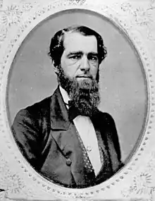
Quitman was a home of James Pierpont, author of the song "Jingle Bells" (1857), and uncle of American financier J.P. Morgan. Pierpont was organist for the First Presbyterian Church.[6] James' daughter, Lillie, was Quitman's first librarian in 1880.[7]
A local Quitman ordinance prohibits chickens from crossing the road.[8]
It is called the "Camellia City", as the tree grows in profusion around the area.
History
Quitman was designated county seat of newly formed Brooks County in 1858. It was incorporated as a town in 1859 and as a city in 1904.[9] As the county seat, it was the center of trading in the county, which was devoted to cotton plantations before and after the American Civil War. The community was named for John A. Quitman, a hero of the Mexican–American War.[10]
Geography
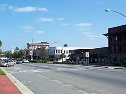
Quitman is located in southern Georgia at 30°47′05″N 83°33′39″W.[11] U.S. Routes 84 and 221 pass through the center of the city. US 84 leads west 121 miles to Dothan, Alabama, while US 221 leads south 24 miles (39 km) to Greenville, Florida, and 26 miles (42 km) to Interstate 10. US 84 and US 221 together lead east 15 miles (24 km) to Interstate 75 and 17 miles (27 km) to Valdosta.
According to the United States Census Bureau, Quitman has a total area of 4.1 square miles (10.7 km2), of which 0.019 square miles (0.05 km2), or .50%, is water.[5]
Demographics
| Census | Pop. | Note | %± |
|---|---|---|---|
| 1870 | 784 | — | |
| 1880 | 1,400 | 78.6% | |
| 1890 | 1,868 | 33.4% | |
| 1900 | 2,281 | 22.1% | |
| 1910 | 3,915 | 71.6% | |
| 1920 | 4,393 | 12.2% | |
| 1930 | 4,149 | −5.6% | |
| 1940 | 4,450 | 7.3% | |
| 1950 | 4,769 | 7.2% | |
| 1960 | 5,071 | 6.3% | |
| 1970 | 4,818 | −5.0% | |
| 1980 | 5,188 | 7.7% | |
| 1990 | 5,292 | 2.0% | |
| 2000 | 4,638 | −12.4% | |
| 2010 | 3,850 | −17.0% | |
| 2020 | 4,064 | 5.6% | |
| U.S. Decennial Census[12] | |||
2020 census
| Race | Num. | Perc. |
|---|---|---|
| White | 983 | 24.19% |
| Black or African American | 2,805 | 69.02% |
| Native American | 3 | 0.07% |
| Asian | 30 | 0.74% |
| Pacific Islander | 2 | 0.05% |
| Other/Mixed | 113 | 2.78% |
| Hispanic or Latino | 128 | 3.15% |
As of the 2020 United States Census, there were 4,064 people, 1,476 households, and 836 families residing in the city.
2000 census
As of the census[2] of 2000, there were 4,638 people, 1,707 households, and 1,131 families residing in the city. The population density was 1,211.1 inhabitants per square mile (467.6/km2). There were 2,034 housing units at an average density of 531.1 per square mile (205.1/km2). The racial makeup of the city was 30.98% White, 66.36% African American, 0.13% Native American, 0.37% Asian, 1.06% from other races, and 1.10% from two or more races. Hispanic or Latino of any race were 2.18% of the population.
There were 1,707 households, out of which 31.3% had children under the age of 18 living with them, 31.9% were married couples living together, 30.2% had a female householder with no husband present, and 33.7% were non-families. 30.4% of all households were made up of individuals, and 14.2% had someone living alone who was 65 years of age or older. The average household size was 2.61 and the average family size was 3.26.
In the city, the population was spread out, with 30.1% under the age of 18, 8.8% from 18 to 24, 22.9% from 25 to 44, 20.3% from 45 to 64, and 17.9% who were 65 years of age or older. The median age was 35 years. For every 100 females, there were 78.6 males. For every 100 females age 18 and over, there were 68.6 males.
The median income for a household in the city was $20,924, and the median income for a family was $24,154. Males had a median income of $22,727 versus $17,391 for females. The per capita income for the city was $10,594. About 31.2% of families and 34.2% of the population were below the poverty line, including 46.7% of those under age 18 and 20.9% of those age 65 or over.
Industry
The prevalent industries in Quitman are farming and automotive. Cass Burch Automotive Group is located in downtown Quitman, with both Dodge Chrysler Jeep & Ram and Chevrolet dealerships represented.
Climate
The climate in this area is characterized by hot, humid summers and generally mild to cool winters. According to the Köppen Climate Classification system, Quitman has a humid subtropical climate, abbreviated "Cfa" on climate maps.[14]
| Climate data for Quitman, Georgia | |||||||||||||
|---|---|---|---|---|---|---|---|---|---|---|---|---|---|
| Month | Jan | Feb | Mar | Apr | May | Jun | Jul | Aug | Sep | Oct | Nov | Dec | Year |
| Average high °C (°F) | 18 (64) |
19 (67) |
23 (73) |
27 (80) |
31 (87) |
33 (91) |
33 (92) |
33 (91) |
31 (88) |
27 (81) |
23 (73) |
18 (65) |
26 (79) |
| Average low °C (°F) | 4 (40) |
6 (42) |
9 (48) |
12 (54) |
16 (61) |
20 (68) |
21 (70) |
21 (70) |
19 (66) |
13 (56) |
8 (46) |
4 (40) |
13 (55) |
| Average precipitation mm (inches) | 100 (4.1) |
110 (4.4) |
120 (4.6) |
91 (3.6) |
89 (3.5) |
140 (5.7) |
180 (6.9) |
150 (6) |
120 (4.6) |
64 (2.5) |
64 (2.5) |
94 (3.7) |
1,320 (51.9) |
| Source: Weatherbase [15] | |||||||||||||
Education
Schools for Quitman are Quitman Elementary School, Brooks County Middle School, and Brooks County High School.
Media
Radio station WGOV-FM 96.7 is licensed to broadcast from Quitman. The Quitman Free Press, a weekly newspaper, is the official legal publication for Brooks County. It has been in operation since 1876.
Notable people
- Nellie Weldon Cocroft - ragtime composer, born in Quitman
- Edna Cain Daniel, writer, journalist, long-time publisher of the Quitman Free Press
- Dana A. Dorsey - Banker, realtor, business executive, and philanthropist. Child of freed slaves.
- Henry L. Reaves - politician, farmer, and cattleman
- James Lord Pierpont - songwriter of Jingle Bells, church organist, taught at the Quitman Academy. Uncle of J.P. Morgan.
References
- "2020 U.S. Gazetteer Files". United States Census Bureau. Retrieved December 18, 2021.
- "U.S. Census website". United States Census Bureau. Retrieved January 31, 2008.
- "US Board on Geographic Names". United States Geological Survey. October 25, 2007. Retrieved January 31, 2008.
- "Find a County". National Association of Counties. Archived from the original on May 31, 2011. Retrieved June 7, 2011.
- "Geographic Identifiers: 2010 Demographic Profile Data (G001): Quitman city, Georgia". U.S. Census Bureau, American Factfinder. Archived from the original on February 12, 2020. Retrieved November 7, 2013.
- Jingle Bell history page
- Polling, Dean (December 23, 2021). "Dashing through Valdosta's 'Jingle Bells'". Valdosta Daily Times. Retrieved July 11, 2023.
- Sheryl Lindsell-Roberts, Loony Laws & Silly Statutes, Sterling Publishing Co., Inc., 1994. ISBN 0-8069-0472-0
- Paul T. Hellmann (November 1, 2004). Historical Gazetteer of the United States. Taylor & Francis. p. 243. ISBN 978-0-203-99700-0.
- Krakow, Kenneth K. (1975). Georgia Place-Names: Their History and Origins (PDF). Macon, GA: Winship Press. p. 183. ISBN 0-915430-00-2.
- "US Gazetteer files: 2010, 2000, and 1990". United States Census Bureau. February 12, 2011. Retrieved April 23, 2011.
- "Census of Population and Housing". Census.gov. Retrieved June 4, 2015.
- "Explore Census Data". data.census.gov. Retrieved December 9, 2021.
- Climate Summary for Quitman, Georgia
- "Weatherbase.com". Weatherbase. 2013. Retrieved on October 15, 2013.
External links
![]() Media related to Quitman, Georgia at Wikimedia Commons
Media related to Quitman, Georgia at Wikimedia Commons
Municipalities and communities of Brooks County, Georgia, United States | ||
|---|---|---|
| Cities | 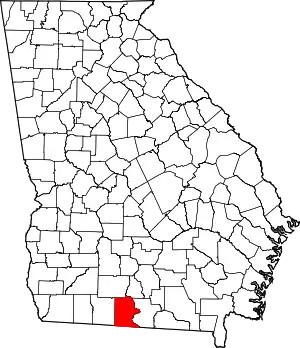 Map of Georgia highlighting Brooks County | |
| CDP | ||
| Other unincorporated communities | ||
| Footnotes | ‡This populated place also has portions in an adjacent county or counties | |