RAF Wigsley
Royal Air Force Wigsley, also known as RAF Wigsley, is a former Royal Air Force satellite station located 7.3 miles (11.7 km) east of Tuxford, Nottinghamshire and 7.6 miles (12.2 km) west of Lincoln, Lincolnshire, England.
| RAF Wigsley | |||||||||||
|---|---|---|---|---|---|---|---|---|---|---|---|
| Wigsley, Nottinghamshire in England | |||||||||||
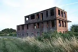 RAF Wigsley watchtower | |||||||||||
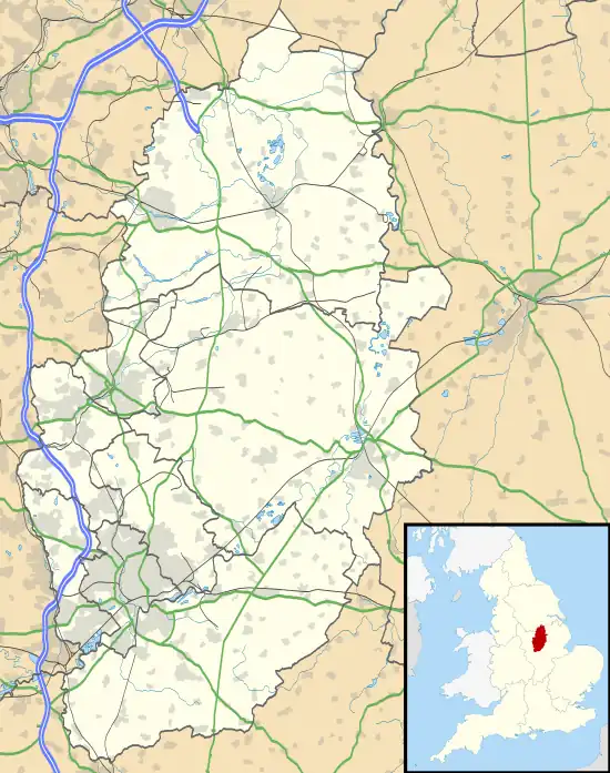 RAF Wigsley Shown within Nottinghamshire 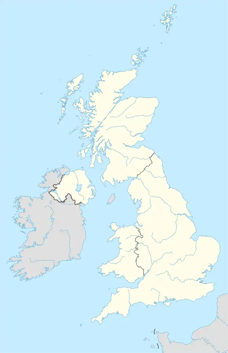 RAF Wigsley RAF Wigsley (the United Kingdom) | |||||||||||
| Coordinates | 53°12′53″N 000°43′42″W | ||||||||||
| Type | Satellite station | ||||||||||
| Code | UG[1] | ||||||||||
| Site information | |||||||||||
| Owner | Air Ministry | ||||||||||
| Operator | Royal Air Force | ||||||||||
| Controlled by | RAF Bomber Command * No. 5 Group RAF * No. 7 (HCU) Group RAF RAF Flying Training Command * No. 21 Group RAF | ||||||||||
| Site history | |||||||||||
| Built | 1941/42 | ||||||||||
| Built by | Sir Robert McAlpine & Sons Ltd | ||||||||||
| In use | February 1942 - July 1958 | ||||||||||
| Battles/wars | European theatre of World War II | ||||||||||
| Airfield information | |||||||||||
| Elevation | 7 metres (23 ft)[1] AMSL | ||||||||||
| |||||||||||
History
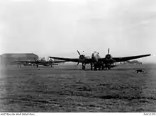
A RAAF Hampden of No. 455 Squadron at RAF Wigsley, Nottinghamshire, circa 1942
- Detachment from No. 14 (Pilots) Advanced Flying Unit RAF between April and May 1942[2]
- No. 28 Air Crew Holding Unit RAF between September 1945 and January 1946[3]
- Satellite of No. 201 Advanced Flying School RAF between 1947 and 1954[4]
- Satellite of No. 204 Advanced Flying School RAF between 1950 and 1952[5][6]
- No. 455 Squadron RAAF with the Handley Page Hampden between 8 February and 28 April 1942[7]
- No. 1654 Conversion Unit RAF between June and October 1942 became No. 1654 Heavy Conversion Unit RAF between October 1942 and September 1945[8]
- Relief Landing Ground for No. 8 Flying Training School RAF between August 1955 and August 1959[9]
- No. 50 Conversion Flight during August 1942[10]
- No. 83 Conversion Flight during August 1942[10]
- No. 2776 Squadron RAF Regiment][6]
- Relief Landing Ground for the RAF College during 1955[11]
Current use
The site is now used as farmland.[6]
References
Citations
- Falconer 2012, p. 214.
- Sturtivant & Hamlin 2007, p. 34.
- Sturtivant & Hamlin 2007, p. 44.
- Sturtivant & Hamlin 2007, p. 32.
- Sturtivant & Hamlin 2007, p. 33.
- "Wigsley II". Airfields of Britain Conservation Trust. Retrieved 25 October 2012.
- Jefford 1988, p. 93.
- Sturtivant & Hamlin 2007, p. 97.
- Sturtivant & Hamlin 2007, p. 137.
- Sturtivant & Hamlin 2007, p. 96.
- Sturtivant & Hamlin 2007, p. 227.
Bibliography
- Falconer, J. (2012). RAF Airfields of World War 2. UK: Ian Allan Publishing. ISBN 978-1-85780-349-5.
- Jefford, C. G. (1988). RAF Squadrons. A comprehensive record of the movement and equipment of all RAF squadrons and their antecedents since 1912. Shrewsbury: Airlife. ISBN 1-85310-053-6.
- Sturtivant, R.; Hamlin, J. (2007). Royal Air Force flying training and support units since 1912. UK: Air-Britain (Historians). ISBN 978-0851-3036-59.
Wikimedia Commons has media related to RAF Wigsley.
| formations and units |
| ||||||
|---|---|---|---|---|---|---|---|
| branches and components | |||||||
| reserve forces | |||||||
| equipment | |||||||
| personnel | |||||||
| appointments | |||||||
| symbols and uniform | |||||||
| associated civil organisations | |||||||
This article is issued from Wikipedia. The text is licensed under Creative Commons - Attribution - Sharealike. Additional terms may apply for the media files.