Rabacca Dry River
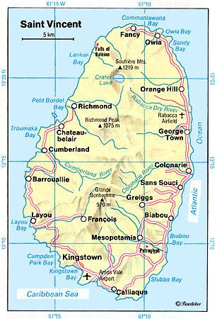
The Rabacca Dry River is a river of Saint Vincent and the Grenadines. It is a seasonal river and will only flow like a normal when there is heavy rainfall. It is located on the outskirts of Georgetown. It was formed as a result of the eruption of the La Soufriere volcano, there is its source.
| Rabacca Dry | |
|---|---|
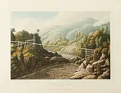 The Rabacca or Dry River, Soufriere Mountain in the distance. Painted ca. 1836 | |
| Nickname(s) | Dry River |
| Location | |
| Country | Saint Vincent and the Grenadines |
| Region | Charlotte |
| Physical characteristics | |
| Source | La Soufrière |
| • elevation | 4,048 m (13,281 ft) |
| Mouth | Rabacca |
• location | Atlantic Ocean |
• coordinates | [1] |
• elevation | 0 m (0 ft) |
| Length | 8 km (5.0 mi) |
References
- GEOnet Names Server
- Tourist Map
- Environmental Investigation and Cataloguing, St. Vincent Cross Country Road Project Final Report
This article is issued from Wikipedia. The text is licensed under Creative Commons - Attribution - Sharealike. Additional terms may apply for the media files.