Rajgarh, Madhya Pradesh
Rajgarh is a city and a municipality in the state of Madhya Pradesh in India. It is the administrative headquarters of Rajgarh District, and was a princely state under the British Raj, named Rajgarh State. The old city belongs to the Malwa region and is surrounded by a battlemented wall. Rajgarh is now known for NTPC solar power plant and dam projects running over here, as a result companies like Tata and Reliance power have shown interest.Rajgarh is also famous for Jalpama temple
Rajgarh
Rajghur | |
|---|---|
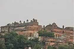
 From top: Rajgarh fort in Rajgarh, Madhya Pradesh, India | |
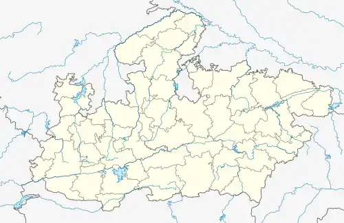
 Rajgarh Location in Madhya Pradesh, India  Rajgarh Rajgarh (India) | |
| Coordinates: 24.03°N 76.88°E | |
| Country | |
| State | Madhya Pradesh |
| District | Rajgarh |
| Government | |
| • Member of Parliament Rajgarh | Rodmal Nagar (BJP) |
| • Member of Legislative Assembly Rajgarh | Bapu singh tanwar (INC) |
| Area | |
| • Total | 1,105 km2 (427 sq mi) |
| Elevation | 491 m (1,611 ft) |
| Population (2011) | |
| • Total | 45,726 |
| • Density | 41/km2 (110/sq mi) |
| Demonym | Rajgarhians |
| Languages | |
| • Official | Hindi |
| Time zone | UTC+5:30 (IST) |
| PIN | 465661 |
| Telephone code | 07372 |
| ISO 3166 code | IN-MP |
| Vehicle registration | MP-33 |
| Sex ratio | 1000/956 ♂/♀ |
| Website | rajgarh |
Geography
Rajgarh district is located in the northern part of Malwa Plateau & Rajgarh is almost in the middle of the district. It forms the North Western part of Division of Bhopal Commissioner. Rajgarh District extends between the parallels of Latitude 23027' 12" North and 24017' 20" North and between the meridians of Longitude 76011' 15" and 77014' East. It has a Quadrangular shape with the Northern and Western sides longer than the Southern and Eastern sides respectively. The zigzag boundaries of the District resemble a pear. Rajgarh District is bounded by Shajapur District in the South as well as west. The District of Sehore, Bhopal, Guna and Jhalawar (Rajasthan) enclose it from the South-East, East, North-East, and North directions respectively. The total Geographical area of the District is 6,154 km2. with a population of 1,545,814 according to census 2011. It is one of the small districts of Madhya Pradesh both in respect of area and population. It is about 145 km north-west from the state capital Bhopal & 198 km from Indore which is the commercial capital as well as largest city of Madhya Pradesh.
Climate
| Climate data for Rajgarh, Madhya Pradesh (1981–2010, extremes 1955–2011) | |||||||||||||
|---|---|---|---|---|---|---|---|---|---|---|---|---|---|
| Month | Jan | Feb | Mar | Apr | May | Jun | Jul | Aug | Sep | Oct | Nov | Dec | Year |
| Record high °C (°F) | 33.8 (92.8) |
38.2 (100.8) |
42.1 (107.8) |
46.3 (115.3) |
46.8 (116.2) |
48.3 (118.9) |
43.6 (110.5) |
39.0 (102.2) |
39.0 (102.2) |
39.3 (102.7) |
37.2 (99.0) |
35.8 (96.4) |
48.3 (118.9) |
| Average high °C (°F) | 26.1 (79.0) |
29.0 (84.2) |
34.8 (94.6) |
39.6 (103.3) |
42.3 (108.1) |
39.5 (103.1) |
32.8 (91.0) |
30.6 (87.1) |
32.5 (90.5) |
34.1 (93.4) |
31.0 (87.8) |
27.9 (82.2) |
33.3 (91.9) |
| Average low °C (°F) | 9.0 (48.2) |
11.4 (52.5) |
16.9 (62.4) |
22.5 (72.5) |
27.3 (81.1) |
27.0 (80.6) |
24.5 (76.1) |
23.4 (74.1) |
22.3 (72.1) |
17.9 (64.2) |
13.0 (55.4) |
9.3 (48.7) |
18.7 (65.7) |
| Record low °C (°F) | 1.3 (34.3) |
1.2 (34.2) |
5.7 (42.3) |
12.3 (54.1) |
16.7 (62.1) |
16.8 (62.2) |
16.2 (61.2) |
18.2 (64.8) |
13.8 (56.8) |
9.1 (48.4) |
4.3 (39.7) |
0.0 (32.0) |
0.0 (32.0) |
| Average rainfall mm (inches) | 8.6 (0.34) |
2.3 (0.09) |
0.9 (0.04) |
1.7 (0.07) |
7.3 (0.29) |
59.4 (2.34) |
173.9 (6.85) |
258.1 (10.16) |
73.1 (2.88) |
12.3 (0.48) |
6.9 (0.27) |
2.6 (0.10) |
607.2 (23.91) |
| Average rainy days | 0.6 | 0.4 | 0.2 | 0.2 | 0.8 | 3.3 | 8.0 | 10.3 | 4.2 | 1.0 | 0.3 | 0.2 | 29.5 |
| Average relative humidity (%) (at 17:30 IST) | 39 | 31 | 24 | 24 | 26 | 43 | 68 | 76 | 65 | 43 | 37 | 38 | 43 |
| Source: India Meteorological Department[1][2] | |||||||||||||
Demographics
As of the 2011 Census of India,[3] Rajgarh had a population of 29,726. Males constitute 52% of the population and females 48%. Rajgarh has an average literacy rate of 70%, higher than the national average of 59.5%: male literacy is 78%, and female literacy is 61%. In Rajgarh, 14% of the population is under 6 years of age.

Schools
- Kendriya Vidyalaya, Rajgarh
- Govt. Excellence School, Rajgarh
- Govt. Post Graduation College, Rajgarh
- Rajeshwar Convent School, Rajgarh
- Swami Vivekanand Public School, Rajgarh
- Bhartiya Vidhya Mandir School, Rajgarh
- Deepak Public School, Rajgarh
- Career Convent Public School, Rajgarh
- K. K. College Of Science & Management, Rajgarh
- Sarswati Shishu Mandir, Rajgarh
- Unix Computer College, Rajgarh
- Advance Computer Academy, Rajgarh
References
- "Station: Rajgarh Climatological Table 1981–2010" (PDF). Climatological Normals 1981–2010. India Meteorological Department. January 2015. pp. 649–650. Archived from the original (PDF) on 5 February 2020. Retrieved 6 January 2021.
- "Extremes of Temperature & Rainfall for Indian Stations (Up to 2012)" (PDF). India Meteorological Department. December 2016. p. M127. Archived from the original (PDF) on 5 February 2020. Retrieved 6 January 2021.
- "Rajgarh Town Population : Census 2011".
4.http://www.thebetterindia.com/42226/engineers-shivnathpura-village-council-free-wifi-mp/
5. http://www.financialexpress.com/economy/dream-of-digital-rajgarh/204970/
6. http://mashable.com/2016/01/11/free-wifi-indian-villages/