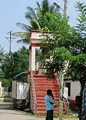
Ramanathapura, Hassan
Ramanathapura is a village in Hassan district of Karnataka state, India.
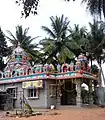
Subramanyia Temple area
Ramanathapura | |
|---|---|
village | |
.jpg.webp) Ramanathapura | |
| Coordinates: 12.61576°N 76.07932°E | |
| Country | |
| State | Karnataka |
| District | Hassan |
| Taluk | Arkalgud |
| Elevation | 849 m (2,785 ft) |
| Population (2011) | |
| • Total | 1,578 |
| Languages | |
| • Official | Kannada |
| Time zone | UTC+5:30 (IST) |
Administration
Ramanathapura is part of the Arkalgud taluk which is again part of Hassan district of Karnataka.
Post office
There is a post office at Ramanathapura and the postal code is 573133.[1]
Educational organizations
- HMS Padavi Purva College
- BSS Junior College
- Kuvempu School
- JSP School
- GHP School
Gallery
 Hiddamma temple
 Siradanahalli
 Basavapatna
References
- "Ramanathapura, Hassan District Pincode 573133". Archived from the original on 18 October 2016. Retrieved 16 October 2016.
This article is issued from Wikipedia. The text is licensed under Creative Commons - Attribution - Sharealike. Additional terms may apply for the media files.