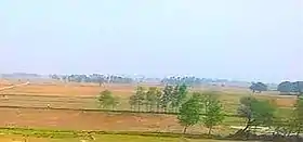
Rasulpur newada
Rasulpur newada is a village of Kamsaar in Ghazipur district, Uttar Pradesh, India.[1][2][3] As of 2011 census the main population of Rasulpur lived in an area of 7.5 acres.[4]
Rasulpur
Rasulpur, Mahmudpur, Dewaitha Khurd | |
|---|---|
Village | |
| Rasulpur Newada | |
 Frams of Rasulpur Newada | |
 Rasulpur Location of Rasupur Newada in Uttar Pradesh | |
| Coordinates: 25.3737362°N 83.6324100°E | |
| Country | |
| State | Uttar Pradesh |
| District | Ghazipur |
| Established | 1660 |
| Founded by | Zamindar Mahmud Khan |
| Government | |
| • Type | Gram panchayat |
| • Body | Sarpanch |
| Area | |
| • Total | 263.03 ha (649.96 acres) |
| • Land | 255.013 ha (630.151 acres) |
| • Water | 8.017 ha (19.810 acres) |
| Elevation | 72 m (236 ft) |
| Population (2011) | |
| • Total | 1,181 |
| Languages | |
| • Official | Hindi/Urdu |
| Time zone | UTC+5:30 (IST) |
| PIN | 232326 to** (** area code) |
| Vehicle registration | UP 61 |
| Sex ratio | 926 (2011) ♂/♀ |
| Climate | BW (Köppen) |
Historical population
| Year | Pop. | ±% |
|---|---|---|
| 1861 | 850 | — |
| 1871 | 935 | +10.0% |
| 1881 | 1,028 | +9.9% |
| 1891 | 886 | −13.8% |
| 1901 | 975 | +10.0% |
| 1911 | 1,072 | +9.9% |
| 1921 | 1,170 | +9.1% |
| 1931 | 1,298 | +10.9% |
| 1941 | 1,427 | +9.9% |
| 1951 | 1,359 | −4.8% |
| 1961 | 1,130 | −16.9% |
| 1971 | 1,070 | −5.3% |
| 1981 | 996 | −6.9% |
| 1991 | 1,096 | +10.0% |
| 2001 | 1,105 | +0.8% |
| 2011 | 1,181 | +6.9% |
| Source:Census of India[5][6][7] | ||
References
- "Rasulpur newada, Ghazipur".
- "List of Villages in Ghazipur, Uttar Pradesh".
- "Villages in Ghazipur district, Uttar Pradesh".
- "Bhulekh".
- "Census of India". mospi.gov.in. Archived from the original on 13 August 2008. Retrieved 23 June 2008.
- "2011 census of India".
- "Historical Census of India". Archived from the original on 17 February 2013. Retrieved 5 November 2015.
This article is issued from Wikipedia. The text is licensed under Creative Commons - Attribution - Sharealike. Additional terms may apply for the media files.