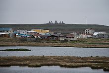
Raufarhöfn
Raufarhöfn (Icelandic pronunciation: [ˈrœyːvarˌhœpn̥]) is a village located on the northeastern tip of the Melrakkaslétta [ˈmɛlˌrahkaˌstljɛhta] peninsula in Iceland.
Raufarhöfn | |
|---|---|
Village | |
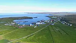 Raufarhöfn seen from the air | |
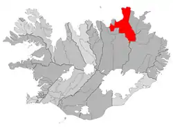 Location of the Municipality of Norðurþing | |
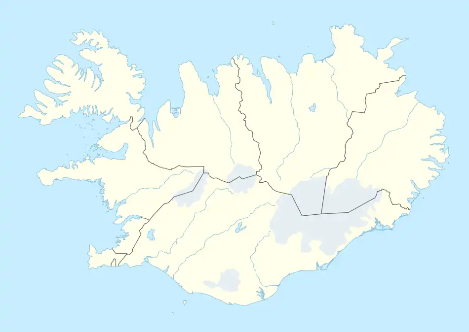 Raufarhöfn Location of Raufarhöfn in Iceland | |
| Coordinates: 66°27′15″N 15°57′00″W | |
| Country | |
| Constituency | Northeast Constituency |
| Region | Northeastern Region |
| Municipality | Norðurþing |
| Population (2019) | |
| • Total | 188 |
| Time zone | UTC+0 (GMT) |
History
At one point in time, this small village was home to largest export harbor in Iceland. In the forties and fifties, the herring frenzy dominated the Icelandic economy[1] and Raufarhöfn was an important place in that economic chain. But after the herring were fished out, the effect was devastating for the village. As of 2019, it had 188[2] inhabitants.
The village is also the site of a modern monument called the "Arctic Henge" which is aligned to the heavens and is inspired by the mythical world of the Eddic poem Völuspá (Prophecy of the Seeress).[3]
Sights
The church was built in 1928 by Guðjón Samúelsson, one of the most important Icelandic architects, and inaugurated on 1 January 1929.[4] It was renovated in 1979.[5] Circa 1996, a large stone monument, "Arctic Henge" (Heimskautsgerði [ˈheimˌskœytsˌcɛrðɪ] in Icelandic), was constructed close to the village.[6] Inspired by historic stone circles as of 2021 the site is still under construction.[7]
Climate
The climate is tundra (Koppen: ET). As the northernmost community of mainland Iceland, Raufarhöfn is also the coldest with an annual average of 2.0 °C.[8]
| Climate data for Raufarhöfn (1961–1990) | |||||||||||||
|---|---|---|---|---|---|---|---|---|---|---|---|---|---|
| Month | Jan | Feb | Mar | Apr | May | Jun | Jul | Aug | Sep | Oct | Nov | Dec | Year |
| Record high °C (°F) | 10.3 (50.5) |
11.0 (51.8) |
12.7 (54.9) |
17.0 (62.6) |
20.8 (69.4) |
24.0 (75.2) |
23.0 (73.4) |
24.7 (76.5) |
21.7 (71.1) |
17.2 (63.0) |
14.8 (58.6) |
10.6 (51.1) |
24.7 (76.5) |
| Average high °C (°F) | 0.4 (32.7) |
0.8 (33.4) |
0.6 (33.1) |
2.8 (37.0) |
5.8 (42.4) |
9.3 (48.7) |
10.9 (51.6) |
10.8 (51.4) |
8.0 (46.4) |
5.1 (41.2) |
1.9 (35.4) |
0.8 (33.4) |
4.8 (40.6) |
| Daily mean °C (°F) | −2.2 (28.0) |
−1.9 (28.6) |
−2.2 (28.0) |
−0.2 (31.6) |
2.9 (37.2) |
6.4 (43.5) |
8.0 (46.4) |
8.0 (46.4) |
5.3 (41.5) |
2.6 (36.7) |
−0.6 (30.9) |
−2.0 (28.4) |
2.0 (35.6) |
| Average low °C (°F) | −5.0 (23.0) |
−4.6 (23.7) |
−4.9 (23.2) |
−2.8 (27.0) |
0.5 (32.9) |
4.0 (39.2) |
5.7 (42.3) |
5.7 (42.3) |
2.8 (37.0) |
0.2 (32.4) |
−3.3 (26.1) |
−4.9 (23.2) |
−0.6 (30.9) |
| Record low °C (°F) | −21.5 (−6.7) |
−21.2 (−6.2) |
−24.6 (−12.3) |
−21.8 (−7.2) |
−16.0 (3.2) |
−3.7 (25.3) |
−2.3 (27.9) |
−2.2 (28.0) |
−6.0 (21.2) |
−11.2 (11.8) |
−17.9 (−0.2) |
−17.9 (−0.2) |
−24.6 (−12.3) |
| Average precipitation mm (inches) | 76 (3.0) |
57 (2.2) |
66 (2.6) |
47 (1.9) |
28 (1.1) |
39 (1.5) |
48 (1.9) |
58 (2.3) |
73 (2.9) |
86 (3.4) |
80 (3.1) |
76.5 (3.01) |
733 (28.9) |
| Mean monthly sunshine hours | 5.2 | 25.7 | 47.5 | 75.7 | 108.2 | 113.5 | 96.2 | 90.2 | 57.7 | 31.6 | 9.5 | 0.1 | 661.1 |
| Source: Vedur.is[8] | |||||||||||||
See also
References
- http://www.sild.is/en/history/history-in-short/nr/142
- https://www.statice.is/statistics/population/inhabitants/municipalities-and-urban-nuclei/ zipcode 675, in March 2019.
- Nemiroff, R.; Bonnell, J., eds. (30 April 2012). "Aurora Over Raufarhöfn". Astronomy Picture of the Day. NASA. Retrieved 30 April 2012.
- http://kirkjukort.net/kirkjur/raufarhafnarkirkja_0385.html
- "Raufarhöfn the tiny northern most village in Iceland".
- "Arctic Henge".
- "The Arctic Henge". Atlas Obscura. Retrieved 29 October 2022.
- "Climate data for Raufarhöfn". vedur.is.