Lake Rawa Pening
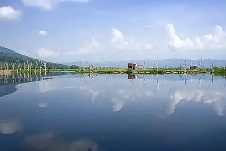
Rawa Pening (literally meaning 'Clear Swamp', from the Javanese Bening) is a lake in the Ambarawa Basin in Central Java, Indonesia. It serves as a source of power, irrigation, and flood control, and is used for fishing. Due partly to high numbers of aquatic plants, it may dry out by 2021.
| Rawa Pening | |
|---|---|
 Rawa Pening in 2008 | |
 Rawa Pening | |
| Coordinates | 7°17′S 110°26′E |
| Basin countries | Indonesia |
| Surface area | 2,500 to 2,670 hectares (25.0 to 26.7 km2; 9.7 to 10.3 sq mi) |
Location and description
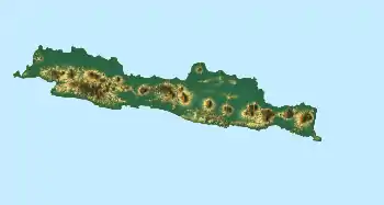
Rawa Pening is located in the volcanic Ambarawa Basin in Central Java, [1] between Ambarawa and Salatiga. It covers a total area of 2,500 to 2,670 hectares (25.0 to 26.7 km2; 9.7 to 10.3 sq mi).[2][3] It is shallow and swamplike,[1] with muddy banks.[4]
History
Rawa Pening is estimated to have been formed between 18,000 and 13,500 BC after a period of increased precipitation. It reached its largest size from 11,000 to 9,000 BC, but shrank until it reached its current size around 6,000 BC.[5]
In order to protect Rawa Pening, the local government has enacted a green belt policy. Several establishments, such as the tourist attraction Kampoeng Rawa, were controversial owing to their construction within this belt.[6]
Role

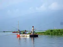
One of the major roles of Rawa Pening is as a source of hydroelectricity, with a power station located on the Tuntang River near the lake. Fishing is common as a source of supplementary income, and the water from the lake irrigates nearby rice fields. It has also been cited as being used for flood control.[4]
Plant infestation

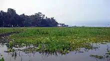
Numerous species of aquatic plants live in Rawa Pening, including Panicum repens,[7] Eichhornia crassipes, Salvinia cucullata,[8] and Hydrilla verticillata.[3] Estimates of the total number of species vary, from 20 in 1949 to 19 aquatic and 71 semi-aquatic species in 1972.[9] According to Soenarto Hardjosuwarno, P. repens is one of the main contributors to the formation of floating islands in the lake,[7] with M. Soerjani noting that E. crassipes and S. cucullata also contribute.[8] The aquatic plants, such as H. verticillatta, take root in the large amount of peat (in some places measuring 2 metres (6.6 ft) thick), causing more peat to gather. Eventually, terrestrial plants take root in the floating islands as well.[10]
According to Tri Retnaningsih Soeprobowati, a researcher at Diponegoro University in Semarang, Rawa Pening could become dry by 2021 due to increasing sedimentation. She reports a total rate of deposition of 270 to 880 kilograms (600 to 1,940 lb) per day, averaging 780 tonnes yearly,[2] with the water level dropping 29% since 1989.[3] The overabundance of aquatic plants has been blamed, especially E. crassipes. As such, there are calls for a culling of the E. crassipes population to 20% by 2030.[3] Other suggestions include the introduction of grass carp to control the plant population and the use of herbicides as last resorts.[2][3] The destruction of H. verticillatta had earlier been attempted beginning in 1932, originally using mechanical methods but later switching to herbicides. These efforts were discontinued in the 1960s.[11]
References
- Footnotes
- Sémah et al. 2004, p. 64.
- Nugrahanti 2011, Rawa Pening.
- Nugrahanti 2011, 2030 Rawa Pening.
- UNEP, Role of Rawa Pening.
- Sémah et al. 2004, p. 85.
- Herusansono 2012, Kampoeng Rawa.
- Siregar & Soemarwoto 1976, p. 211.
- Soerjani 1976, p. 63.
- Soerjani 1976, p. 64.
- Soerjani 1976, pp. 64–65.
- Soerjani 1976, p. 75.
- Bibliography
- Herusansono, Winarto (20 December 2012). "Kampoeng Rawa Salahi Peruntukkan Rawapening" [Kampoeng Rawa Goes Against Planning for Rawapening]. Kompas (in Indonesian). Archived from the original on 6 July 2014. Retrieved 6 July 2014.
- Nugrahanti, Amanda Putri (3 March 2011). "2030, Rawa Pening Bebas Eceng Gondok" [2030, Rawa Pening must be free of water hyacinths]. Kompas (in Indonesian). Retrieved 1 September 2011.
- Nugrahanti, Amanda Putri (15 March 2011). "Rawa Pening 10 Tahun Lagi Jadi Daratan" [Rawa Pening Could Be Land in 10 Years]. Kompas (in Indonesian). Retrieved 1 September 2011.
- "Role of Rawa Pening". United Nations Environment Programme. Retrieved 1 September 2011.
- Sémah, Anne-Marie; Sémah, François; Moudrikah, Rachid; Fröhlich, François; Djubiantono, Tony (2004). "A Late Pleistocene and Holocene Sedimentary Record in Central Java and its Palaeoclimatic Significance". In Keates, S.G.; Pasveer, Juliette Maria (eds.). Quaternary research in Indonesia. Modern quaternary research in Southeast Asia. Vol. 18. Leiden: A.A.Balkema. pp. 63–88. ISBN 978-90-5809-674-6. OCLC 61693775.
- Siregar, H.; Soemarwoto, Otto (1976). "Studies on Panicum Repens L. in West Java". In Varshney, C. K.; Rzoska, Julian (eds.). Aquatic weeds in South East Asia : proceedings of a Regional Seminar on Noxious Aquatic Vegetation, New Delhi, 12-17 December 1973. Hague: W. Junk. pp. 211–214. ISBN 9789061935568. OCLC 21650665.
- Soerjani, M. (1976). "Aquatic Weed Problems in Indonesia, with Special Reference to the Construction of Man-Made Lakes". In Varshney, C. K.; Rzoska, Julian (eds.). Aquatic weeds in South East Asia : proceedings of a Regional Seminar on Noxious Aquatic Vegetation, New Delhi, 12-17 December 1973. Hague: W. Junk. pp. 63–78. ISBN 9789061935568. OCLC 21650665.