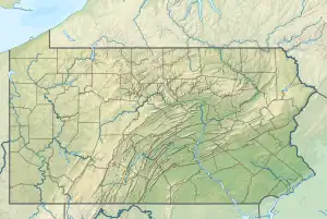
Reading Creek (West Branch Neshaminy Creek tributary)
Reading Creek is a tributary of the West Branch Neshaminy Creek,[1] within New Britain Township, Bucks County, Pennsylvania.[2][3][4]
| Reading Creek | |
|---|---|
 Reading Creek | |
| Location | |
| Country | United States |
| State | Pennsylvania |
| County | Bucks |
| Township | New Britain |
| Physical characteristics | |
| Source | |
| • coordinates | 40°18′37″N 75°14′58″W |
| • elevation | 540 feet (160 m) |
| Mouth | |
• coordinates | 40°17′30″N 75°14′29″W |
• elevation | 279 feet (85 m) |
| Length | 1.14 miles (1.83 km) |
| Basin features | |
| Progression | Reading Creek → West Branch Neshaminy Creek → Neshaminy Creek → Delaware River → Delaware Bay |
| River system | Delaware River |
| Bridges | Chalfont Road Township Line Road Curley Mill Road Sellersville Road Walter Road Rue St Pierre Rue St Andre Road |
| Slope | 228.95 feet per mile (43.362 m/km) |
New Britain Township developed Lexington Park, a natural resource park, along the creek for recreation. It is located along the Reading Creek Greenway, which run from the streams confluence with the West Branch Neshaminy Creek north through New Britain.[5]
Course
Reading Creek rises at an elevation of 540 feet (160 m) flowing generally south until it meets its confluence with the West Branch Neshaminy Creek at an elevation of 279 feet (85 m) resulting in an average slope of 228.95 feet per mile (43.362 m/km).
Crossings and Bridges
| Crossing | Latitude | Longitude |
|---|---|---|
| Township Line Road | 40°18'30"N | 75°14'31"W |
| Curley Mill Road | 40°18'23"N | 75°14'25"W |
| Sellersville Road | 40°18'21"N | 75°14'26"W |
| Walter Road | 40°17'57"N | 75°14'36"W |
| Rue St Pierre | 40°17'50"N | 75°14'36"W |
| Rue St Andre Road | 40°17'49"N | 75°14'35"W |
See also
References
- "Water Resources", Tri-Municipal Master Trail & Greenway Plan (PDF), Department of Conservation and Natural Resources, Bureau of Recreation and Conservation, Pennsylvania, November 2010, p. 25, retrieved June 12, 2017
- "MS4 Requirements Table (Municipal)" (PDF). Department of Environmental Protection, Pennsylvania. May 9, 2017. p. 40. Retrieved June 12, 2017.
- "Reading Creek". Google Maps. Retrieved June 12, 2017.
- "Reading Creek". Geographic Names Information System, U.S. Geological Survey. Retrieved June 12, 2017.
- "Trails", Tri-Municipal Master Trail & Greenway Plan (PDF), Department of Conservation and Natural Resources, Bureau of Recreation and Conservation, Pennsylvania, November 2010, pp. 33, 47, retrieved June 12, 2017
This article is issued from Wikipedia. The text is licensed under Creative Commons - Attribution - Sharealike. Additional terms may apply for the media files.