Rhea's Mill Township, Washington County, Arkansas
Rhea's Mill Township (pronounced rays /reɪz/[3]) is one of thirty-seven townships in Washington County, Arkansas, USA.[4] As of the 2000 census, its total population was 480.
Township of Rhea's Mill | |
|---|---|
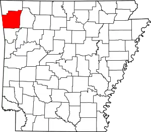 Location of Washington County in Arkansas | |
| Coordinates: 36°01′5″N 94°23′21″W | |
| Country | |
| State | |
| County | Washington |
| Established | 1880-90[1] |
| Area | |
| • Total | 16.4 sq mi (42 km2) |
| • Land | 16.2 sq mi (42 km2) |
| • Water | 0.2 sq mi (0.5 km2) |
| Elevation | 1,175 ft (358 m) |
| Population (2000) | |
| • Total | 480 |
| • Density | 30/sq mi (10/km2) |
| Time zone | UTC-6 (CST) |
| • Summer (DST) | UTC-5 (CDT) |
| Area code | 479 |
| GNIS feature ID | 69801[2] |
Geography
According to the United States Census Bureau, Rhea's Mill Township covers an area of 16.4 square miles (42 km2), with 16.2 square miles (42 km2) of land and 0.2 square miles (0.52 km2) of water.[4]
Cities, towns, villages
Cemeteries
The township contains Crawford Cemetery.
Major routes
The township contains no state highways.
References
- Baker, Russell (1985). Arkansas Township Atlas 1819-1930. Hot Springs, AR: Arkansas Genealogical Society. p. 202. OCLC 11528205.
- U.S. Geological Survey Geographic Names Information System: Rhea's Mill Township, Washington County, Arkansas
- Holt, Alfred H. (1969). American Place Names. Detroit: Gale Research Company. p. 159. ISBN 9780810332355. Retrieved November 7, 2022.
The same 'ray' in Rea, Mo., Rhea, Ark. and Okla., and Rhea County, Tenn.
- "Township of Rhea's Mill, Washington County, Arkansas". U.S. Census Bureau. Retrieved February 1, 2012.
External links
Places adjacent to Rhea's Mill Township, Washington County, Arkansas | ||||||||||||||||
|---|---|---|---|---|---|---|---|---|---|---|---|---|---|---|---|---|
| ||||||||||||||||
This article is issued from Wikipedia. The text is licensed under Creative Commons - Attribution - Sharealike. Additional terms may apply for the media files.