Richland Creek (Crabtree Creek tributary)
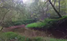
Richland Creek is a 5.25 mi (8.45 km) long 2nd order tributary to Crabtree Creek in Raleigh, North Carolina that rises in a pond on the North Carolina State Fairgrounds. The creek then flows north across I-40 and through Schenck Forest to eventually join Crabtree Creek. The watershed is mainly developed with about 30% of it forested.

| Richland Creek Tributary to Crabtree Creek | |
|---|---|
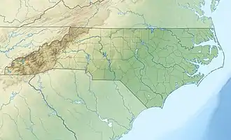
 Location of Richland Creek mouth  Richland Creek (Crabtree Creek tributary) (the United States) | |
| Location | |
| Country | United States |
| State | North Carolina |
| County | Wake |
| City | Raleigh |
| Physical characteristics | |
| Source | Pond at the North Carolina State Fairgrounds in Raleigh, North Carolina |
| • location | Raleigh, North Carolina |
| • coordinates | 35°47′19″N 078°43′47″W[1] |
| • elevation | 440 ft (130 m) |
| Mouth | Crabtree Creek |
• location | Raleigh, North Carolina |
• coordinates | 35°50′42″N 078°43′15″W[1] |
• elevation | 236 ft (72 m)[1] |
| Length | 5.25 mi (8.45 km)[2] |
| Basin size | 6.84 square miles (17.7 km2)[3] |
| Discharge | |
| • location | Crabtree Creek |
| • average | 7.87 cu ft/s (0.223 m3/s) at mouth with Crabtree Creek[3] |
| Basin features | |
| Progression | Crabtree Creek → Neuse River → Pamlico Sound → Atlantic Ocean |
| River system | Neuse River |
| Tributaries | |
| • left | unnamed tributaries |
| • right | unnamed tributaries |
| Waterbodies | unnamed waterbodies |
Course
Richland Creek rises in a pond on the North Carolina State Fairgrounds and then flows north across I-40 and through Schenck Forest to join Crabtree Creek.[4] The watershed is about 30% forested.[3]
Watershed
Reedy Creek drains 4.44 square miles (11.5 km2) of area and is underlaid by the Raleigh terrane geologic formation.[5] The watershed receives an average of 46.3 in/year of precipitation and has a wetness index of 407.29.[3]
See also
External links
References
- "GNIS Detail – Richland Creek". geonames.usgs.gov. US Geological Survey. Retrieved 14 September 2019.
- "ArcGIS Web Application". epa.maps.arcgis.com. US EPA. Retrieved 14 September 2019.
- "Richland Creek Watershed Report". Waters Geoviewer. US EPA. Retrieved 14 September 2019.
- "Southwest Prong Beaverdam Creek Topo Map, Wake County NC (Raleigh West Area)". TopoZone. Locality, LLC. Retrieved 14 September 2019.
- "Generalized Bedrock Geologic Map of Wake County, North Carolina" (PDF). County of Wake. Wake County, North Carolina. Retrieved 27 September 2019.