Richland Parish, Louisiana
Richland Parish is a parish located in the North Louisiana Delta Country in the U.S. state of Louisiana, known for its fertile, flat farmland, cane brakes, and open spaces. The parish had a population of 20,043 at the 2020 United States census.[1] The name Richland was chosen due to the rich production from farming. The parish seat and largest community is Rayville.
Richland Parish | |
|---|---|
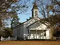 Alto Presbyterian Church | |
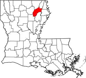 Location within the U.S. state of Louisiana | |
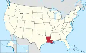 Louisiana's location within the U.S. | |
| Coordinates: 32.421736°N 91.762070°W | |
| Country | |
| State | |
| Founded | September 29, 1878 |
| Named for | Fertile (rich) land in the area |
| Seat | Rayville |
| Largest town | Rayville |
| Area | |
| • Total | 576 sq mi (1,490 km2) |
| • Land | 559 sq mi (1,450 km2) |
| • Water | 9.375 sq mi (24.28 km2) 1.6% |
| Population (2020) | |
| • Total | 20,043 |
| • Density | 35/sq mi (13/km2) |
| Time zone | UTC−6 (Central) |
| • Summer (DST) | UTC−5 (CDT) |
History
The parish was officially created on September 29, 1868.[2] Rayville, Louisiana, the parish seat, was named for John Ray, a politician from Monroe with large land holdings in present-day Rayville.[3]
Richland Parish is home to the first public parish library in the State of Louisiana, the Rhymes Memorial Library. The library was built in 1925 by the Lambda Kappa Club of Rayville. R.R. Rhymes donated the original building in memory of his wife, Nonnie Roark Rhymes.[4]
Geography
Bayou Macon flows through the western areas of Richland. Other tributaries in the parish include Crew Lake, and the Lafourche Diversion Canal are located in the western portion of the parish. Boeuf River flows from the northern end to the southern end in the center of the parish.
Adjacent parishes
- Morehouse Parish (north)
- West Carroll Parish (northeast)
- Madison Parish (east)
- Franklin Parish (south)
- Caldwell Parish (southwest)
- Ouachita Parish (west)
Parks and wildlife management areas
Communities
Village
Census-designated place
Unincorporated communities
Transportation

| Interstates and State Highways | |
|---|---|
| Interstate 20 | |
| U.S. Highway 80 | |
| Louisiana Highway 15 | |
| Louisiana Highway 17 | |
| Louisiana Highway 585 | |
| Louisiana Highway 132 | |
| Louisiana Highway 133 | |
| Louisiana Highway 135 | |
| Air, Rail, Levee | |
|---|---|
| Rayville Municipal Airport | |
| Delhi Municipal Airport | |
| Monroe Regional Airport | |
| Kansas City Southern Railroad | |
| Tensas Basin Levee District | |
Demographics
| Census | Pop. | Note | %± |
|---|---|---|---|
| 1870 | 5,110 | — | |
| 1880 | 8,440 | 65.2% | |
| 1890 | 10,230 | 21.2% | |
| 1900 | 11,116 | 8.7% | |
| 1910 | 15,769 | 41.9% | |
| 1920 | 20,860 | 32.3% | |
| 1930 | 26,374 | 26.4% | |
| 1940 | 28,829 | 9.3% | |
| 1950 | 26,672 | −7.5% | |
| 1960 | 23,824 | −10.7% | |
| 1970 | 21,774 | −8.6% | |
| 1980 | 22,187 | 1.9% | |
| 1990 | 20,629 | −7.0% | |
| 2000 | 20,981 | 1.7% | |
| 2010 | 20,725 | −1.2% | |
| 2020 | 20,043 | −3.3% | |
| U.S. Decennial Census[5] 1790–1960[6] 1900–1990[7] 1990–2000[8] 2010[9] | |||
2020 census
| Race | Num. | Perc. |
|---|---|---|
| White (non-Hispanic) | 11,667 | 58.21% |
| Black or African American (non-Hispanic) | 7,303 | 36.44% |
| Native American | 53 | 0.26% |
| Asian | 50 | 0.25% |
| Other/Mixed | 570 | 2.84% |
| Hispanic or Latino | 400 | 2.0% |
As of the 2020 United States census, there were 20,043 people, 7,459 households, and 4,972 families residing in the parish.
Education
Public schools
- Delhi Elementary
- Delhi Junior High
- Delhi High School
- Holli Ridge Elementary
- Mangham Elementary
- Mangham Junior High
- Mangham High School
- Rayville Elementary
- Rayville Junior High
- Rayville, High School
- Start Elementary
Private schools
- Riverfield Academy, K-12
Charter schools
- Delhi Charter, K-12
Community and technical colleges
- Louisiana Delta Community College, (with campus locations in neighboring Tallulah, Winnsboro, Lake Providence, Bastrop, Monroe, and West Monroe.)
Regional universities
- University of Louisiana at Monroe
- Louisiana Tech University, (Ruston)
- Grambling State University, (Grambling)
Government
| Parish Administration | Administrators |
|---|---|
| Sheriff | Gary Gilley, No Party |
| Coroner | Dr. Matt Prine, Republican |
| Assessor | Lee Brown, III, Democrat |
| School Board Superintendent | Sheldon Jones |
| Homeland Security | Dawn Williams |
| Parish Police Jury | Police Jurors |
|---|---|
| District 1, Delhi | Steve Craig, Republican |
| District 2, Delhi | Patrick Stubblefield, Democrat |
| District 3, Rayville | Sharon Gee, Democrat |
| District 4, Rayville | Steve Lofton, Republican |
| District 5, Rayville | Paul Slayter, Republican |
| District 6, Rayville | Althan Smith, Democrat |
| District 7, Alto | Cecil Reddick, Republican |
| District 8, Start | Elliot Colvin, Republican |
| District 9, Mangham | Roy Wiggins, Jr., Republican |
| 5th Judicial District | Parish Judicial Leaders |
|---|---|
| Division "A" | Clay Hamilton, Republican |
| Division "B" | Will Rhymes Barham, Republican |
| Division "C" | Steve Dean, Republican |
| Clerk of Court | Stacie Williamson, Republican |
| Parish School Board | Board Members |
|---|---|
| District 1, Delhi | Billy Calvert, No Party |
| District 2, Delhi | Eugene Young, Jr., Democrat |
| District 3, Rayville | Moses "DeJohn" Wilkins, Democrat |
| District 4, Rayville | James Hough, Republican |
| District 5, Rayville | Alece Copeland, No Party |
| District 6, Rayville | Marie Lewis, Democrat |
| District 7, Archibald | Joe Chapman, No Party |
| District 8, Start | Kevin Eppinette, No Party |
| District 9, Mangham | Chris Pruitt, Republican |
Notable people
- Julia Letlow, from Start, elected Member of Congress in the United States House of Representatives.
- Luke Letlow, from Start, elected to the United States House of Representatives, but died of a heart attack caused by COVID-19 before he could be seated.
- Ralph Abraham, from Alto, elected Member of Congress in United States House of Representatives.
- Harry W. Addison was a Southern author and humorist who resided in Rayville from 1945 to 1957.
- Jamar Adcock, a politician and banker in Monroe, born in Richland Parish
- Benny Gay Christian, state representative for Richland Parish, 1964 to 1974.
- Terry Doughty, is a federally appointed judge for the Western District of Louisiana.
- George B. Franklin, Jr., was a prominent planter, philanthropist, and conservationist.
- Elvin Hayes, NBA Hall of Fame basketball player, born in Rayville
- Arlene Howell, Miss Louisiana USA 1958, Miss USA 1958
- Fred W. Jones, Jr., city, district, and state court judge, born in Rayville; resided in Ruston, Louisiana
- Ralph E. King, Winnsboro physician who represented Richland Parish in the Louisiana State Senate from 1944 to 1952 and again from 1956 to 1960
- William L. Kirk, of Rayville was a United States Air Force four-star general who served as Commander in Chief, U.S. Air Forces in Europe/Commander, Allied Air Forces Central Europe.
- Ernie Ladd, a football player/professional wrestler, born in Rayville
- Moses J. Liddell was appointed by President Grover Cleveland as a judge for the Supreme Court of the Montana Territory.
- Wiley Person Mangham, an American publisher and editor. He is the namesake for the town of Mangham, Louisiana
- Charles McConnell, politician in Springhill, Louisiana; a native of Richland Parish
- Keith Munyan, Jr., commercial photographer in North Hollywood, California
- Tim McGraw, Country musician, born in Delhi, and raised in Start
- Darryl Riser, editor of the Delhi Dispatch and Richland Beacon-News and, formerly, the Richland Journal
- Robert Max Ross, was a Republican politician and activist who qualified to run for governor, U.S. Senate, and the U.S. House, for the purpose of advancing the two-party system in Louisiana, at a time it did not exist.
- Francis C. Thompson served in the Louisiana House of Representatives from 1975 until 2008; since in the Louisiana State Senate
 Tim McGraw, a famous country musician.
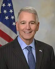 Ralph Abraham, U.S. House of Representatives.
 Elvin Hayes, NBA's 50th Anniversary All-Time Team.
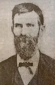 Wiley Person Mangham, American Publisher and Editor.
Gallery
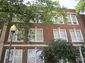 Former Rayville High School, operated by the Richland Parish School Board and originally designed by the Shreveport architect Edward F. Neild, was renovated into an apartment complex
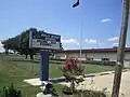 Holly Ridge High School in Holly Ridge in rural Richland Parish
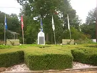 Veteran's Memorial in Mangham
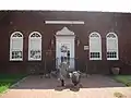 Rhymes Memorial Library in Rayville was the first parish wide public library in Louisiana.
_IMG_7439.JPG.webp) Poverty Point Reservoir in Delhi.
Poverty Point Reservoir in Delhi.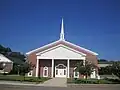 Start Baptist Church
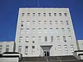 Richland Parish Courthouse, in Rayville
- Alto Presbyterian Church, built in 1873
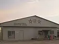 Richland Parish Detention Center near Alto, Louisiana
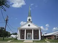 First Baptist Church in Delhi
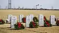 Northeast Louisiana Veterans Cemetery
Politics
| Year | Republican | Democratic | Third party | |||
|---|---|---|---|---|---|---|
| No. | % | No. | % | No. | % | |
| 2020 | 6,607 | 66.47% | 3,225 | 32.44% | 108 | 1.09% |
| 2016 | 6,287 | 65.51% | 3,157 | 32.90% | 153 | 1.59% |
| 2012 | 5,846 | 62.66% | 3,387 | 36.31% | 96 | 1.03% |
| 2008 | 5,751 | 62.64% | 3,311 | 36.06% | 119 | 1.30% |
| 2004 | 5,471 | 63.14% | 3,082 | 35.57% | 112 | 1.29% |
| 2000 | 4,895 | 57.69% | 3,282 | 38.68% | 308 | 3.63% |
| 1996 | 3,765 | 43.23% | 4,143 | 47.57% | 802 | 9.21% |
| 1992 | 3,808 | 42.77% | 3,706 | 41.63% | 1,389 | 15.60% |
| 1988 | 5,226 | 62.85% | 2,833 | 34.07% | 256 | 3.08% |
| 1984 | 5,980 | 65.84% | 2,918 | 32.13% | 185 | 2.04% |
| 1980 | 4,772 | 54.57% | 3,745 | 42.83% | 227 | 2.60% |
| 1976 | 3,630 | 49.93% | 3,495 | 48.07% | 145 | 1.99% |
| 1972 | 4,304 | 70.80% | 1,335 | 21.96% | 440 | 7.24% |
| 1968 | 1,031 | 15.95% | 1,017 | 15.74% | 4,415 | 68.31% |
| 1964 | 4,498 | 85.76% | 747 | 14.24% | 0 | 0.00% |
| 1960 | 1,378 | 35.62% | 996 | 25.74% | 1,495 | 38.64% |
| 1956 | 1,063 | 29.88% | 1,094 | 30.76% | 1,400 | 39.36% |
| 1952 | 1,645 | 39.70% | 2,499 | 60.30% | 0 | 0.00% |
| 1948 | 119 | 4.69% | 960 | 37.87% | 1,456 | 57.44% |
| 1944 | 488 | 18.95% | 2,087 | 81.05% | 0 | 0.00% |
| 1940 | 310 | 11.37% | 2,417 | 88.63% | 0 | 0.00% |
| 1936 | 165 | 6.36% | 2,425 | 93.48% | 4 | 0.15% |
| 1932 | 46 | 2.53% | 1,773 | 97.42% | 1 | 0.05% |
| 1928 | 242 | 18.26% | 1,083 | 81.74% | 0 | 0.00% |
| 1924 | 116 | 14.61% | 678 | 85.39% | 0 | 0.00% |
| 1920 | 50 | 7.00% | 664 | 93.00% | 0 | 0.00% |
| 1916 | 7 | 1.07% | 650 | 98.93% | 0 | 0.00% |
| 1912 | 2 | 0.46% | 393 | 89.93% | 42 | 9.61% |
References
- "Census - Geography Profile: Richland Parish, Louisiana". Retrieved January 22, 2023.
- "Richland Parish". Center for Cultural and Eco-Tourism. Retrieved September 5, 2014.
- Leeper, Clare D’Artois (2012). Louisiana Place Names: Popular, Unusual, and Forgotten Stories of Towns, Cities, Plantations, Bayous, and Even Some Cemeteries. Baton Rouge: Louisiana State University Press. p. 204.
- "Richland Library First To Form Under New Law". No. page 3. The Town Talk (Alexandria, Louisiana). Newspapers.com. January 13, 1928. Retrieved July 21, 2018.
- "U.S. Decennial Census". United States Census Bureau. Archived from the original on April 26, 2015. Retrieved September 1, 2014.
- "Historical Census Browser". University of Virginia Library. Retrieved September 1, 2014.
- "Population of Counties by Decennial Census: 1900 to 1990". United States Census Bureau. Retrieved September 1, 2014.
- "Census 2000 PHC-T-4. Ranking Tables for Counties: 1990 and 2000" (PDF). United States Census Bureau. Archived (PDF) from the original on March 27, 2010. Retrieved September 1, 2014.
- "State & County QuickFacts". United States Census Bureau. Archived from the original on June 6, 2011. Retrieved August 18, 2013.
- "Explore Census Data". data.census.gov. Retrieved December 19, 2021.
- Leip, David. "Dave Leip's Atlas of U.S. Presidential Elections". uselectionatlas.org. Retrieved March 7, 2018.
External links
Places adjacent to Richland Parish, Louisiana | ||||||||||||||||
|---|---|---|---|---|---|---|---|---|---|---|---|---|---|---|---|---|
| ||||||||||||||||
Municipalities and communities of Richland Parish, Louisiana, United States | ||
|---|---|---|
| Towns | | |
| Village | ||
| CDP | ||
| Other unincorporated communities | ||
| Footnotes | ‡This populated place also has portions in an adjacent parish or parishes | |
| Current |
| ||||
|---|---|---|---|---|---|
| Former |
| ||||