Riel, Netherlands
Riel is a village (Dutch: dorp) in the municipality of Goirle, south of Tilburg in the province pf North Brabant. Until 1997 it belonged to the municipality Alphen en Riel. On the east it is bordered by the stream valley of the river Donge, on the west by the deactivated railroad Turnhout- Tilburg.
Riel | |
|---|---|
Village | |
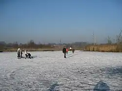 Regte Heide in winter, with Riel in the background | |
| Coordinates: 51°31′26″N 5°1′18″E | |
| Country | Netherlands |
| Province | North Brabant |
| Municipality | Goirle |
| Area | |
| • Total | 1.73 km2 (0.67 sq mi) |
| Elevation | 15 m (49 ft) |
| Population (2021)[1] | |
| • Total | 2,560 |
| • Density | 1,500/km2 (3,800/sq mi) |
| Time zone | UTC+1 (CET) |
| • Summer (DST) | UTC+2 (CEST) |
| Postal code | 5133[1] |
| Dialing code | 013 |
Riel is a so-called esdorp. The village grew and stretched out as new enclosures took place alongside the main road. First development took place as early as in the 7th century, with a peak in the 12th century when the church stimulated the enclosure of the common grounds and development.
Nowadays Riel is a commuter village. In the South and East large nature preserves are located, such as the moor "Regte Heide", also a tumulus site, "Riels Laag" and hunting ground "Hoefke". Because the stream valley cuts through moor and sandy areas, there is a considerable difference in heights.
Gallery
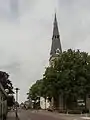 Riel, church: de Sint Antonius Abtkerk
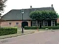 Farm in Riel
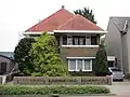 House in Riel
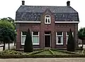 House in Riel
References
- "Kerncijfers wijken en buurten 2021". Central Bureau of Statistics. Retrieved 16 April 2022.
- "Postcodetool for 5133AA". Actueel Hoogtebestand Nederland (in Dutch). Het Waterschapshuis. Retrieved 16 April 2022.