Roddam, Northumberland
Roddam is a village and civil parish about 24 miles from Morpeth, in the county of Northumberland, England. In 2001 the parish had a population of 77.[1] The parish touches Bewick, Hedgeley, Ilderton, Ingram and Lilburn.[2] It lies near the foot of the Cheviot Hills.[3]
| Roddam | |
|---|---|
 | |
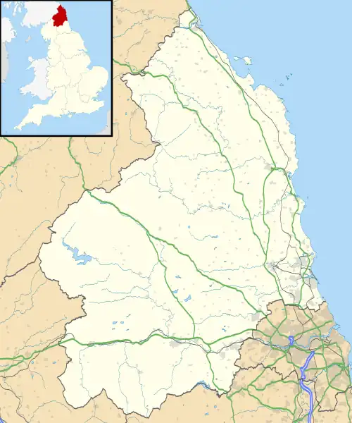 Roddam Location within Northumberland | |
| Area | 12.36 km2 (4.77 sq mi) |
| Population | 77 (2001 census) |
| • Density | 6/km2 (16/sq mi) |
| Civil parish |
|
| Unitary authority | |
| Shire county | |
| Region | |
| Country | England |
| Sovereign state | United Kingdom |
Landmarks
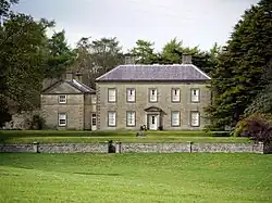
There are 16 listed buildings in Roddam, including Roddam Hall.[4]
History
The name "Roddam" means 'At the clearings'.[5] Roddam is a deserted medieval village, the village existed in 1296 but by the 19th century it had almost disappeared.[6] Roddam was formerly a township in the parish of Ilderton,[7] in 1866 Roddam became a civil parish in its own right. On 1 April 1955 Reaveley, Roseden and Wooperton parishes were merged with Roddam.[8]
References
- Neighbourhood Statistics
- "Roddam". Ordnance Survey. Retrieved 15 May 2021.
- "Cheviotside (Northumberland)". Keys to the Past. Retrieved 15 May 2021. Note title "Cheviotside" appears to be an error.
- "Listed buildings in Roddam, Northumberland". British Listed Buildings. Retrieved 15 May 2021.
- "Roddam Key to English Place-names". The University of Nottingham. Retrieved 15 May 2021.
- "Roddam (Cheviotside)". Keys to the Past. Retrieved 15 May 2021.
- "History of Roddam, in Berwick upon Tweed and Northumberland". A Vision of Britain through Time. Retrieved 15 May 2021.
- "Relationships and changes Roddam Tn/CP through time". A Vision of Britain through Time. Retrieved 15 May 2021.
- "Roddam". City Population De. Retrieved 15 May 2021.
Wikimedia Commons has media related to Roddam.
This article is issued from Wikipedia. The text is licensed under Creative Commons - Attribution - Sharealike. Additional terms may apply for the media files.