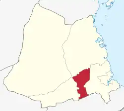
Ruangwa District, Lindi
Ruangwa is one of six districts of the Lindi Region of Tanzania. It is bordered to the north by the Kilwa District, to the south by the Mtwara Region and to the west by the Nachingwea District.
Ruangwa
| |
|---|---|
 Ruangwa District of Lindi Region | |
| Coordinates: 10.0663°S 38.94047°E | |
| Country | |
| Region | Lindi Region |
| District | Ruangwa District |
| Government | |
| • Type | Council |
| • Chairman | Andrea Chikongwe |
| • Director | Frank Fabian Chonya |
| Area | |
| • Total | 2,516 km2 (971 sq mi) |
| Population (2016)[1] | |
| • Total | 136,065 |
| • Density | 54/km2 (140/sq mi) |
| Time zone | EAT |
| Postcode | 65xxx |
| Area code | 023 |
| Website | zzzz District Website |
In 2016 the Tanzania National Bureau of Statistics report there were 136,065 people in the district, from 131,080 in 2012.[2][1]
Development
The region boasts an abundance of minerals and a huge agricultural potential. Being in the Ruvuma basin it has large deposits of graphite and uranium, among other commercially demanded minerals. With the discovery of minerals, the area has seen an influx of people working in the sector. This has put a pressure on existing social amenities such as hotels, guest houses and lodges. The road network is still poor as tarmac is less than 5 kilometers. The prime minister being the member of parliament for the area, rapid developments are expected as works on the road linking Ruangwa to Masasi are being constructed to tarmac level.
Wards
The Ruangwa District is administratively divided into 21 wards:[3]
- Chibula
- Chienjere
- Chinongwe
- Chunyu
- Likunja
- Luchelegwa
- Makanjiro
- Malolo
- Mandarawe
- Mandawa
- Matambarale
- Mbekenyera
- Mnacho
- Nachingwea
- Nambilanje
- Namichiga
- Nandagala
- Nanganga
- Narung'ombe
- Mbwemkuru
- Nkowe
- Ruangwa
Notable persons from Ruangwa District
- Kassim Majaliwa, 10th Tanzanian Prime Minister
References
- 2016 Makadirio ya Idadi ya Watu katika Majimbo ya Uchaguzi kwa Mwaka 2016, Tanzania Bara [Population Estimates in Administrative Areas for the Year 2016, Mainland Tanzania] (PDF) (Report) (in Swahili). Dar es Salaam, Tanzania: National Bureau of Statistics. 1 April 2016. Archived (PDF) from the original on 27 December 2021. Retrieved 3 July 2022.
- 2012 Population and Housing Census - Population Distribution by Administrative Areas (PDF) (Report). Dar es Salaam, Tanzania: National Bureau of Statistics. 1 March 2013. Archived (PDF) from the original on 26 March 2022. Retrieved 3 July 2022.
- "2012 Population and Housing Census" (PDF). The United Republic of Tanzania. March 2013. p. 84.