Rumelihisarı, Sarıyer
Rumelihisarı is a neighbourhood in the municipality and district of Sarıyer, Istanbul Province, Turkey.[2] Its population is 10,073 (2022).[3] It is on the European side of Istanbul. The neighborhood is famous for and named after its medieval fortress, Rumelihisarı, built by Mehmed the Conqueror between 1451 and 1452 CE.
Rumelihisarı | |
|---|---|
 Rumelihisarı Location in Turkey 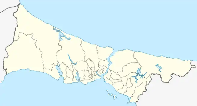 Rumelihisarı Rumelihisarı (Istanbul) | |
| Coordinates: 41°5′18″N 29°2′58″E | |
| Country | Turkey |
| Province | Istanbul |
| District | Sarıyer |
| Population (2022) | 10,073 |
| Time zone | TRT (UTC+3) |

The port of Rumeli Hisari (1880-1893)[1]
Looking at its administrative borders, to the north is Baltalimanı, to the northwest is Fatih Sultan Mehmet, to the west is Etiler, a district of Beşiktaş distrcit, to the south is Bebek of Beşiktaş again, and to the east is the Bosphorus Strait.
References
- "The port of Rumeli Hisarı". Archived from the original on 13 March 2017. Retrieved 27 March 2013.
- Mahalle, Turkey Civil Administration Departments Inventory. Retrieved 12 July 2023.
- "Address-based population registration system (ADNKS) results dated 31 December 2022, Favorite Reports" (XLS). TÜİK. Retrieved 12 July 2023.
This article is issued from Wikipedia. The text is licensed under Creative Commons - Attribution - Sharealike. Additional terms may apply for the media files.