Rupes Nigra
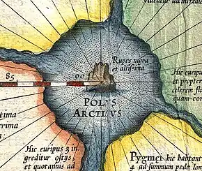
The Rupes Nigra ("Black Rock") was a theorized black rock located at the Magnetic North Pole or at the North Pole itself. Described by Mercator as 33 "French" miles in size, it provided a supposed explanation for why all compasses point to this location. This fact came from a lost work titled Inventio Fortunata, and the island featured on maps from the sixteenth and seventeenth centuries, including those of Gerardus Mercator and his successors. Mercator described the island in a 1577 letter to John Dee:
In the midst of the four countries is a Whirl-pool, into which there empty these four indrawing Seas which divide the North. And the water rushes round and descends into the Earth just as if one were pouring it through a filter funnel. It is four degrees wide on every side of the Pole, that is to say eight degrees altogether. Except that right under the Pole there lies a bare Rock in the midst of the Sea. Its circumference is almost 33 French miles, and it is all of magnetic Stone [Jacobus Cnoyen] years ago.[1]


In fiction

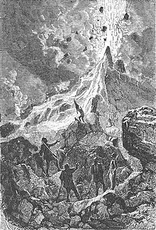
In Jules Verne's The Adventures of Captain Hatteras (1866), the North Pole is occupied by Queen Island, created by a volcano (Mount Hatteras) in the middle of an Open Polar Sea.
References
- Taylor, E.G.R. (1956). "A Letter Dated 1577 from Mercator to John Dee". Imago Mundi. 13: 56–68. doi:10.1080/03085695608592127.