Rutherford, Edmonton
Rutherford is a neighbourhood in south Edmonton, Alberta, Canada. It is named after Alexander Cameron Rutherford, Alberta's first premier.
Rutherford | |
|---|---|
Neighbourhood | |
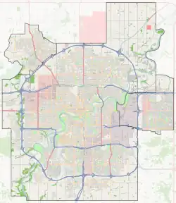
 Rutherford Location of Rutherford in Edmonton | |
| Coordinates: 53.419°N 113.527°W | |
| Country | |
| Province | |
| City | Edmonton |
| Quadrant[1] | SW |
| Ward[1] | Ipiihkoohkanipiaohtsi |
| Sector[2] | Southwest |
| Area[3][4] | Heritage Valley |
| Government | |
| • Administrative body | Edmonton City Council |
| • Councillor | Jennifer Rice |
| • MP | Matt Jeneroux (Conservative) |
| • MLA | Rhiannon Hoyle (NDP) |
| Area | |
| • Total | 2.26 km2 (0.87 sq mi) |
| Elevation | 696 m (2,283 ft) |
| Population (2012)[7] | |
| • Total | 8,407 |
| • Density | 3,719.9/km2 (9,634/sq mi) |
| • Change (2009–12) | |
| • Dwellings | 3,498 |
According to the 2005 municipal census, approximately 85% of the residences in the neighbourhood are single-family dwellings. The remainder are mostly duplexes[8] (13%) with a small number of row houses (2%). The majority of residences (96%) are owner-occupied.[9]
It is bounded on the west by 127 Street, on the east by James Mowatt Trail (111 Street), on the north by Ellerslie Road, and on the south by Blackmud Creek Ravine and a line connecting the ravine to 127 Street about 25 Avenue SW.
Demographics
In the City of Edmonton's 2012 municipal census, Rutherford had a population of 8,407 living in 3,498 dwellings,[7] a 28.9% change from its 2009 population of 6,521.[10] With a land area of 2.26 km2 (0.87 sq mi),[6] it had a population density of 3,719.9 people/km2 in 2012.[7][6]
Education
Rutherford is home to two schools for students in kindergarten through grade nine – Johnny Bright School of Edmonton Public Schools and Monsignor Fee Otterson Elementary/Junior High School of Edmonton Catholic Schools.[11][12]
Surrounding neighbourhoods
References
- "City of Edmonton Wards & Standard Neighbourhoods" (PDF). City of Edmonton. Archived from the original (PDF) on May 3, 2014. Retrieved February 13, 2013.
- "Edmonton Developing and Planned Neighbourhoods, 2011" (PDF). City of Edmonton. Archived from the original (PDF) on September 4, 2013. Retrieved February 13, 2013.
- "The Way We Grow: Municipal Development Plan Bylaw 15100" (PDF). City of Edmonton. 2010-05-26. Archived from the original (PDF) on May 2, 2015. Retrieved February 13, 2013.
- "City of Edmonton Plans in Effect" (PDF). City of Edmonton. November 2011. Archived from the original (PDF) on October 17, 2013. Retrieved February 13, 2013.
- "City Councillors". City of Edmonton. Retrieved February 13, 2013.
- "Neighbourhoods (data plus kml file)". City of Edmonton. Retrieved February 13, 2013.
- "Municipal Census Results – Edmonton 2012 Census". City of Edmonton. Retrieved February 22, 2013.
- Duplexes include triplexes and quadruplexes.
- http://censusdocs.edmonton.ca/C05002/MUNICIPAL%202005/Neighbourhood/RUTHERFORD.pdf
- "2009 Municipal Census Results". City of Edmonton. Retrieved February 22, 2013.
- "Johnny Bright School". Edmonton Public Schools. Retrieved 2012-04-27.
- "Monsignor Fee Otterson Elementary/Junior High School". Edmonton Catholic Schools. Retrieved 2012-04-27.