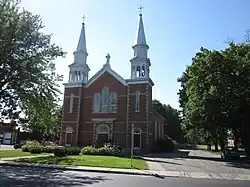
Saint-Albert, Quebec
Saint-Albert is a municipality located in the Centre-du-Québec region of Quebec, Canada.
Saint-Albert | |
|---|---|
 | |
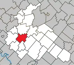 Location within Arthabaska RCM | |
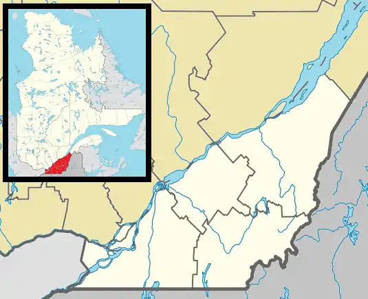 Saint-Albert Location in southern Quebec. | |
| Coordinates: 46°00′N 72°05′W[1] | |
| Country | |
| Province | |
| Region | Centre-du-Québec |
| RCM | Arthabaska |
| Constituted | January 1, 1864 |
| Government | |
| • Mayor | Alain St-Pierre |
| • Federal riding | Richmond—Arthabaska |
| • Prov. riding | Drummond–Bois-Francs |
| Area | |
| • Total | 70.30 km2 (27.14 sq mi) |
| • Land | 69.87 km2 (26.98 sq mi) |
| Population | |
| • Total | 1,526 |
| • Density | 21.8/km2 (56/sq mi) |
| • Pop 2006-2011 | |
| Time zone | UTC−5 (EST) |
| • Summer (DST) | UTC−4 (EDT) |
| Postal code(s) | |
| Area code | 819 |
| Highways | |
| Website | www |
Notable people
References
- "Reference number 333856 in Banque de noms de lieux du Québec". toponymie.gouv.qc.ca (in French). Commission de toponymie du Québec.
- "Geographic code 39085 in the official Répertoire des municipalités". www.mamh.gouv.qc.ca (in French). Ministère des Affaires municipales et de l'Habitation.
- "Saint-Albert, Quebec (Code 2439085) Census Profile". 2011 census. Government of Canada - Statistics Canada.
Places adjacent to Saint-Albert, Quebec | |
|---|---|
| Cities | |
|---|---|
| Municipalities | |
| Parishes | |
| Townships | |
| |
This article is issued from Wikipedia. The text is licensed under Creative Commons - Attribution - Sharealike. Additional terms may apply for the media files.